Trail Fast Facts
Hale Conservation Park Circuit is a 4km, grade 3 hike in Hale Conservation Park, South Australia. This hike typically takes 1.5 hours to complete.
Hike Overview
Hale Conservation Park Circuit offers a rewarding 4-kilometre loop trail through the park's diverse landscapes. Classified as grade 3, the hike is suitable for experienced walkers and takes approximately 1.5 hours to complete. Begin your journey at the Warren Road carpark.
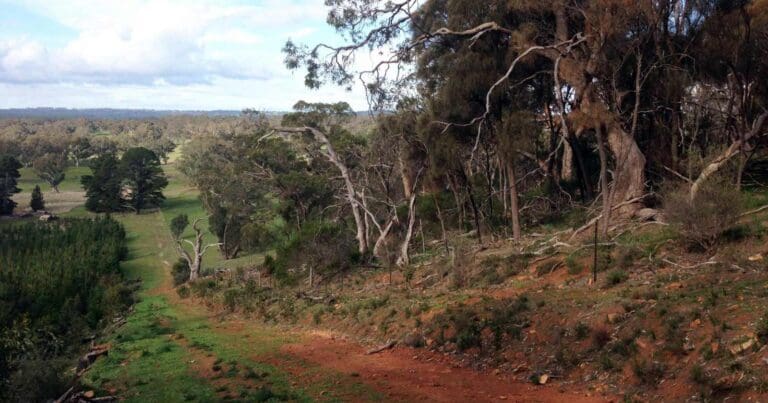
This well-marked circuit trail winds its way past rocky lookouts, a waterfall, and remnants of historic mine workings. Keep your eyes peeled for echidnas, which are common in the park and can sometimes be spotted rustling through the undergrowth. The trail starts at the carpark on Warren Road, located 2.5 kilometres south of Williamstown. Remember to follow the anti-clockwise markers (turn right at the trailhead at Gate 1) for a smooth exploration of the circuit.
Track Grade
Grade 3 (Moderate) - Walks for Most Fitness Levels: Grade 3 on the AWTGS represents moderate walking tracks. These are ideal for walkers with some fitness who are comfortable with some hills and uneven terrain. While suitable for most ages, some bushwalking experience is recommended to ensure a safe and enjoyable experience. Tracks may have short, steep hill sections, a rough surface, and many steps. The total distance of a Grade 3 walk can be up to 20 kilometers.
Map and GPX file
Max elevation: 429 m
Min elevation: 335 m
Total climbing: 165 m
Total descent: -165 m
Trail Location (trailhead)
Sorry, no records were found. Please adjust your search criteria and try again.
Sorry, unable to load the Maps API.
Getting there
Hale Conservation Park lies approximately 60 kilometres northeast of Adelaide. To reach the park, take Mount Pleasant Road.
Photo gallery
If you have any photos from this hike and are happy to share them, please upload your .jpg files here.
Please note: Uploading photos does not transfer ownership of copyright away from you. If requested, you will be credited for any photos you provide and can ask they be deleted at any time.
About the region
Hale Conservation Park boasts a diverse landscape of steep rocky ridges and sheltered valleys. It's a haven for some of Australia's more elusive mammals and plays a vital role in conserving the oyster bay cypress pine.
The park offers challenging walking trails that reward hikers with spectacular views of the South Para Valley and reservoir. One trail winds from the highlands down to the South Para River, while another follows a creek line to the park's northeastern boundary, emerging in grasslands near Williamstown. Spring is a particularly beautiful time to visit, with wildflowers blooming abundantly and the creeks carrying water.
For a few winter weeks, the park transforms into a fiery landscape as the flame heath bursts into bloom. The vibrant red flowers provide stunning photographic opportunities.
Similar trails nearby
Explore Safe
While planning your hike, it’s important to check official government sources for updated information, temporary closures and trail access requirements. Before hitting the trail, check local weather and bushfire advice for planned burns and bushfire warnings and let someone know before you go. Plan ahead and hike safely.
Let someone know
Adventure with peace of mind: Fill out your trip intentions form. Before you hit the trail, fill out an online form to privately send important details about your hike to your family or friends. If you don’t return on time, they can easily alert emergency services, preventing worry and ensuring a swift response. Hike with peace of mind and enjoy your outdoor adventure to the fullest. Be smart, be safe: Register your plans here.
Gear to consider
What you carry in your pack will depend on the weather, terrain, time of year, type of adventure, and personal preferences. Having trouble deciding what gear’s right for you? My free planning, food and packing checklists provide an introduction to things your could consider (as well as the Ten Essentials) on your day, overnight and multi-day adventures. Customise your kit according to your personal needs, always considering safety first.
Suggest an edit
Trail changed? New features discovered? Has the route changed? Trail permanently closed? Help fellow hikers by suggesting edits! Click above to update route descriptions, GPX file, trail features (like boardwalks), or access conditions (like parking availability). Help me keep the trails info fresh!
Weather
Acknowledgement of Country
Trail Hiking Australia acknowledges the Traditional Owners of the lands on which we hike and pay respects to their Elders, past and present, and we acknowledge the First Nations people of other communities who may be here today.


