Hike at a Glance
Max elevation: 1293m
Min elevation: 675m
Total Ascent: 715m
Important info
It’s best to avoid the walk when the top of the mountain is covered in cloud or after wet weather. Water is not available along the trails so come prepared with extra water bottles and always inform a friend of your plans.
Hike overview
The Kahlpahlim Ridge Trail, an 11-kilometre return hike, takes you deep into the rugged beauty of Dinden National Park, Queensland. This challenging trail is classified as grade 5, making it suitable for experienced hikers. Expect to spend around 4 to 5 hours on this hike, depending on your pace and fitness level.
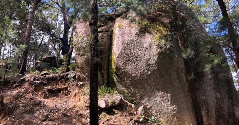
One of the standout features of this hike is its ascent to Lambs Head, also known as Kahlpahlim Rock. At 1300 metres above sea level, this is the highest point in the Lamb Range of Davies Creek National Park. The trail presents a steep climb, but with the right footwear, such as sturdy hiking boots or trail runners, the steep sections are manageable. These are essential for maintaining grip on the rocky terrain, particularly on the more challenging stretches.
There are two main paths that lead to Kahlpahlim Rock: the Kahlpahlim Rock Trail and the Kahlpahlim Ridge Trail. Both trails meet near the summit, allowing you to walk the hike as a circuit. The trails offer stunning views of the surrounding landscape, with towering granite boulders and expansive vistas that reward your effort as you make your way up.
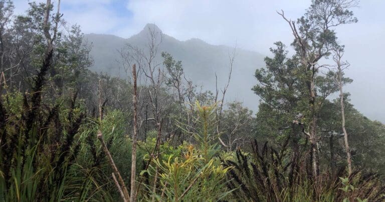
Given the challenging nature of the hike, it's best to begin early in the day. Starting in the cooler morning temperatures not only makes the hike more comfortable but also allows you to complete the journey with time to spare before the heat of the day sets in. The round-trip journey can take several hours, so it’s important to plan accordingly. Be sure to avoid the hike if there’s cloud cover at the summit or if the trail has been wet, as these conditions can make the terrain slippery and more difficult to navigate.
One key consideration is that there is no water available along the trail, so it’s crucial to bring enough water with you for the entire journey. Additionally, it’s a good idea to inform a friend or family member of your plans before setting off.
The hike begins at the carpark along Davies Creek Road, where the path starts off relatively gently. However, as you move east, the trail begins to ascend steeply toward Kahlpahlim Rock. You can either retrace your steps on the return route or opt for the Kahlpahlim Rock Trail to complete the circuit, offering a different perspective on the journey back.
Tips
- Start early: Take advantage of cooler morning temperatures and ample daylight for the return journey, which can take several hours.
- Check the forecast: Avoid hiking when the summit is clouded over or after heavy rain.
- Bring plenty of water: No water is available on the trails, so plan accordingly.
- Inform a friend: Let someone know your hiking plans for safety reasons.
Content use
Please don’t copy GPX files or content from this site to AllTrails or other platforms. Each trail has been personally mapped, documented, and refined to support Australia’s bushwalking and hiking community. While some details come from land managers, every listing reflects significant personal effort. This is a free, community-driven initiative—your respect helps keep it that way.
Walk map and GPX file
Max elevation: 1293 m
Min elevation: 675 m
Total climbing: 715 m
Total descent: -714 m
Getting there
Getting to the trailhead: Dinden National Park.
To reach the trailhead, head west from Cairns along the Kennedy Highway towards Kuranda. After passing the Kuranda turn-off, continue for approximately 21 kilometres before turning left onto Davies Creek Road. This unsealed road can be heavily corrugated and is not recommended for caravans. Follow the road for around 10 kilometres to reach the Upper Davies Creek camping area, which is 3.8 kilometres beyond the Lower Davies Creek camping area. The trailhead is located nearby, and due to the rough conditions, a four-wheel-drive vehicle is strongly recommended to access the area safely.
Closest towns to this walk: Atherton, Cairns, Lake Eacham, Malanda, Mareeba, Tolga, Yungaburra
About the region
Tucked into the Atherton Tableland, Davies Creek and Dinden National Parks offer a quiet yet striking landscape of open forest, granite outcrops, and cool streams. These parks are a welcome escape from the busier spots of Far North Queensland, with a network of tracks and camp sites that offer space to slow down and explore at your own pace.
The Turtle Rock Circuit begins between camp sites 3 and 4 along Davies Creek Road. This trail weaves through eucalyptus woodland and past impressive boulder formations, offering peaceful views across the tableland. Further along the same road, past camp sites 5 and 6, you'll come to the start of the Kahlpahlim Rock trail—also known as Lambs Head. This is one of the more challenging hikes in the area, taking you to one of the highest points on the Lamb Range. On a clear day, you’ll find sweeping views that stretch across the surrounding forests and ridgelines. The road continues past camp sites 7 and 8, with each site providing a simple, natural base for resting overnight.
Within nearby Dinden National Park, a drive along Clohesy River Road leads to one of the lesser-known gems of the region: the Clohesy River fig tree. The short boardwalk through the forest brings you face to face with a towering green fig—a sprawling natural sculpture that feels almost otherworldly in its scale and presence. Access to Clohesy River Road is from the Kennedy Highway, either 9 kilometres north of the Davies Creek Road intersection or 10 kilometres south of Kuranda. This route is strictly for four-wheel-drive vehicles, and conditions can change quickly. Creek crossings along the way may become impassable after rain, so it’s important to check forecasts and track conditions in advance. All vehicles using this road must be road-registered.
Be aware that roads throughout Davies Creek and Dinden National Park are sometimes closed during the wet season, typically from December to April. Closures may also occur after heavy rain due to flooding or for essential maintenance. Before heading out, it’s a good idea to check the latest weather updates through the Bureau of Meteorology to help plan a safe and enjoyable trip.
Similar walks nearby
Looking for more walks in or near Dinden National Park? Try these trails with a similar difficulty grade.
Track grade
Grade 5 (Difficult) - Walks for the Most Experienced: Grade 5 represents the most challenging walking tracks on the AWTGS. These are only recommended for very experienced and fit walkers with specialised skills, including navigation and emergency first aid. Tracks are likely to be very rough, very steep, and unmarked. Walks may be more than 20 kilometers. These challenging walks demand a high level of fitness and experience to navigate difficult terrain, significant elevation changes, and potentially unformed paths.
Explore safe
Plan ahead and hike safely! Carry enough water, pack layers for changing conditions, and bring safety gear like a torch, PLB, and reliable communication device. Check official sources for trail updates, closures, and access requirements, and review local weather and bushfire advice. Most importantly, share your plans with someone before you go. Being prepared makes for a safer and more enjoyable hike! Stay Safe, Explore More, and Always #ExploreSafe.
Packing checklists
What you carry in your pack depends on factors like weather, terrain, and your adventure type. Not sure what to bring? My free planning, food, and packing checklists are a great starting point, covering day hikes, overnight trips, and multi-day adventures. Use them to customise your kit and always prioritise safety.
Let someone know
Before heading out, take a moment to fill out your trip intentions form. It’s a quick way to share your hike details with family or friends. If something goes wrong, they can notify emergency services, ensuring a faster response and peace of mind. Stay safe and enjoy your adventure
Suggest an edit
Spotted a change on this trail? Maybe there are new features, the route has shifted, or the trail is permanently closed. Whatever the update, I’d love your input. Your feedback helps fellow hikers stay informed and ensures that our trail info stays fresh and reliable.
Acknowledgement of Country
Trail Hiking Australia acknowledges the Traditional Owners of the lands on which we hike and pay respects to their Elders, past and present, and we acknowledge the First Nations people of other communities who may be here today.
/Kahlpahlim-Ridge-Trail%20(17).jpg)
/Kahlpahlim-Ridge-Trail%20(11).jpg)
/Kahlpahlim-Ridge-Trail%20(5).jpg)
/Kahlpahlim-Ridge-Trail%20(20).jpg)
/Kahlpahlim-Ridge-Trail%20(23).jpg)
/Kahlpahlim-Ridge-Trail%20(14).jpg)
/Kahlpahlim-Ridge-Trail%20(25).jpg)
/Kahlpahlim-Ridge-Trail%20(10).jpg)
/Kahlpahlim-Ridge-Trail%20(4).jpg)
/Kahlpahlim-Ridge-Trail%20(16).jpg)
/Kahlpahlim-Ridge-Trail%20(19).jpg)
/Kahlpahlim-Ridge-Trail%20(2).jpg)
/Kahlpahlim-Ridge-Trail%20(6).jpg)
/Kahlpahlim-Ridge-Trail%20(13).jpg)
/Kahlpahlim-Ridge-Trail%20(28).jpg)


1 Review on “Kahlpahlim Ridge Trail (11km)”
A great walk up in the cloud forest 👌
Darren Bowman it certainly is that.
Loved this hike. Seems to be home for leeches at the top so maybe one to avoid if you aren’t keen on those little critters.
Fantastic hike. My wife and I walked the circuit, heading up the ridge trail first. It was certainly steep and unrelenting at times. Had a bot of fun with leeches near the summit and the views were a bit obscured by clouds. But well worth the effort.