Hike at a Glance
Max elevation: 262m
Min elevation: 175m
Total Ascent: 238m
Hike overview
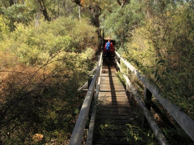
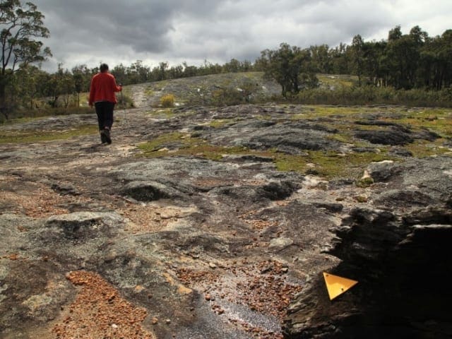
The Jarrahdale 1872 Timber Tramway Trail offers a fascinating journey through Western Australia’s rich timber and railway history. Winding through the jarrah forests near Jarrahdale, this well-marked 9.5 km trail follows the path of a former timber tramway that once transported logs from the mills to their next destination. The route leads to the historic site of the Balmoral POW Camp and also forms part of the renowned Munda Biddi Trail, making it an ideal choice for both history buffs and nature lovers alike.
As you walk, it’s easy to picture the bustling industry that once defined this landscape. One of the most intriguing remnants of the railway era is the series of box drains constructed entirely from jarrah sleepers. Remarkably, these original timber structures have withstood the test of time, hidden beneath the rail track and quietly preserving a piece of the past. Informational signage along the way brings the area’s history to life, adding depth to the experience and offering insights into Jarrahdale’s role in Western Australia’s timber trade.
The trail is particularly stunning in spring when wildflowers burst into colour, carpeting the forest floor with delicate native blooms. Towering jarrah and marri trees provide welcome shade, while birdsong and the occasional rustling of wildlife add to the peaceful atmosphere. Despite its historical significance, the track is mostly easygoing, rated as a Grade 2 walk that takes around three to four hours to complete. However, there are a few steep sections and spots that can become muddy after rain, so sturdy footwear is recommended.
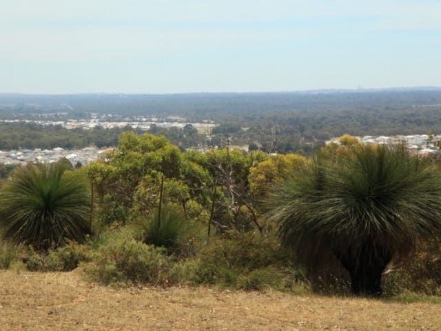
For those looking to extend their walk, the trail includes a loop section that deviates from the original railway formation, bringing the total return distance to 8 km. This additional stretch allows hikers to experience more of the region’s natural beauty while maintaining a connection to the historic route. Whether you're drawn by the area’s rich heritage, the quiet serenity of the forest, or simply the chance to stretch your legs on a well-formed compacted earth path, the Jarrahdale 1872 Timber Tramway Trail offers a rewarding and immersive experience in Western Australia’s great outdoors.
Gallery
Got some great shots from this hike? Upload your photos here to inspire others and show off the beauty of the trail!
Click to view form >>
Submitting your photos doesn’t mean you lose ownership. You can be credited for your contributions, and you can request removal at any time.
Content use
Please don’t copy GPX files or content from this site to AllTrails or other platforms. Each trail has been personally mapped, documented, and refined to support Australia’s bushwalking and hiking community. While some details come from land managers, every listing reflects significant personal effort. This is a free, community-driven initiative—your respect helps keep it that way.
Walk map and GPX file
Max elevation: 262 m
Min elevation: 175 m
Total climbing: 238 m
Total descent: -238 m
Getting there
Getting to the trailhead: Serpentine National Park.
Getting to the Jarrahdale 1872 Timber Tramway is straightforward, with the trailhead located just 1 kilometre west of Jarrahdale at the corner of Nettleton Road and Jarrahdale Road. If you’re driving from Perth, it’s about a 50-kilometre journey southeast, taking just under an hour via South Western Highway. Once in Jarrahdale, follow the signs towards Serpentine National Park and turn onto Jarrahdale Road. The trail begins at an information bay, where you’ll find parking and interpretive signage to guide your walk. The area is well-signposted, making it easy to locate, and the nearby township offers a great spot for a coffee or bite to eat before or after your hike.
Closest towns to this walk: Bedfordale, Byford, Jarrahdale, Mundijong, Oakford, Serpentine
About the region
Just 55 kilometres southeast of Perth, Serpentine National Park offers stunning bushwalks, hikes, and scenic trails through rugged terrain. The park, located on the Darling Scarp, is home to the Serpentine River and the famous Serpentine Falls, where water cascades over smooth granite into a deep, natural pool.
With a variety of all trails to explore, you’ll find everything from easy walks to more challenging hikes through the Serpentine River Valley. Wildlife is abundant—keep an eye out for kangaroos at dawn and dusk or spot red-capped parrots, black cockatoos, and yellow robins in the treetops.
From July to November, the park bursts into colour with wildflowers, reaching its peak in September when the hillsides are dotted with orchids, banksias, and kangaroo paws. Whether you're after a family-friendly bushwalk or a rewarding day hike, this park has something for everyone.
Want to find the best trails in Serpentine National Park for an adventurous hike, casual walk, or a family trip? Trail Hiking Australia has the best trails for walking, hiking, running, and more.
Similar walks nearby
Looking for more walks in or near Serpentine National Park? Try these trails with a similar difficulty grade.
Track grade
Grade 2 (Easy) - A Gentle Introduction to Inclines: Grade 2 on the AWTGS represents easy walking tracks that offer a slightly more challenging experience compared to Grade 1. Similar to Grade 1, no prior bushwalking experience is required. The track surface is typically hardened or compacted and may have gentle hill sections or occasional steps. The total distance of a Grade 2 walk is typically no greater than 10 kilometers. These walks are still suitable for families with a bit more experience or those seeking a gentle introduction to some inclines.
Explore safe
Plan ahead and hike safely! Carry enough water, pack layers for changing conditions, and bring safety gear like a torch, PLB, and reliable communication device. Check official sources for trail updates, closures, and access requirements, and review local weather and bushfire advice. Most importantly, share your plans with someone before you go. Being prepared makes for a safer and more enjoyable hike! Stay Safe, Explore More, and Always #ExploreSafe.
Packing checklists
What you carry in your pack depends on factors like weather, terrain, and your adventure type. Not sure what to bring? My free planning, food, and packing checklists are a great starting point, covering day hikes, overnight trips, and multi-day adventures. Use them to customise your kit and always prioritise safety.
Let someone know
Before heading out, take a moment to fill out your trip intentions form. It’s a quick way to share your hike details with family or friends. If something goes wrong, they can notify emergency services, ensuring a faster response and peace of mind. Stay safe and enjoy your adventure
Suggest an edit
Spotted a change on this trail? Maybe there are new features, the route has shifted, or the trail is permanently closed. Whatever the update, I’d love your input. Your feedback helps fellow hikers stay informed and ensures that our trail info stays fresh and reliable.
Acknowledgement of Country
Trail Hiking Australia acknowledges the Traditional Owners of the lands on which we hike and pay respects to their Elders, past and present, and we acknowledge the First Nations people of other communities who may be here today.


