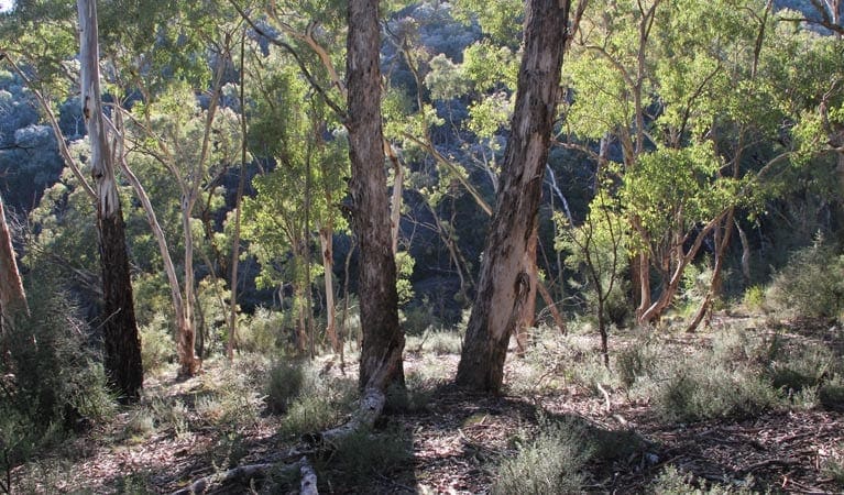
The Grove Creek Falls walking track is a scenic 6-kilometre (grade 4) hike within the Abercrombie Karst Conservation Reserve in New South Wales. This moderately challenging route, taking roughly 3 hours to complete, is perfect for those seeking a rewarding bushwalking experience.
The track winds its way through picturesque bushland alongside Grove Creek, culminating in a breathtaking view of the namesake falls. Witness the tranquil waters cascading over a sheer 70-metre cliff, creating a scene of immense natural beauty.
A designated lookout provides the perfect vantage point to admire the power and majesty of the falls. For those short on time, a car park is accessible near the falls, allowing visitors to experience the wonder without the hike. Pack a picnic lunch and enjoy a refreshing meal amidst the stunning scenery.
The return journey offers a leisurely stroll alongside the creek, providing ample opportunity for birdwatching. Keen observers might spot vibrant parrots and rosellas flitting amongst the trees as they make their way back to the visitor centre.
- There is no mobile reception in this park, but a public phone is available at the visitor centre.
- Remember to take your binoculars if you want to birdwatch
Photo credit: Ted Wells and NSW National Parks and Wildlife Service.
Please don’t copy GPX files or content from this site to AllTrails or other platforms. Each trail has been personally mapped, documented, and refined to support Australia’s bushwalking and hiking community. While some details come from land managers, every listing reflects significant personal effort. This is a free, community-driven initiative—your respect helps keep it that way.
Total distance: 6257 m
Max elevation: 634 m
Min elevation: 580 m
Total climbing: 217 m
Total descent: -217 m
Getting there
Getting to the trailhead: Abercrombie Karst Conservation Reserve.
Once you’ve entered the Abercrombie Karst Conservation Reserve, follow Cave Road until you reach the visitor centre. Here, you can grab a helpful local map to guide you further. The trailhead for Grove Creek Falls lies south of the visitor centre, following the course of the creek. Remember to check the weather forecast beforehand, as heavy rain can make the access road boggy. Luckily, there’s convenient parking available right at the Grove Creek Falls walking track.
Closest towns to this walk: Black Springs, Crookwell, Goulburn, Hampton, Little Hartley, Mudgee, Oberon, Taralga, Tarana
About the region
Famous for its incredible limestone caves, Abercrombie Karst Conservation Reserve offers great bushwalking, waterfalls and picturesque camping for the whole family. An Abercrombie Caves tour is an unforgettable experience.
Set in a peaceful valley, Abercrombie Karst Conservation Reserve is a spectacular place to visit and a unique opportunity to experience the hidden depths of NSW. Abercrombie Caves boasts the largest natural arch in the southern hemisphere, as well as a number of other grand, richly decorated caves. Take the kids on a cave tour and go on a magical underground journey.
Abercrombie Karst Conservation Reserve and caves are open Thursday to Monday (closed Tuesday and Wednesday). The reserve and caves area open daily during NSW school holidays. Closed Christmas Day.
Similar walks nearby
Looking for more walks in or near Abercrombie Karst Conservation Reserve? Try these trails with a similar difficulty grade.
Favourite

Abercrombie Karst Conservation Reserve
Favourite

Jenolan Karst Conservation Reserve
Favourite

Blue Mountains National Park
Favourite

Jenolan Karst Conservation Reserve
Track grade
Grade 4 (Hard) -
Challenging Walks for Experienced Walkers: Grade 4 on the
AWTGS signifies challenging walking tracks. Bushwalking experience is recommended for these tracks, which may be long, rough, and very steep. Directional signage may be limited, requiring a good sense of navigation. These walks are suited for experienced walkers who are comfortable with steeper inclines, rougher terrain, and potentially longer distances.
Explore safe
Plan ahead and hike safely! Carry enough water, pack layers for changing conditions, and bring safety gear like a torch, PLB, and reliable communication device. Check official sources for trail updates, closures, and access requirements, and review local weather and bushfire advice. Most importantly, share your plans with someone before you go. Being prepared makes for a safer and more enjoyable hike! Stay Safe, Explore More, and Always #ExploreSafe.
Packing checklists
What you carry in your pack depends on factors like weather, terrain, and your adventure type. Not sure what to bring? My free planning, food, and packing checklists are a great starting point, covering day hikes, overnight trips, and multi-day adventures. Use them to customise your kit and always prioritise safety.
Let someone know
Before heading out, take a moment to fill out your trip intentions form. It’s a quick way to share your hike details with family or friends. If something goes wrong, they can notify emergency services, ensuring a faster response and peace of mind. Stay safe and enjoy your adventure
Suggest an edit
Spotted a change on this trail? Maybe there are new features, the route has shifted, or the trail is permanently closed. Whatever the update, I’d love your input. Your feedback helps fellow hikers stay informed and ensures that our trail info stays fresh and reliable.
/Grove%20Creek%20Falls%20Walking%20Track.jpg)
/Grove%20Creek%20Falls%20Walking%20Track_1.jpg)


