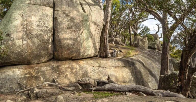
This Fryers Ridge Circuit hike will take you though the scenic woodlands expanse of Fryers Ridge Nature Conservation Reserve. This is a quiet woodland area with several small streams.
Tracks are very well-marked four-wheel drive trails. Bird life is very active in this park and you will most probably see some wallabies and kangaroos.
You will find plenty of good places to have lunch near dams or in general open Woodland.
The hike starts out with a moderate assent on good well-marked four-wheel drive tracks. The terrain is undulating hills but nothing to difficult.
Around the northern section near Telecom Track the tracks become steeper.
Variation - The hike is fairly long. A recommended variation is at the far northern section of hike whilst on Sugarbag Track to take a right on the unnamed track (-37.145523°, 144.284649°) to shorten the track by a couple of kilometres. Another reason for this variation is that the current path takes you close to the edge of the reserve.
Got some great shots from this hike? Upload your photos here to inspire others and show off the beauty of the trail!
Submitting your photos doesn’t mean you lose ownership. You can be credited for your contributions, and you can request removal at any time.
Please don’t copy GPX files or content from this site to AllTrails or other platforms. Each trail has been personally mapped, documented, and refined to support Australia’s bushwalking and hiking community. While some details come from land managers, every listing reflects significant personal effort. This is a free, community-driven initiative—your respect helps keep it that way.
Total distance: 19132 m
Max elevation: 582 m
Min elevation: 393 m
Total climbing: 456 m
Total descent: -455 m
Thanks to Pete Vino for sharing this trail
Getting there
Getting to the trailhead: Fryers Ridge Nature Conservation Reserve.
Take the Calder Freeway northbound from Melbourne. Exit C794 towards Malmsbury. Continue through Malsbury and into Taradale.
Turn left (near old BP/Post Office across road) on Roderick Street. Roderick Street will join Fryerstown Road. Continue past the properties and vineyards until you cross the creek and reach Salt Water track. Limited parking near this intersection.
Closest towns to this walk: Castlemaine, Fryerstown, Maldon, Newstead, Taradale
About the region
The Fryers Ridge Nature Conservation Reserve west of Taradale, Victoria, Australia. The west edge of the Reserve is delimited by the Fryers Ridge Track. The east edge of the Reserve is delimited by the Coliban Main Channel. The service track alongside the portion of the channel within the reserve is accessible to walkers. Generally the gradient of the service track is very low.
Similar walks nearby
Looking for more walks in or near Fryers Ridge Nature Conservation Reserve? Try these trails with a similar difficulty grade.
Favourite

Castlemaine Diggings National Heritage Park
Favourite

Castlemaine Diggings National Heritage Park
Favourite

Greater Bendigo National Park
Favourite

Mount Alexander Regional Park
Track grade
Grade 3 (Moderate) - Walks for Most Fitness Levels: Grade 3 on the
AWTGS represents moderate walking tracks. These are ideal for walkers with some fitness who are comfortable with some hills and uneven terrain. While suitable for most ages, some bushwalking experience is recommended to ensure a safe and enjoyable experience. Tracks may have short, steep hill sections, a rough surface, and many steps. The total distance of a Grade 3 walk can be up to 20 kilometers.
Explore safe
Plan ahead and hike safely! Carry enough water, pack layers for changing conditions, and bring safety gear like a torch, PLB, and reliable communication device. Check official sources for trail updates, closures, and access requirements, and review local weather and bushfire advice. Most importantly, share your plans with someone before you go. Being prepared makes for a safer and more enjoyable hike! Stay Safe, Explore More, and Always #ExploreSafe.
Packing checklists
What you carry in your pack depends on factors like weather, terrain, and your adventure type. Not sure what to bring? My free planning, food, and packing checklists are a great starting point, covering day hikes, overnight trips, and multi-day adventures. Use them to customise your kit and always prioritise safety.
Let someone know
Before heading out, take a moment to fill out your trip intentions form. It’s a quick way to share your hike details with family or friends. If something goes wrong, they can notify emergency services, ensuring a faster response and peace of mind. Stay safe and enjoy your adventure
Suggest an edit
Spotted a change on this trail? Maybe there are new features, the route has shifted, or the trail is permanently closed. Whatever the update, I’d love your input. Your feedback helps fellow hikers stay informed and ensures that our trail info stays fresh and reliable.


11 Reviews on “Fryers Ridge Circuit Hike (19.1km)”
This one’s a bit out of the box. It’s not far to get to from Melbourne and has a good distance to it. It isn’t so busy, and it’s not far from towns where you can easily find a place to stay if you want to make a weekend of it. It’s a good one to save for the cooler month as the bush and tracks get pretty warm in summer.
Rob Gillespie great advice. Thanks heaps.
Gemma Romiti
Steven Anderson
Teresa Thomas
Dariush
Thanks for posting more hikes to enjoy. Would love to learn more multiday hikes around Australia too if you have info
Thanks Pete Vino for sharing this trail
Van Diemens
Beaut pic, guys! 😀 Was up at Kuitpo in SA yesterday and the woodlands looked quite similar.
Great, quiet little walk. The timing of 5 hours is pretty good if you include a break for a bit of lunch. The second half of the trek is nicer, as you’re up more on the ridge and have views through the trees.
Kerrie Battisson