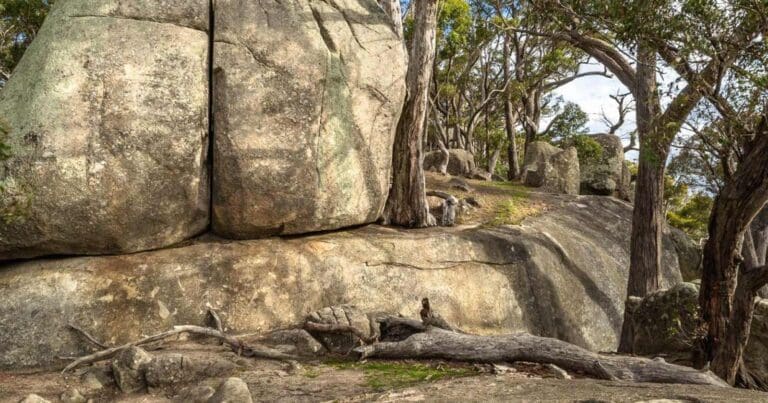
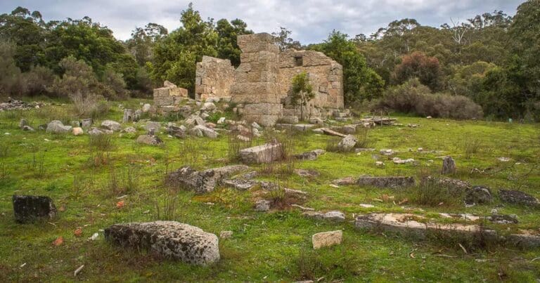
This hike is along some of the many wonderful walking tracks in the Castlemaine Diggings and includes part of the the Goldfields Trail. Walk from Chewton to the Welsh Village in the Castlemaine Diggings Heritage Park. The trail takes in the Manchester Mine, the remains of the Garfield Water Wheel, the Welsh Village and return via Forest Creek.
Easy walk along relatively flat terrain. Keep to the track as there are many mine shafts in this park.
Please don’t copy GPX files or content from this site to AllTrails or other platforms. Each trail has been personally mapped, documented, and refined to support Australia’s bushwalking and hiking community. While some details come from land managers, every listing reflects significant personal effort. This is a free, community-driven initiative—your respect helps keep it that way.
Total distance: 14032 m
Max elevation: 427 m
Min elevation: 315 m
Total climbing: 322 m
Total descent: -322 m
Getting there
Getting to the trailhead: Castlemaine Diggings National Heritage Park.
Closest towns to this walk: Campbells Creek, Castlemaine, Chewton, Elphinstone, Fryerstown, Guildford, Maldon, Newstead, Vaughan
About the region
The Castlemaine Diggings National Heritage Park is near the town of Castlemaine, Victoria, Australia. The park protects a nationally significant historic cultural landscape of heritage value and relics of the Victorian gold rush. The Castlemaine Diggings National Heritage Park was added to the Victorian Heritage Register in December 2003. It is the largest non-indigenous protected cultural landscape in Australia. In January 2005 the park was added to the Australian National Heritage List recognizing its outstanding heritage value and importance in the course of Australia's migration history.
Similar walks nearby
Looking for more walks in or near Castlemaine Diggings National Heritage Park? Try these trails with a similar difficulty grade.
Favourite

Mount Alexander Regional Park
Favourite

Greater Bendigo National Park
Favourite

Castlemaine Diggings National Heritage Park
Favourite

Mount Alexander Regional Park
Track grade
Grade 3 (Moderate) - Walks for Most Fitness Levels: Grade 3 on the
AWTGS represents moderate walking tracks. These are ideal for walkers with some fitness who are comfortable with some hills and uneven terrain. While suitable for most ages, some bushwalking experience is recommended to ensure a safe and enjoyable experience. Tracks may have short, steep hill sections, a rough surface, and many steps. The total distance of a Grade 3 walk can be up to 20 kilometers.
Explore safe
Plan ahead and hike safely! Carry enough water, pack layers for changing conditions, and bring safety gear like a torch, PLB, and reliable communication device. Check official sources for trail updates, closures, and access requirements, and review local weather and bushfire advice. Most importantly, share your plans with someone before you go. Being prepared makes for a safer and more enjoyable hike! Stay Safe, Explore More, and Always #ExploreSafe.
Packing checklists
What you carry in your pack depends on factors like weather, terrain, and your adventure type. Not sure what to bring? My free planning, food, and packing checklists are a great starting point, covering day hikes, overnight trips, and multi-day adventures. Use them to customise your kit and always prioritise safety.
Let someone know
Before heading out, take a moment to fill out your trip intentions form. It’s a quick way to share your hike details with family or friends. If something goes wrong, they can notify emergency services, ensuring a faster response and peace of mind. Stay safe and enjoy your adventure
Suggest an edit
Spotted a change on this trail? Maybe there are new features, the route has shifted, or the trail is permanently closed. Whatever the update, I’d love your input. Your feedback helps fellow hikers stay informed and ensures that our trail info stays fresh and reliable.
/Castlemaine-Diggings-Hike_21.jpg)
/Castlemaine-Diggings-Hike_5.jpg)
/Castlemaine-Diggings-Hike_3.jpg)
/Castlemaine-Diggings-Hike_14.jpg)
/Castlemaine-Diggings-Hike_20.jpg)
/Castlemaine-Diggings-Hike_15.jpg)
/Castlemaine-Diggings-Hike_18.jpg)
/Castlemaine-Diggings-Hike_6.jpg)
/Castlemaine-Diggings-Hike_13.jpg)
/Castlemaine-Diggings-Hike_11.jpg)
/Castlemaine-Diggings-Hike_17.jpg)
/Castlemaine-Diggings-Hike_9.jpg)
/Castlemaine-Diggings-Hike_19.jpg)
/Castlemaine-Diggings-Hike_8.jpg)
/Castlemaine-Diggings-Hike_12.jpg)


9 Reviews on “Castlemaine Diggings Hike (14km)”
I did a slight variation on this trail today, I added a detour from north east of the reservoir up into the pine plantation. The plantation gets very steep and it’s a bit desolate where the lots have been felled, but it’s got some nice views.
The Diggings park itself has heaps of trails, don’t worry too much about taking the exact ones, as long as you have a compass you can’t really get lost, and you’re never far from a road.
The reservoir is really worth the visit. It’s also possible to swim – at your own risk of course. No toilets or taps anywhere, so take plenty of water.
Great trail but you need GPS and a copy of the map as there are trails everywhere for different walks and it gets a bit confusing.