Hike at a Glance
Max elevation: 737m
Min elevation: 233m
Total Ascent: 1453m
Hike overview
The journey from Castlemaine to Bendigo, spanning 61 kilometers, showcases the Leanganook Track, named after the towering Mt Alexander, known as Leanganook in Aboriginal culture, which overlooks Castlemaine. While walkers can ascend to the summit of Mt Alexander, reaching 746 meters, cyclists take a detour north via Harcourt, circumnavigating the mountain's base before rejoining the shared track at the Coliban Channel.
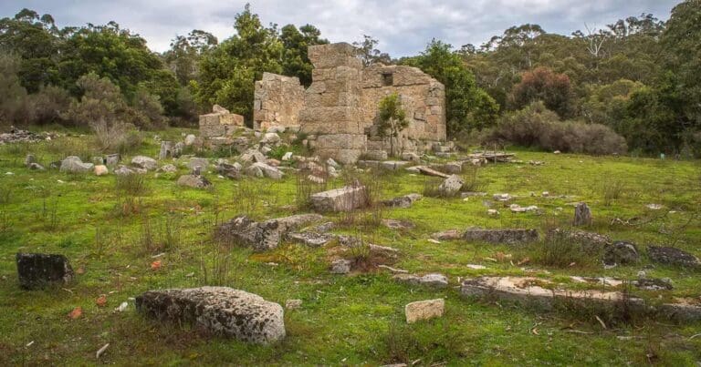
The Leanganook Track is a vital part of the Goldfields Track, linking the 'golden' cities of Castlemaine, Bendigo, and Ballarat. Beginning from Castlemaine Railway Station, the track immerses travelers in rich heritage, passing through intact streetscapes and historic mining sites within Australia’s first cultural national heritage park. Highlights include a gold rush era cemetery, remnants of the Garfield water wheel, and the ruins of a Welsh village and its slate quarry. Cyclists can also explore the Harcourt Mountain Bike Park on the western flank of Leanganook, boasting purpose-built trails.
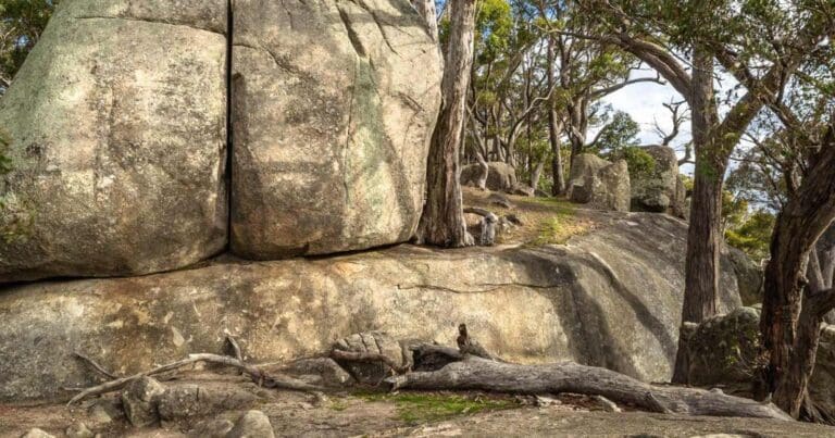
As the track progresses, walkers traverse impressive granite tors and mature box woodland, following the Coliban Water main channel, a feat of 1870s engineering. The shared track then winds through boulder-strewn farmland and forest, leading to the Sandhurst Reservoir. Along the way, travelers are treated to a floral spectacle during spring and summer, with wildflowers and orchids adorning the trail from Diamond Hill to the Salomon Gully Flora Reserve on the outskirts of Bendigo.
The Leanganook Track offers four distinct Walks/Rides, each starting from the south and heading north. The Heritage Park Walk/Ride begins at Castlemaine Railway Station, guiding visitors through suburban landscapes before delving into historic sites and natural wonders. For walkers only, the Leanganook Summit Walk provides an ascent through granite formations before rejoining cyclists at the Coliban Water main channel. The Coliban Water Walk/Ride continues along the shared track next to the channel, passing by heritage-listed tunnels and waterfalls. Finally, the Bendigo Goldfields Walk/Ride takes travelers through forested terrain and floral displays before culminating at Bendigo railway station via suburban streets marked by Goldfields Track signs.
Gallery
Got some great shots from this hike? Upload your photos here to inspire others and show off the beauty of the trail!
Click to view form >>
Submitting your photos doesn’t mean you lose ownership. You can be credited for your contributions, and you can request removal at any time.
Content use
Please don’t copy GPX files or content from this site to AllTrails or other platforms. Each trail has been personally mapped, documented, and refined to support Australia’s bushwalking and hiking community. While some details come from land managers, every listing reflects significant personal effort. This is a free, community-driven initiative—your respect helps keep it that way.
Walk map and GPX file
Max elevation: 737 m
Min elevation: 233 m
Total climbing: 1453 m
Total descent: -1504 m
Getting there
Getting to the trailhead: Greater Bendigo National Park.
Closest towns to this walk: Bendigo, Eaglehawk, Huntly, Marong, Strathdale
About the region
Greater Bendigo National Park is part of the traditional lands of the Dja Dja Wurrung People. The Dja Dja Wurrung People’s rights were recognised through a Recognition and Settlement Agreement with the State of Victoria in March 2013. The Dja Dja Wurrung People maintain a close and continuing connection to Djandak, their traditional Country.
Djandak is a cultural landscape that includes both tangible objects such as scarred trees, mounds, wells and stone artefact scatters; and intangible stories. Djandak is a living entity, which holds stories of creation and histories that cannot be erased. Parks Victoria pays our respects to Dja Dja Wurrung Elders, past, present, and future, and asks visitors to do the same. Aboriginal artefacts are protected by law, and it is prohibited to disturb them in any way.
Greater Bendigo National Park, along with Kara Kara National Park, Hepburn Regional Park, Kooyoora State Park, Paddy’s Ranges State Park and Wehla Nature Conservation Reserve, is jointly managed by the Dja Dja Wurrung Clans Aboriginal Corporation and Parks Victoria.
The park protects an area of high-quality Box-Ironbark forest, as well as broombush mallee, grassy woodlands and Kamarooka mallee. The park comes alive with native wildflowers in Spring, and is home to an array of wildlife including Swift Parrots and other bushland birds.
Notley Campground is a popular base for exploring the loop tracks and longer bushland trails through the forest, and the One Tree Hill Lookout offers a spectacular sunset view.
Visitors can discover Victoria’s gold rush history along the Old Tom Mine Walk and even try their luck at fossicking.
Similar walks nearby
Looking for more walks in or near Greater Bendigo National Park? Try these trails with a similar difficulty grade.
Track grade
Grade 3 (Moderate) - Walks for Most Fitness Levels: Grade 3 on the AWTGS represents moderate walking tracks. These are ideal for walkers with some fitness who are comfortable with some hills and uneven terrain. While suitable for most ages, some bushwalking experience is recommended to ensure a safe and enjoyable experience. Tracks may have short, steep hill sections, a rough surface, and many steps. The total distance of a Grade 3 walk can be up to 20 kilometers.
Explore safe
Plan ahead and hike safely! Carry enough water, pack layers for changing conditions, and bring safety gear like a torch, PLB, and reliable communication device. Check official sources for trail updates, closures, and access requirements, and review local weather and bushfire advice. Most importantly, share your plans with someone before you go. Being prepared makes for a safer and more enjoyable hike! Stay Safe, Explore More, and Always #ExploreSafe.
Packing checklists
What you carry in your pack depends on factors like weather, terrain, and your adventure type. Not sure what to bring? My free planning, food, and packing checklists are a great starting point, covering day hikes, overnight trips, and multi-day adventures. Use them to customise your kit and always prioritise safety.
Let someone know
Before heading out, take a moment to fill out your trip intentions form. It’s a quick way to share your hike details with family or friends. If something goes wrong, they can notify emergency services, ensuring a faster response and peace of mind. Stay safe and enjoy your adventure
Suggest an edit
Spotted a change on this trail? Maybe there are new features, the route has shifted, or the trail is permanently closed. Whatever the update, I’d love your input. Your feedback helps fellow hikers stay informed and ensures that our trail info stays fresh and reliable.
Acknowledgement of Country
Trail Hiking Australia acknowledges the Traditional Owners of the lands on which we hike and pay respects to their Elders, past and present, and we acknowledge the First Nations people of other communities who may be here today.


4 Reviews on “Great Dividing Trail: Leanganook Track (61km)”
Which state