Trail Fast Facts
Drapers Gorge Trail is a 1.6km, grade 4 hike in Kennedy Range National Park, Western Australia. This hike typically takes 45 minutes to complete.
Hike Overview
This is one of two Class 4 designated hiking trails in the Kennedy Range. The other being the Escarpment Trail. If you are physically able, this short two kilometre return trail offers a rock scrambling challenge as well some great views.
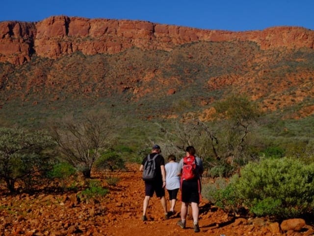
The Drapers Gorge walk is deceptively easy enough for the first section. So you would think for fast walkers, it would be a mere stroll in the park. The reality is however, very much the opposite. As you progress up the stony watercourse, the haRoader it gets. If your aim is to get to the trail's end, obstacles will have to be overcome. There is a lot of scrambling up and down steep loose stony slopes. There are some narrow rock ledges and overhangs to negotiate. Great care should be taken, especially on the upper parts of this trail. Along the well-marked path, you will come across a series of pools that, after rain maybe full, complete with seasonal waterfalls. You can only imagine the roaring rush of water plummeting down this narrow creek after really heavy rain. This is one of six walk trials in the park - Temple Gorge, Honeycomb Gorge, Drapers Gorge, the Escarpment Trail (leading to the top of the range), the Escarpment Base Trail, and Sunrise View.
Track Grade
Grade 4 (Hard) - Challenging Walks for Experienced Walkers: Grade 4 on the AWTGS signifies challenging walking tracks. Bushwalking experience is recommended for these tracks, which may be long, rough, and very steep. Directional signage may be limited, requiring a good sense of navigation. These walks are suited for experienced walkers who are comfortable with steeper inclines, rougher terrain, and potentially longer distances.
Tips
Start Point: Draper Gorge Car Park, south of the Kennedy Range campsite, 150km from Carnarvon which is 900km (9.5hours) north of Perth
End Point: Draper Gorge Car Park, south of the Kennedy Range campsite, 150km from Carnarvon which is 900km (9.5hours) north of Perth
Region: Kennedy Range National Park, Coral Coast
For more information, a location map and GPS file please visit Trails WA.
Map and GPX file
Help fellow hikers navigate with confidence. Share your GPX or KML file for this trail and help build a more comprehensive resource with precise waypoints and elevation profiles. Your contribution will empower adventurers with details they need for a safer and more enjoyable experience. I meticulously verify every file using official maps and surveys, ensuring the highest level of accuracy and reliability. Submit your file now and become a trailblazer for your fellow outdoor enthusiasts.
Trail Location (trailhead)
Sorry, no records were found. Please adjust your search criteria and try again.
Sorry, unable to load the Maps API.
Photo gallery
If you have any photos from this hike and are happy to share them, please upload your .jpg files here.
Please note: Uploading photos does not transfer ownership of copyright away from you. If requested, you will be credited for any photos you provide and can ask they be deleted at any time.
About the region
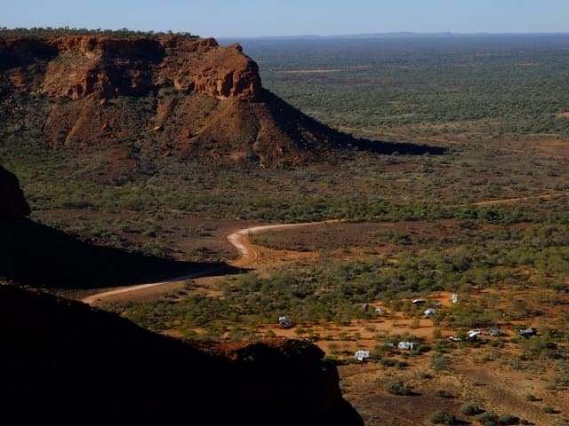
Scenic landscapes, wilderness, wildflowers, camping, walk trails, night skies, geology gemstones and marine fossils (to observe only), bird watching and outback photography are some of the attractions at Kennedy Range National Park. Kennedy Range is known as 'Mundatharrda' to the local Inggarda Aboriginal language group. Kennedy Range is a vast elevated north-south oriented sandstone plateau between 12 and 25km wide and about 75km long. The rocks that comprise the range were originally deposited beneath the sea. Over time they were compressed to form sandstone, then faulted, uplifted and tilted towards the west. Subsequent erosion has isolated the plateau 80m above the surrounding plain. The vegetation of the plain is acacia shrubland (mostly mulga), which shades an abundance of seasonal understory of flowering annuals (including everlastings).
Similar trails nearby
Explore Safe
While planning your hike, it’s important to check official government sources for updated information, temporary closures and trail access requirements. Before hitting the trail, check local weather and bushfire advice for planned burns and bushfire warnings and let someone know before you go. Plan ahead and hike safely.
Let someone know
Adventure with peace of mind: Fill out your trip intentions form. Before you hit the trail, fill out an online form to privately send important details about your hike to your family or friends. If you don’t return on time, they can easily alert emergency services, preventing worry and ensuring a swift response. Hike with peace of mind and enjoy your outdoor adventure to the fullest. Be smart, be safe: Register your plans here.
Gear to consider
What you carry in your pack will depend on the weather, terrain, time of year, type of adventure, and personal preferences. Having trouble deciding what gear’s right for you? My free planning, food and packing checklists provide an introduction to things your could consider (as well as the Ten Essentials) on your day, overnight and multi-day adventures. Customise your kit according to your personal needs, always considering safety first.
Suggest an edit
Trail changed? New features discovered? Has the route changed? Trail permanently closed? Help fellow hikers by suggesting edits! Click above to update route descriptions, GPX file, trail features (like boardwalks), or access conditions (like parking availability). Help me keep the trails info fresh!
Weather
Acknowledgement of Country
Trail Hiking Australia acknowledges the Traditional Owners of the lands on which we hike and pay respects to their Elders, past and present, and we acknowledge the First Nations people of other communities who may be here today.


