Hike at a Glance
Max elevation: 1850m
Min elevation: 1207m
Total Ascent: 1096m
Hike overview
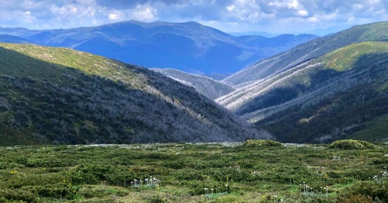
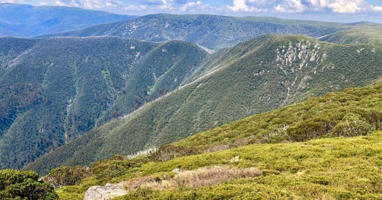
The Dibbins Hut - Mount Loch Circuit is a 20.5 kilometre, grade 4 hike in the Alpine National Park, Victoria. It is a challenging but rewarding hike that offers stunning views of the surrounding mountains and valleys.
The hike can be done as a long day walk or an overnight trip. If you are planning to overnight, there is a camping area at Dibbins Hut.
The hike begins by following a 4WD road along a ridge towards Mount Loch. The views from this section of the hike are amazing. Just short of Mount Loch, you will turn right onto the Australian Alpine Walking Track. The Australian Alpine Walking Track is a well-maintained track that takes you past Derrick Hut and down Swindlers Spur to Dibbins Hut.
The last kilometre before Dibbins Hut is quite steep, so be sure to take your time. Dibbins Hut is in a beautiful river flat beside the Cobungra River. It is a great place to have lunch or spend the night.
The return route first crosses the Cobungra River on a small bridge. From there, you will climb a few meters and then cross Cobungra Gap into the watershed of the East Kiewa River.
From Cobungra Gap, you will travel north-east to the Red Robin Battery. The Red Robin Battery is a fascinating relic of the gold mining era. From the Red Robin Battery, you will swing southerly along a 4WD track that climbs steadily to the Red Robin Mine.
The Red Robin Mine is no longer in operation, but it is still a popular spot for hikers and photographers. From the Red Robin Mine, you will follow a fairly level ridge back to Mount Loch and then to the start at the carpark.
Dibbins Hut
Nestled amidst the picturesque landscapes of the Victorian Alps, two huts stand as testaments to human resilience and the enduring spirit of adventure. Dibbins Hut, named after local cattleman Arthur Dibbins, was originally constructed in 1917. Over time, the elements took their toll, and a new hut, echoing the design of its predecessor, was erected in 1987.
The path to Dibbins Hut winds past Derrick Hut, a day shelter built in 1967 to honor Charles Derrick, a cross-country skier who tragically lost his life while traversing the treacherous terrain between Mount Hotham and Mount Bogong.
Both Dibbins Hut and Derrick Hut serve as welcome havens for weary hikers seeking respite from the challenges of the alpine wilderness. They stand as poignant reminders of the region's rich history and the unwavering determination of those who ventured into its embrace.
Tips
Camping at Blair Hut is as good an option as Dibbins Hut if one wants to even out the days. Also fewer people around.
Gallery
Got some great shots from this hike? Upload your photos here to inspire others and show off the beauty of the trail!
Click to view form >>
Submitting your photos doesn’t mean you lose ownership. You can be credited for your contributions, and you can request removal at any time.
Content use
Please don’t copy GPX files or content from this site to AllTrails or other platforms. Each trail has been personally mapped, documented, and refined to support Australia’s bushwalking and hiking community. While some details come from land managers, every listing reflects significant personal effort. This is a free, community-driven initiative—your respect helps keep it that way.
Walk map and GPX file
Max elevation: 1850 m
Min elevation: 1207 m
Total climbing: 1096 m
Total descent: -1094 m
Getting there
Getting to the trailhead: Alpine National Park.
The hike starts at the Mount Loch carpark. To get there, take the Maroona Road from Mansfield. The carpark is located about 20 kilometres from Mansfield.
Closest towns to this walk: Benalla, Bright, Dinner Plain, Falls Creek, Harrietville, Hotham Heights, Mansfield, Mitta Mitta, Mount Beauty, Mount Hotham, Myrtleford, Omeo, Porepunkah, Tawonga South, Wangaratta
About the region
The Alpine National Park is a national park in the Central Highlands and Alpine regions of Victoria, Australia. The 646,000-hectare national park is located northeast of Melbourne. It is the largest National Park in Victoria, and covers much of the higher areas of the Great Dividing Range in Victoria, including Victoria's highest point, Mount Bogong at 1,986 metres and the associated subalpine woodland and grassland of the Bogong High Plains. The park's north-eastern boundary is along the border with New South Wales, where it abuts the Kosciuszko National Park.
Similar walks nearby
Looking for more walks in or near Alpine National Park? Try these trails with a similar difficulty grade.
Track grade
Grade 4 (Hard) - Challenging Walks for Experienced Walkers: Grade 4 on the AWTGS signifies challenging walking tracks. Bushwalking experience is recommended for these tracks, which may be long, rough, and very steep. Directional signage may be limited, requiring a good sense of navigation. These walks are suited for experienced walkers who are comfortable with steeper inclines, rougher terrain, and potentially longer distances.
Explore safe
Plan ahead and hike safely! Carry enough water, pack layers for changing conditions, and bring safety gear like a torch, PLB, and reliable communication device. Check official sources for trail updates, closures, and access requirements, and review local weather and bushfire advice. Most importantly, share your plans with someone before you go. Being prepared makes for a safer and more enjoyable hike! Stay Safe, Explore More, and Always #ExploreSafe.
Packing checklists
What you carry in your pack depends on factors like weather, terrain, and your adventure type. Not sure what to bring? My free planning, food, and packing checklists are a great starting point, covering day hikes, overnight trips, and multi-day adventures. Use them to customise your kit and always prioritise safety.
Let someone know
Before heading out, take a moment to fill out your trip intentions form. It’s a quick way to share your hike details with family or friends. If something goes wrong, they can notify emergency services, ensuring a faster response and peace of mind. Stay safe and enjoy your adventure
Suggest an edit
Spotted a change on this trail? Maybe there are new features, the route has shifted, or the trail is permanently closed. Whatever the update, I’d love your input. Your feedback helps fellow hikers stay informed and ensures that our trail info stays fresh and reliable.
Acknowledgement of Country
Trail Hiking Australia acknowledges the Traditional Owners of the lands on which we hike and pay respects to their Elders, past and present, and we acknowledge the First Nations people of other communities who may be here today.


