Hike at a Glance
No location or state terms found.
Max elevation: 1881m
Min elevation: 1080m
Total Ascent: 2102m
Important info
This is a challenging hike, in an alpine environment, that should not be underestimated. During the winter months you should consider this a Grade 5 hike.
Hike overview
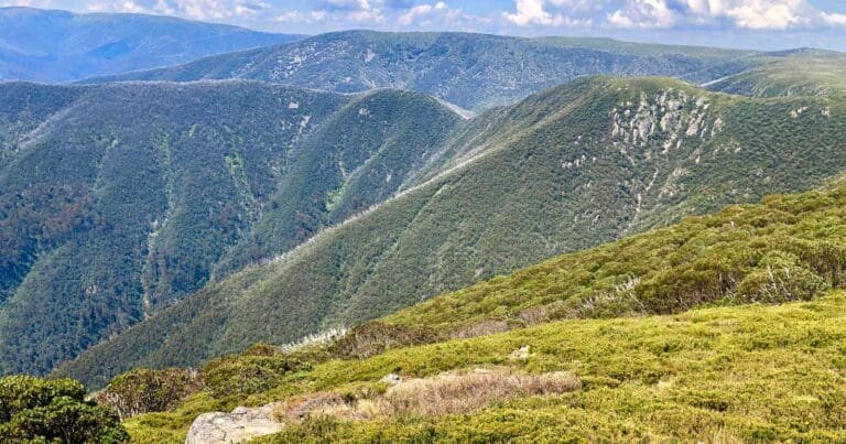
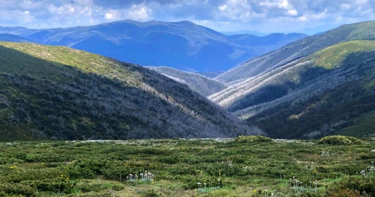
The Feathertop and Highplains circuit begins on the Great Alpine Road at Hotham Heights, guiding you through some of Victoria’s most captivating alpine landscapes. This circuit can be completed in either direction, but due to the challenging nature of Diamantina Spur, descending this section on the second day is generally recommended. For those travelling in an anti-clockwise direction, the adventure starts with a summit of Mount Hotham at 1857 metres. From there, the route follows the Razorback Ridge, crossing the Diamantina Spur en route to Mount Feathertop. Federation Hut, near Feathertop’s summit, provides a popular overnight camping spot, though it can be busy year-round.
On the second day, you’ll retrace your steps briefly to Diamantina Spur, descending its steep and rugged path down to the Kiewa Valley. Along West Keiwa Logging Road, you’ll find a small campsite near Diamantina Horse Yards, which makes for a peaceful overnight stop. Alternatively, you can continue on to Blairs Hut or Westons Hut if you prefer to cover more ground before nightfall.
The third day leads you up onto the Bogong Highplains, following a portion of the Australian Alpine Walking Trail through Cobungra Gap and across the Cobungra River to reach Dibbins Hut. This hut is another good camping option, though you can also choose to continue on to Derrick Hut or return directly to Hotham Heights, depending on your pace and preference.
Here’s a suggested four-day itinerary:
- Day 1: Hotham Heights to Federation Hut (via Mount Feathertop), approximately 14 km.
- Day 2: Federation Hut to Westons Hut (via Blairs Hut), approximately 10 km.
- Day 3: Westons Hut to Dibbins Hut (via Youngs Hut), approximately 13 km.
- Day 4: Dibbins Hut to Hotham Heights (via Derrick Hut), approximately 10 km.
This route offers a balance of challenging ascents, scenic ridge walks, and tranquil camping spots, making it an ideal choice for those looking to immerse themselves in Victoria’s alpine wilderness.
Mount Feathertop
Mount Feathertop, Victoria’s second-highest mountain at 1,922 metres, is renowned for its dramatic slopes and breathtaking alpine scenery. Unlike many nearby peaks, Feathertop’s steep sides rise uninterrupted to the summit, lacking the rounded dome typical of other mountains in the region. Snow covers the peak from June to September, making it a popular destination for hiking in summer and for experienced mountaineers and extreme skiers in winter. However, Feathertop’s beauty comes with risks, as cornices form along the summit ridge in winter, requiring caution due to the history of accidents on the mountain.
Victorian High Country Huts
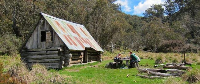
As part of the Feathertop and Highplains circuit, hikers can experience some of the Victorian high country’s historic huts, which were initially built in the 1800s by cattlemen, miners, and loggers. These huts, scattered across the alpine landscape, offer a glimpse into the region’s heritage. Although they provide temporary shelter, they’re not intended for overnight stays to preserve their cultural value. Following the Victorian High Country Huts Code of Conduct is essential to ensure these structures are respected and preserved for future generations.
Federation Hut, nestled among Snow Gums, serves as a base for climbing Mount Feathertop and can be accessed from Harrietville via Bungalow Spur or along The Razorback ridge from Mount Hotham. The hut offers emergency shelter only, and hikers are advised to carry a tent to ensure they have proper accommodation. Basic amenities include a toilet and a small tank with untreated water. Fires are only permitted in the hut’s fireplace, and the surrounding area is designated for fuel stove use only.
Blairs Hut, a log cabin located about 14.4 km from the trailhead, provides a good nearby camping area. Originally built with a bark roof, the hut was renovated in 1968, and its unusual stone-lined fireplace adds to its rustic charm. Westons Hut, another historical site, was rebuilt by volunteers and Parks Victoria after being destroyed in the 2006–2007 fires. Surrounded by snow gums and featuring nearby stockyards, it stands as a testament to community efforts to preserve these huts. Similarly, Youngs Hut, once an SEC survey hut, is maintained in partnership with Parks Victoria.
Dibbins Hut, situated on a snow plain near the headwaters of the Cobungra River, lies along the Australian Alps Walking Track and the Falls to Hotham Alpine Crossing. Built in 1987 to replace the original 1920s structure, it’s popular as a day or overnight stop for hikers and horse riders, though permits are required for horses from 1st December to 30th April. Derrick Hut, built in memory of cross-country skier Charlie Derrick, offers day shelter only and is not intended for overnight accommodation.
Water sources are available throughout the circuit. Near Mount Feathertop, hikers can access a natural spring about 850 metres from Memorial Cross along the North West Spur track. The Kiewa River West Branch provides cold, clear alpine water from Red Robin Battery through to the base of Diamantina Spur. As a precaution, always treat water from natural sources before drinking.
This journey through Mount Feathertop and the Victorian High Country offers both challenging alpine terrain and a unique historical experience, making it a memorable adventure for well-prepared hikers.
Tips
- This is a challenging hike, in an alpine environment, that should not be underestimated. During the winter months you should consider this a Grade 5 hike.
- This hike requires that you have a sufficient level of equipment (in good working order), fitness and self-reliance.
- There is no water on Diamantina Spur, and the only good camp site is right at the top. A small party could camp at the bottom, beside the bridge over the Diamantina River.
Trail features
- Trail Running
- Alpine Region
- Scenic Viewpoints
- Alpine Huts
- Exposed Ledges
- Rock Scrambling
- Steep Terrain
- River Crossings
- Untreated Water
- Overnight Campsites
Gallery
Got some great shots from this hike? Upload your photos here to inspire others and show off the beauty of the trail!
Click to view form >>
Submitting your photos doesn’t mean you lose ownership. You can be credited for your contributions, and you can request removal at any time.
Content use
Please don’t copy GPX files or content from this site to AllTrails or other platforms. Each trail has been personally mapped, documented, and refined to support Australia’s bushwalking and hiking community. While some details come from land managers, every listing reflects significant personal effort. This is a free, community-driven initiative—your respect helps keep it that way.
Walk map and GPX file
Max elevation: 1881 m
Min elevation: 1080 m
Total climbing: 2102 m
Total descent: -2108 m
Getting there
Getting to the trailhead: Alpine National Park.
To reach the trailhead for Mount Hotham, take the Great Alpine Road, which connects the scenic Victorian Alps between Harrietville and Omeo. This route is accessible year-round, though during the declared winter period, it’s mandatory to carry diamond-pattern chains, as stipulated by the Mount Hotham Alpine Resort Management Board. Keep in mind that only diamond-pattern chains are permitted; ladder chains, spider chains, and snow socks are not allowed in the resort area. For those heading out on a multi-day hike, long-term parking is available off Alpine Road, with roadside parking offered at the trail’s starting point for shorter stays. For more details on parking and access points, consult the Hotham access map.
Closest towns to this walk: Benalla, Bright, Dinner Plain, Falls Creek, Harrietville, Hotham Heights, Mansfield, Mitta Mitta, Mount Beauty, Mount Hotham, Myrtleford, Omeo, Porepunkah, Tawonga South, Wangaratta
About the region
Exploring Australia's Alpine National Park
The Alpine National Park offers a range of exciting outdoor activities that cater to all levels of adventure. Located in Victoria, this park is home to some of the state's highest mountain ranges, making it a popular destination for bushwalkers, hikers, and nature lovers. The park’s stunning landscapes are perfect for exploring on foot, on horseback, or even by mountain bike, with plenty of world-class trails to enjoy.
For a truly memorable experience, try the Falls to Hotham Alpine Crossing, which takes you across towering alpine ridgelines and through lush river valleys, all set against breathtaking alpine scenery. If you're looking to learn about the region's history, you can drive along the Wonnangatta Four-wheel Drive route, where you'll uncover the stories of the past while taking in rugged bushland and mountain views. For those keen on a challenge, the Razorback Ridge hike leads to Victoria’s second-highest peak, Mount Feathertop, offering some of the most spectacular views of the Great Dividing Range.
Adventurers can also take on the challenge of climbing Mount Bogong, the highest peak in Victoria, or explore the historic huts scattered across the Bogong High Plains, once home to legendary cattlemen. For a thrill of a different kind, white-water rafting trips on the Mitta Mitta River or skiing across the park’s varied terrain can help you experience the park’s wild side. Whether you prefer downhill runs or cross-country trails, the Alpine National Park offers some of the best ski touring opportunities in the state.
The park is also an important part of the Aboriginal cultural landscape, with traditional Country belonging to the Taungurung and Gunaikurnai Peoples.
Want to find the best trails in Alpine National Park for an adventurous hike, casual walk, or a family trip? Trail Hiking Australia has the best trails for walking, hiking, running, and more.
Similar walks nearby
Looking for more walks in or near Alpine National Park? Try these trails with a similar difficulty grade.
Track grade
Grade 4 (Hard) - Challenging Walks for Experienced Walkers: Grade 4 on the AWTGS signifies challenging walking tracks. Bushwalking experience is recommended for these tracks, which may be long, rough, and very steep. Directional signage may be limited, requiring a good sense of navigation. These walks are suited for experienced walkers who are comfortable with steeper inclines, rougher terrain, and potentially longer distances.
Explore safe
Plan ahead and hike safely! Carry enough water, pack layers for changing conditions, and bring safety gear like a torch, PLB, and reliable communication device. Check official sources for trail updates, closures, and access requirements, and review local weather and bushfire advice. Most importantly, share your plans with someone before you go. Being prepared makes for a safer and more enjoyable hike! Stay Safe, Explore More, and Always #ExploreSafe.
Packing checklists
What you carry in your pack depends on factors like weather, terrain, and your adventure type. Not sure what to bring? My free planning, food, and packing checklists are a great starting point, covering day hikes, overnight trips, and multi-day adventures. Use them to customise your kit and always prioritise safety.
Let someone know
Before heading out, take a moment to fill out your trip intentions form. It’s a quick way to share your hike details with family or friends. If something goes wrong, they can notify emergency services, ensuring a faster response and peace of mind. Stay safe and enjoy your adventure
Suggest an edit
Spotted a change on this trail? Maybe there are new features, the route has shifted, or the trail is permanently closed. Whatever the update, I’d love your input. Your feedback helps fellow hikers stay informed and ensures that our trail info stays fresh and reliable.
Acknowledgement of Country
Trail Hiking Australia acknowledges the Traditional Owners of the lands on which we hike and pay respects to their Elders, past and present, and we acknowledge the First Nations people of other communities who may be here today.


8 Reviews on “Feathertop & Highplains Circuit Hike (47km)”
One of my favourites in Victoria’s high country.
A wonderful hike with stunning views over the high country. There are so many great hikes in the Victorian alps, this is certainly one of them.