Trail Fast Facts
Coral Coast Pathways - Elliot Heads Section) is a 2km, grade 1 hike in Elliot Heads, Queensland. This hike typically takes 1.25 hours to complete.
Hike Overview
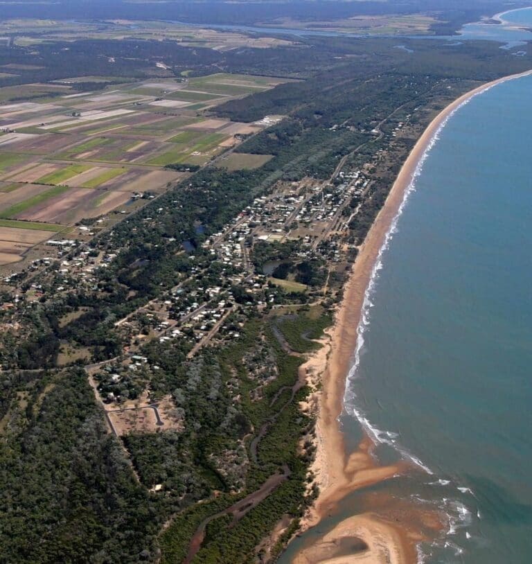
As a part of the Coral Coast Pathways walking tracks, the Elliot Heads Section provides a unique coastal experience. The Journey commences at Life Savers Park at the mouth of the Elliot River through to Bill Stockwell Park at the northern point of Elliot Heads overlooking rural land then beyond to the northern area of Coral Cove. Footpaths line the coastline allowing all a leisurely stroll and enjoying the fresh sea air.
Track Grade
Grade 1 (All-abilities) - Perfect for Families and Beginners: Grade 1 on the AWTGS represents the easiest walking tracks, perfect for families with young children or those new to bushwalking. No prior experience is required. These gentle walks feature a flat, even surface with no steps or steep sections. They are suitable for wheelchair users with assistance due to the even terrain. The total distance of a Grade 1 walk is typically no greater than 5 kilometers, making them a comfortable and manageable option for all ages and fitness levels.
Map and GPX file
Help fellow hikers navigate with confidence. Share your GPX or KML file for this trail and help build a more comprehensive resource with precise waypoints and elevation profiles. Your contribution will empower adventurers with details they need for a safer and more enjoyable experience. I meticulously verify every file using official maps and surveys, ensuring the highest level of accuracy and reliability. Submit your file now and become a trailblazer for your fellow outdoor enthusiasts.
Trail Location (trailhead)
Sorry, no records were found. Please adjust your search criteria and try again.
Sorry, unable to load the Maps API.
Photo gallery
If you have any photos from this hike and are happy to share them, please upload your .jpg files here.
Please note: Uploading photos does not transfer ownership of copyright away from you. If requested, you will be credited for any photos you provide and can ask they be deleted at any time.
About the region
Elliott Heads is a town in the Bundaberg region of Queensland, Australia. The town is located at the mouth of the Elliott River, 359 kilometres (223 mi) north of the state capital, Brisbane. At the 2006 census, Elliott Heads had a population of 810. Elliott Heads is surrounded by small crop and sugarcane farms and is a popular recreation area, offering both surf and stillwater areas for swimming, fishing, sailboarding and jet skiing. Barolin House, constructed as a summer residence by a family with a grazing property near Gin Gin is a distinctive local landmark.
For more information on this hiking trail, please visit Queensland.com
Similar trails nearby
Explore Safe
While planning your hike, it’s important to check official government sources for updated information, temporary closures and trail access requirements. Before hitting the trail, check local weather and bushfire advice for planned burns and bushfire warnings and let someone know before you go. Plan ahead and hike safely.
Let someone know
Adventure with peace of mind: Fill out your trip intentions form. Before you hit the trail, fill out an online form to privately send important details about your hike to your family or friends. If you don’t return on time, they can easily alert emergency services, preventing worry and ensuring a swift response. Hike with peace of mind and enjoy your outdoor adventure to the fullest. Be smart, be safe: Register your plans here.
Gear to consider
What you carry in your pack will depend on the weather, terrain, time of year, type of adventure, and personal preferences. Having trouble deciding what gear’s right for you? My free planning, food and packing checklists provide an introduction to things your could consider (as well as the Ten Essentials) on your day, overnight and multi-day adventures. Customise your kit according to your personal needs, always considering safety first.
Suggest an edit
Trail changed? New features discovered? Has the route changed? Trail permanently closed? Help fellow hikers by suggesting edits! Click above to update route descriptions, GPX file, trail features (like boardwalks), or access conditions (like parking availability). Help me keep the trails info fresh!
Weather
Acknowledgement of Country
Trail Hiking Australia acknowledges the Traditional Owners of the lands on which we hike and pay respects to their Elders, past and present, and we acknowledge the First Nations people of other communities who may be here today.


