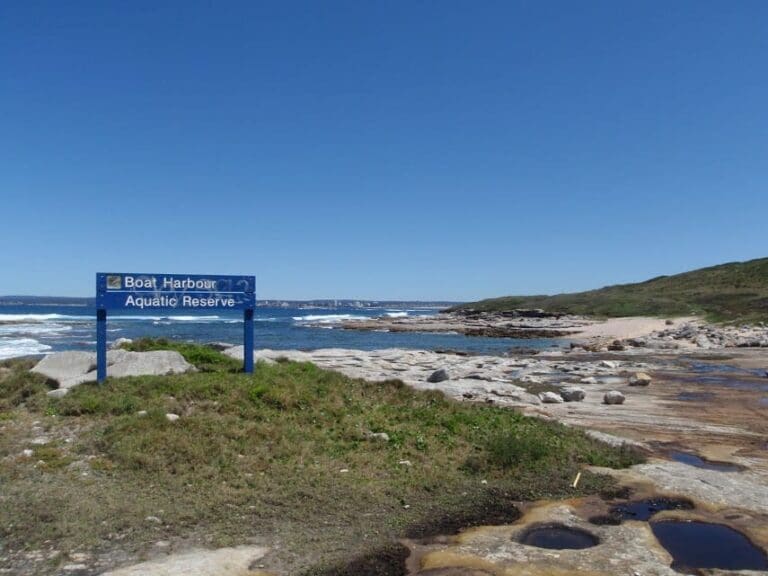
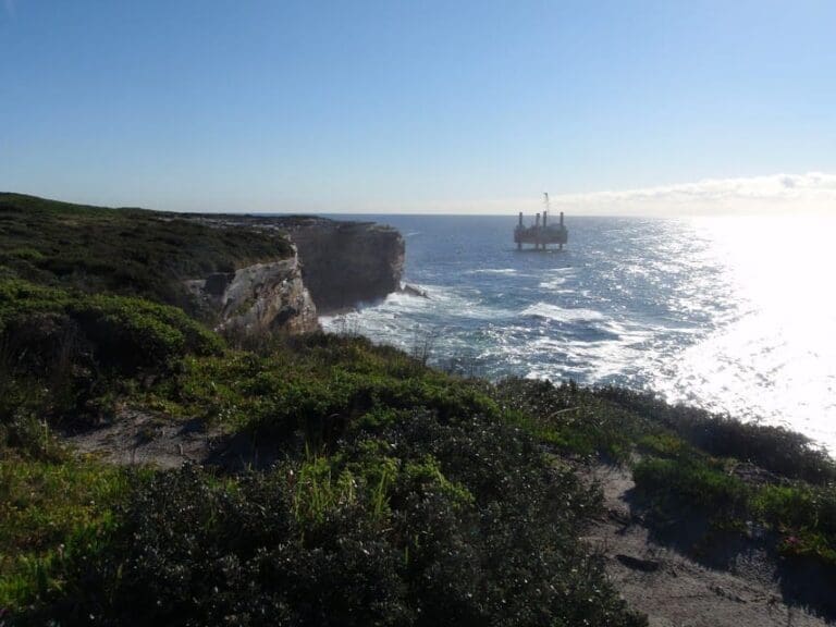
This walk starts from Kurnell's Botany Bay Visitors Centre and heads south through the national park. The track winds through dry gum forest until it breaks out into heath joining onto the Cape Bailey walking track. As it continues south through small sand dunes and in between hanging swamps the track winds in and out of the cliff top coastline to the end of the Sir Joseph Banks drive. The side trip up to the Cape Bailey lighthouse is well worth the small climb.
Download maps and tracknotes for Cape Bailey track from visitor centre to Boat Harbour Reserve hiking track from wildwalks.com.
Got some great shots from this hike? Upload your photos here to inspire others and show off the beauty of the trail!
Submitting your photos doesn’t mean you lose ownership. You can be credited for your contributions, and you can request removal at any time.
Please don’t copy GPX files or content from this site to AllTrails or other platforms. Each trail has been personally mapped, documented, and refined to support Australia’s bushwalking and hiking community. While some details come from land managers, every listing reflects significant personal effort. This is a free, community-driven initiative—your respect helps keep it that way.
It looks like I don’t have a GPX file for this trail yet. If you have one to share, please email it to me! I’ll verify it against official maps before adding it to help other hikers have a safer, easier experience. Thanks for contributing to a better hiking resource.
Getting there
Getting to the trailhead: Botany Bay National Park.
Closest towns to this walk: Banksia, Bexley, Brighton-Le-Sands, Caringbah, Carlton, Cronulla, Hurstville, Kogarah, Kurnell, Kyeemagh, La Perouse, Mascot, Miranda, Ramsgate, Rockdale, Sans Souci, Sydney, Sylvania, Woolooware
About the region
Kamay Botany Bay National Park is located at La Perouse and Kurnell in Sydney. Discover its rich Aboriginal culture, explore Captain Cook's Landing Place, spot native plants on a bushwalk or whales at Cape Solander.
Similar walks nearby
Looking for more walks in or near Botany Bay National Park? Try these trails with a similar difficulty grade.
Favourite

Favourite

Favourite

Favourite

Track grade
Grade 4 (Hard) -
Challenging Walks for Experienced Walkers: Grade 4 on the
AWTGS signifies challenging walking tracks. Bushwalking experience is recommended for these tracks, which may be long, rough, and very steep. Directional signage may be limited, requiring a good sense of navigation. These walks are suited for experienced walkers who are comfortable with steeper inclines, rougher terrain, and potentially longer distances.
Explore safe
Plan ahead and hike safely! Carry enough water, pack layers for changing conditions, and bring safety gear like a torch, PLB, and reliable communication device. Check official sources for trail updates, closures, and access requirements, and review local weather and bushfire advice. Most importantly, share your plans with someone before you go. Being prepared makes for a safer and more enjoyable hike! Stay Safe, Explore More, and Always #ExploreSafe.
Packing checklists
What you carry in your pack depends on factors like weather, terrain, and your adventure type. Not sure what to bring? My free planning, food, and packing checklists are a great starting point, covering day hikes, overnight trips, and multi-day adventures. Use them to customise your kit and always prioritise safety.
Let someone know
Before heading out, take a moment to fill out your trip intentions form. It’s a quick way to share your hike details with family or friends. If something goes wrong, they can notify emergency services, ensuring a faster response and peace of mind. Stay safe and enjoy your adventure
Suggest an edit
Spotted a change on this trail? Maybe there are new features, the route has shifted, or the trail is permanently closed. Whatever the update, I’d love your input. Your feedback helps fellow hikers stay informed and ensures that our trail info stays fresh and reliable.


8 Reviews on “Cape Bailey Track from Visitor Centre to Boat Harbour Reserve Walk (5.7km)”
Tess Campbelll