Trail Fast Facts
Burbie Canyon walking track is a 2.5km, grade 3 hike in Warrumbungle National Park, New South Wales. This hike typically takes 1.5 hours to complete.
Hike Overview
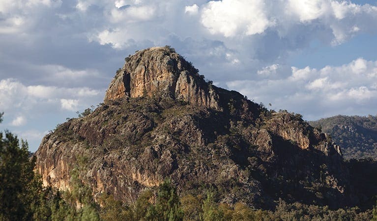
Imagine strolling past a gurgling creek and through a towering sandstone gorge. Burbie Canyon walking track offers a gentle 2.5km escape, perfect for avid birdwatchers trying to spot peregrine falcons or rare turquoise parrots. But this isn't just a haven for bird lovers; Burbie Canyon is a terrific track for families and kids as well. Though good to visit any time of year, spring explodes with wildflowers like the common parrot pea, guinea flower, and even five corners, a popular bushfood. Bring your camera and soak up the stunning ambience of the native forest. You might even spot a shy wallaby or, with a stroke of luck, a koala dozing in a eucalyptus tree.
Track Grade
Grade 3 (Moderate) - Walks for Most Fitness Levels: Grade 3 on the AWTGS represents moderate walking tracks. These are ideal for walkers with some fitness who are comfortable with some hills and uneven terrain. While suitable for most ages, some bushwalking experience is recommended to ensure a safe and enjoyable experience. Tracks may have short, steep hill sections, a rough surface, and many steps. The total distance of a Grade 3 walk can be up to 20 kilometers.
Tips
- Remember to take your binoculars if you want to go birdwatching
- There is limited/no mobile reception in this park
Map and GPX file
Max elevation: 470 m
Min elevation: 438 m
Total climbing: 54 m
Total descent: -54 m
Trail Location (trailhead)
Sorry, no records were found. Please adjust your search criteria and try again.
Sorry, unable to load the Maps API.
Getting there
Burbie Canyon walking track is located within Warrumbungle National Park. If you're coming from Coonabarabran, follow the signs to Warrumbungle National Park from the Newell Highway. Take John Renshaw Parkway for about 33km into the park's center. Continue west on John Renshaw Parkway, passing signs for campgrounds and the visitor center, for approximately 4km more. Look for the turnoff to Burbie Canyon carpark on your right.
For those arriving from Tooraweenah, follow signs east towards Warrumbungle National Park which will lead you onto John Renshaw Parkway. Once inside the park, stay on John Renshaw Parkway for roughly 3km. Burbie Canyon carpark will be on your left-hand side.
You'll find parking available at Burbie Canyon carpark.
Photo gallery
If you have any photos from this hike and are happy to share them, please upload your .jpg files here.
Please note: Uploading photos does not transfer ownership of copyright away from you. If requested, you will be credited for any photos you provide and can ask they be deleted at any time.
About the region
Millions of years ago, a mighty shield volcano sculpted the jagged peaks of Warrumbungle National Park. Today, these ancient formations rise majestically from eucalyptus-dotted plains, creating a landscape unlike any other in New South Wales.
As Australia's first Dark Sky Park, Warrumbungle boasts pristine skies untouched by light pollution. Here, the Milky Way stretches across the heavens, revealing a dazzling display of stars, planets, and distant galaxies. Whether you're a seasoned astronomer or a curious beginner, Warrumbungle offers unforgettable stargazing experiences.
Lace up your boots and explore a network of walking tracks. Hike the iconic Breadknife and Grand High Tops Walk for breathtaking close-up views of the park's most recognizable rock formations. The park is a haven for outdoor enthusiasts, with opportunities for camping, birdwatching, and capturing stunning photographs of the dramatic scenery.
While wildfires impacted the park in 2013, the National Parks and Wildlife Service (NPWS) has meticulously restored walking tracks, campgrounds, and visitor facilities. Start your adventure at the Warrumbungle Visitor Centre, where you can gather park information or purchase a star chart to navigate the night sky.
Similar trails nearby
Explore Safe
While planning your hike, it’s important to check official government sources for updated information, temporary closures and trail access requirements. Before hitting the trail, check local weather and bushfire advice for planned burns and bushfire warnings and let someone know before you go. Plan ahead and hike safely.
Let someone know
Adventure with peace of mind: Fill out your trip intentions form. Before you hit the trail, fill out an online form to privately send important details about your hike to your family or friends. If you don’t return on time, they can easily alert emergency services, preventing worry and ensuring a swift response. Hike with peace of mind and enjoy your outdoor adventure to the fullest. Be smart, be safe: Register your plans here.
Gear to consider
What you carry in your pack will depend on the weather, terrain, time of year, type of adventure, and personal preferences. Having trouble deciding what gear’s right for you? My free planning, food and packing checklists provide an introduction to things your could consider (as well as the Ten Essentials) on your day, overnight and multi-day adventures. Customise your kit according to your personal needs, always considering safety first.
Suggest an edit
Trail changed? New features discovered? Has the route changed? Trail permanently closed? Help fellow hikers by suggesting edits! Click above to update route descriptions, GPX file, trail features (like boardwalks), or access conditions (like parking availability). Help me keep the trails info fresh!
Weather
Acknowledgement of Country
Trail Hiking Australia acknowledges the Traditional Owners of the lands on which we hike and pay respects to their Elders, past and present, and we acknowledge the First Nations people of other communities who may be here today.


3 Reviews on “Burbie Canyon Walking Track (2.5km)”
We have done this hike 2 months ago in very hot conditions and loved it