Hike at a Glance
Max elevation: 695m
Min elevation: 466m
Total Ascent: 641m
Important info
This circuit hike passes along the boundary of the Ruths Gully Reference Area. Please do not enter this area and obey all signs and map directions.
Hike overview
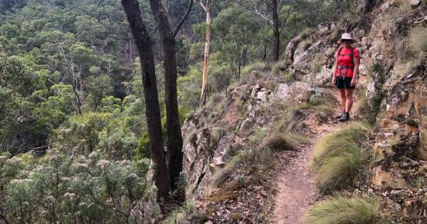
The Ruths Gully Circuit is a 17-kilometre hike that takes you deep into the heart of Victoria’s Lerderderg State Park and Wombat State Forest. With a grade 4 rating, this trail presents a challenging yet rewarding experience, typically taking around 6 hours to complete. The hike offers more than just a physical challenge; it’s an opportunity to connect with nature, enjoy stunning views, and explore a region steeped in history.
Starting at the Blackwood Mineral Springs Reserve, the journey begins with a crossing over a bridge near the mineral springs, followed by a turn left along a water race. From here, the trail gradually ascends through open woodland, leading you toward the serene Shaws Lake. As you pass the lake to its northern side, the route shifts, guiding you along a mix of walking and vehicle tracks that take you from Lerderderg State Park into the Wombat State Forest. Along the way, you'll travel the Ruth and Hayden Tracks, heading south along the eastern boundary of the Ruths Gully Reference Area. This area is off-limits to hikers, so it's important to follow the signs and map directions carefully.
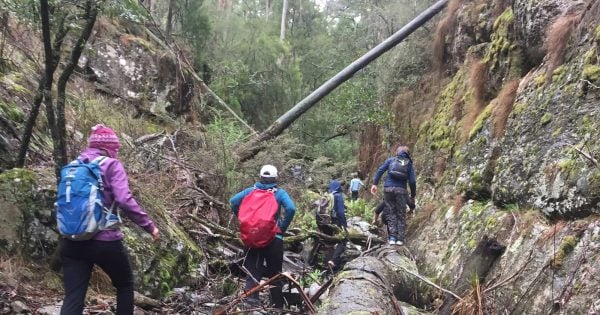
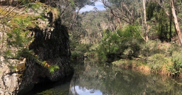
From here, the trail descends into the rugged depths of the Lerderderg River. The path crosses the river before continuing along Amblers Lane and a brief section of the Byers Back Track. After another crossing of the Lerderderg River, you’ll connect to Tunnel Point Track. This part of the trail can be tricky to navigate, as the path is less defined, so it’s essential to be comfortable with map reading and direction finding.
Tunnel Point Track takes you north to North Blackwood Road, where you’ll retrace your steps towards Shaws Lake and back to the Blackwood Springs Reserve. Along the way, you’ll be treated to moments of peace, a sense of isolation, and the kind of wild beauty that makes this hike truly memorable. Whether you’re after a challenging trek or a chance to lose yourself in nature, the Ruths Gully Circuit delivers on both counts.
Shaw's Water Race
Shaw's Water Race is a remnant of the gold rush era, built in the 1850s to divert water from Yankee Creek to auriferous (gold-bearing) ground. It's a tangible reminder of the area's mining past. The race is about 3.5 kilometers long and winds through picturesque bushland, offering glimpses of the forest's diverse flora and fauna.
Ruths Gully Reference Area
The Ruths Gully Reference Area in Wombat State Forest is a place of untouched natural beauty and ecological significance. It's not your typical hiking destination - instead, it's a protected zone where conservation reigns supreme. This area is strictly off-limits to the public, allowing native flora and fauna to thrive undisturbed. It's a haven for rare and threatened species, like the Leadbeater's Possum and the Powerful Owl. This untouched wilderness also protects vital water catchments and fragile ecosystems.
The area serves as a vital living laboratory for researchers and scientists. They study the delicate balance of ecosystems, monitor threatened species, and learn about the natural processes that sustain this unique environment. This knowledge is crucial for conservation efforts across the region.
By keeping human interference minimal, Ruths Gully acts as a reference point for how healthy ecosystems function. This knowledge is invaluable for restoring degraded landscapes and ensuring the long-term survival of native species. It's a reminder of what we can achieve when we prioritise conservation.
Remember, even though you can't explore the heart of Ruths Gully, respecting its boundaries and appreciating its role in protecting our natural heritage is an adventure in itself. It's a chance to connect with the wild places we choose to safeguard for future generations.
Tips
This circuit hike passes along the boundary of the Ruths Gully Reference Area. Please do not enter this area and obey all signs and map directions.
While a great deal of this hike is along well formed trails, it does involve steep sections on and off formed tracks, two river crossings and some off track navigation. A good topographic map as well as competent navigation skills are required.
Track grade
Grade 4 (Hard) - Challenging Walks for Experienced Walkers: Grade 4 on the AWTGS signifies challenging walking tracks. Bushwalking experience is recommended for these tracks, which may be long, rough, and very steep. Directional signage may be limited, requiring a good sense of navigation. These walks are suited for experienced walkers who are comfortable with steeper inclines, rougher terrain, and potentially longer distances.
Walk map and GPX file
Max elevation: 695 m
Min elevation: 466 m
Total climbing: 641 m
Total descent: -641 m
Content use
Please don’t copy GPX files or content from this site to AllTrails or other platforms. Each trail has been personally mapped, documented, and refined to support Australia’s bushwalking and hiking community. While some details come from land managers, every listing reflects significant personal effort. This is a free, community-driven initiative—your respect helps keep it that way.
Getting there
Getting to the trailhead: Lerderderg State Park.
Drive to Blackwood on the Western Highway via Melton and Bacchus Marsh, taking the Greendale-Myrninong Rd turn-off from the highway and then the Greendale-Trentham Rd to Blackwood. In Blackwood follow Martin Street north to Golden Point Road. Follow this east for 500m to the Mineral Springs Reserve on the left.
Need a rental car to get you to the hike? Find one here.
Access conditions
- 2WD Access
- Bitumen Road
- Entry Fee
- Large Car Park
- Public Toilets
- Untreated Water
- Picnic Shelter
- Picnic Table
- BBQ Facilities
About the region
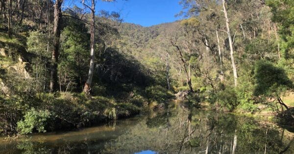
Rising in the Great Dividing Range, the Lerderderg River has cut a 300 metre deep gorge through sandstone and slate, almost bisecting the park. The park has a wide variety of vegetation and wildlife and some interesting relics of gold mining. Lerderderg State Park encompasses scenic and geological gorge formations surrounding the Lerderderg River as well as the volcanic cone of Mount Blackwood. The adjacent and separate block called the Pyrete Range forms part of the park. The Lerderderg is known for its remote setting and the 300m deep Lerderderg River gorge is a dominant feature. Private land abuts the park to the south and the Wombat State forest abuts to the north and west.
Lerderderg State Park (incorporating the former Pyrete State Forest) is a 14,250-hectare park located between Bacchus Marsh and Blackwood, an hour's drive from Melbourne, Australia. There are several maintained tracks for walking through the park and camping is allowed.
The park is named for the Lerderderg River which has cut the 300 metre deep Lerderderg Gorge through sandstone and slate, almost bisecting the park. Parks Victoria maintains six designated walks: three short walks of 3.5 km or less; Blackwood-O'Briens Crossing and return (22 km); O'Briens Crossing-Cowan Track loop (14 km); and the overnight walk O'Briens Crossing to Mackenzies Flat (20 km).
In addition, one leg of the Great Dividing Trail, the Lerderderg Track, passes through the park, entering from Blackwood in the park's northwest, and exiting south towards Bacchus Marsh. Bicycles are prohibited from one section of this track, due to a conservation area.
Find a place to stay
Wondering where to stay near this hike? Find accommodation close to the trailhead — hotels, cabins and campgrounds nearby. Click the button to view the interactive map.
Closest towns to this walk: Bacchus Marsh, Ballan, Blackwood, Bullengarook, Coimadai, Darley, Daylesford, Gisborne, Kyneton, Macarthur, Macedon, Maddingley, Melton, Myrniong, Sunbury, Trentham, Woodend
Let someone know
Heading out? Fill in a trip intentions form so someone knows your plans. If things go wrong, they can raise the alarm fast, giving you peace of mind on the trail.
Similar walks nearby
Looking for more walks in or near Lerderderg State Park? Try these trails with a similar difficulty grade.
Suggest an edit
Notice something different about this trail? Whether it’s a new feature, a route change, or a closure, share your update so we can keep our info accurate and helpful for fellow hikers.
Click to suggest edits >>
Explore safe
Plan ahead and hike safely! Carry enough water, pack layers for changing conditions, and bring safety gear like a torch, PLB, and reliable communication device. Check official sources for trail updates, closures, and access requirements, and review local weather and bushfire advice. Most importantly, share your plans with someone before you go. Being prepared makes for a safer and more enjoyable hike! Stay Safe, Explore More, and Always #ExploreSafe.
Packing checklists
What you carry in your pack depends on factors like weather, terrain, and your adventure type. Not sure what to bring? My free planning, food, and packing checklists are a great starting point, covering day hikes, overnight trips, and multi-day adventures. Use them to customise your kit and always prioritise safety.
Acknowledgement of Country
Trail Hiking Australia acknowledges the Traditional Owners of the lands on which we hike and pay respects to their Elders, past and present, and we acknowledge the First Nations people of other communities who may be here today.
/Ruths-Gully-Circuit-Hike_12.jpg)
/Ruths-Gully-Circuit-Hike_45.jpg)
/Ruths-Gully-Circuit-Hike_36.jpg)
/Ruths-Gully-Circuit-Hike_22.jpg)
/Ruths-Gully-Circuit-Hike_44.jpg)
/Ruths-Gully-Circuit-Hike_33.jpg)
/Ruths-Gully-Circuit-Hike_24.jpg)
/Ruths-Gully-Circuit-Hike_16.jpg)
/Ruths-Gully-Circuit-Hike_39.jpg)
/Ruths-Gully-Circuit-Hike_9.jpg)
/Ruths-Gully-Circuit-Hike_46.jpg)
/Ruths-Gully-Circuit-Hike_38.jpg)
/Ruths-Gully-Circuit-Hike_25.jpg)
/Ruths-Gully-Circuit-Hike_15.jpg)
/Ruths-Gully-Circuit-Hike_3.jpg)


8 Reviews on “Ruths Gully Circuit Hike (17km)”
The GPX track has a different start/finish to the description which might confuse some.
Also, it took us less than 5h, with breaks. Probably 4h walk time.
This is an excellent hike with some steep climbs and descents. It should be noted that a 4WD vehicle is required to access this trail. My mate and i did this hike in pouring rain and it was very enjoyable and challenging but getting back out with the vehicle was just was challenging and required some winching.