Hike at a Glance
Max elevation: 2218m
Min elevation: 426m
Total Ascent: 2020m
Important info
This is a remote alpine area where access can be challenging and the weather unpredictable, particularly on the exposed Main Range. Be prepared for rapidly changing conditions by carrying sufficient food and water, along with a map, compass, and GPS for reliable navigation. A Personal Locator Beacon (PLB) is strongly recommended, as mobile reception is often unavailable. Pack high-quality, moisture-wicking layers and an alpine-grade shelter or bivvy for emergencies. Always inform someone of your hiking plans, including your route and expected return time.
Hike overview
Hannels Spur Track is a demanding yet deeply rewarding 23-kilometre journey through the rugged beauty of Kosciuszko National Park, New South Wales. Classified as a grade 5 hike, it typically takes two to three days to complete and is widely regarded as one of the most challenging treks in New South Wales. Its difficulty lies not only in the relentless ascent – the greatest elevation gain of any tracked spur in the country – but also in the need for strong navigation skills through remote wilderness. Despite its challenges, the trail’s rich history and striking natural diversity make it an extraordinary experience for those prepared to tackle it.
Starting near Geehi Flat on the Alpine Way, the hike begins with a clear marker indicating the route to the summit of Mount Kosciuszko, 15.5 kilometres ahead. However, for those continuing beyond Australia’s highest peak, this trail extends to Thredbo alpine village, offering a full and immersive experience of the Snowy Mountains' western slopes.
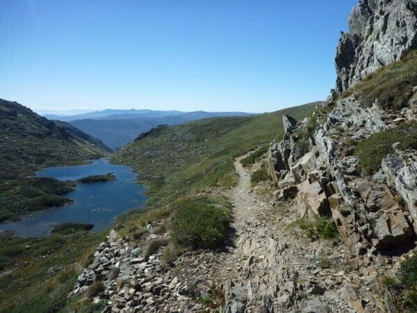
The Hannels Spur Track is unparalleled in Australia, boasting the country’s greatest elevation gain of 1,800 metres. As you ascend, the landscape transforms dramatically, carrying you from dense forests near the Geehi and Swampy Plain Rivers to sub-alpine woodlands and, eventually, to the windswept alpine zones of the Main Range. Along the way, the shifting vegetation paints a vivid picture of the Snowy Mountains' ecological complexity, making the climb as captivating as it is physically demanding.
This trail also holds a significant place in history. It retraces the path taken in 1840 by Polish explorer Paul Strzelecki, James McArthur, and their Aboriginal guides, who led Strzelecki to become the first European to ascend and name Mount Kosciuszko. Walking in their footsteps, you feel a sense of connection to the explorers and the traditional custodians of this land, whose knowledge and resilience are inextricably tied to this terrain.
For decades, the Hannels Spur Track was favoured by mountaineers preparing for Himalayan expeditions, particularly for its relentless ascent through remote wilderness. While the 2003 bushfires left the trail nearly impassable, dedicated work by the National Parks and Wildlife Service (NPWS) and volunteers in 2018 restored much of the route. Clearing efforts reopened the trail to its full length, though it remains a formidable challenge best suited to experienced hikers and trail runners.
The climb to Byatts Camp, which lies approximately 1,350 metres above the starting point, is steep and demanding. From there, the journey grows even more challenging as the marked path gives way to 3-4 kilometres of uncleared footpad through alpine heath above the tree line. Cairns provide some guidance south from Byatts Camp and around Abbott Ridge to the Wilkinson Creek valley. However, hikers must exercise caution, particularly when navigating the exposed ridges where weather can change in an instant.
Preparation is key for anyone tackling this track. A detailed map, compass or GPS, and a personal locator beacon (PLB) are essential, as mobile reception is unreliable. Proper clothing for all conditions, emergency shelter, and ample provisions are also a must. While the rewards of the Hannels Spur Track are many – from breathtaking views to the satisfaction of conquering Australia’s toughest climb – the trail demands respect, experience, and careful planning.
For those prepared to take on the challenge, this hike offers an unparalleled connection to the raw beauty of the Snowy Mountains, a glimpse into Australia’s mountaineering legacy, and a journey that stays with you long after the final step into Thredbo.
Mount Kosciuszko
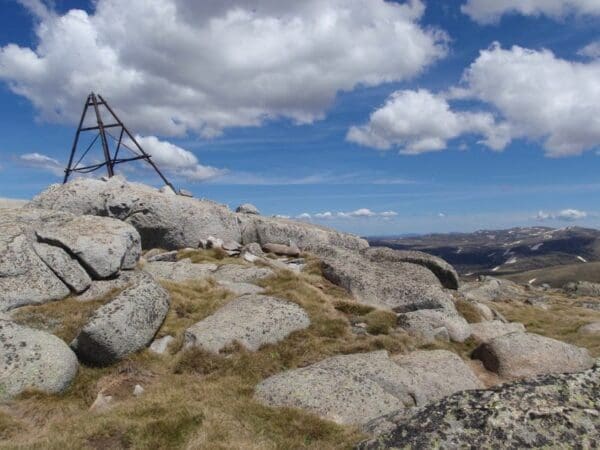
Mount Kosciuszko is Australia’s highest peak, rising to an elevation of 2,228 metres in the Snowy Mountains of the Australian Alps, southeastern New South Wales. Located 240 miles (390 km) southwest of Sydney, the mountain is situated in Kosciuszko National Park and is near Mounts Townsend, Twynam, North Ramshead, and Carruthers (all exceeding 2,100 metres), whose melting snows feed the rivers and reservoirs that make up the Snowy Mountains Hydro-electric Scheme. The sweeping 3600 views across the Snowy Mountains and Victorian High Country are sure to inspire you. Stay a while to soak in the fresh alpine air and appreciate your sense of achievement, before continuing along the track to Thredbo.
Campsites
Moiras Flat (approximately 9.5km from trail head)
- Moiras Flat at around 1520m in elevation (where water is generally available from a nearby creek) is a logical campsite. A small (not flat) clearing along the track that is suitable for a few tents. For water, continue a little further along the main track before water sign leads you north along a cleared route to a small creek. You may need to use a vessel to collect water and should not rely on this source after extended dry spells.
- Byatts Camp is a possible campsite although it is not far from Moiras Flat so most hikers bypass this and opt for a campsite closer o the end of the Hannels Spur. Byatts Camp is an open site just beyond the snow gums as you reach the top of Hannels Spur. It provides great views of the valley below.
Wilkinson's Creek (13.2km fro trail head)
- An open area in the stunning Wilkinsons Creek Valley. This is a great campsite as it is close to Wilkinsons Creek
Muellers Pass (unofficial campsite below Muellers peak approximately 14km from trail head)
- Muellers Pass is an open area just before you reach the Main Range Walking Track. As This site is not as good as Wilkinsons Creek as it is closer to the main public trail.
Tips
- This is a remote alpine area where access can be challenging, and the weather can be unpredictable and extreme, especially on the exposed Main Range. Be fully prepared for rapidly changing conditions.
- It’s essential to carry enough food and water for the journey, along with a map, compass, and GPS to ensure reliable navigation. A Personal Locator Beacon (PLB) is strongly recommended, as mobile reception is unreliable in this remote region.
- Pack high-quality, moisture-wicking layers that can handle various weather scenarios, and make sure you have an alpine-grade shelter or bivvy for emergencies.
- Always let someone know your hiking plans, including your intended route and return time, so they can take action if necessary. For extra peace of mind, you can submit your trip details through the online trip intentions form.
- Shuttle services are available in the region, but they can be costly, with prices starting at around $450. To avoid this expense, plan ahead with two vehicles to manage a car shuffle between the start and end points. The return drive from Thredbo to the trailhead near Geehi Flat takes approximately 1.5 hours. Alternatively, you can opt to complete this hike as a return trip if logistics allow.
- A Kosciuszko National Parks Pass is required to access the park boundaries near Thredbo. Be sure to purchase your pass in advance online or at designated entry points to avoid any inconvenience.
Trail features
- Alpine Region
- Waterfalls
- Scenic Viewpoints
- Alpine Huts
- Exposed Ledges
- Rock Scrambling
- Steep Terrain
- River Crossings
- Untreated Water
Track grade
Grade 5 (Difficult) - Walks for the Most Experienced: Grade 5 represents the most challenging walking tracks on the AWTGS. These are only recommended for very experienced and fit walkers with specialised skills, including navigation and emergency first aid. Tracks are likely to be very rough, very steep, and unmarked. Walks may be more than 20 kilometers. These challenging walks demand a high level of fitness and experience to navigate difficult terrain, significant elevation changes, and potentially unformed paths.
Walk map and GPX file
Hannels Spur Track Map (23km)
Max elevation: 2218 m
Min elevation: 426 m
Total climbing: 2020 m
Total descent: -522 m
Hannels Spur to Dead Horse Gap (28km)
This extended variation follows the same route until you near Thredbo. Just before reaching the amenities on your descent into Thredbo, turn right and follow the Dead Horse Gap Walking Track down to Dead Horse Gap on the Alpine Way.
Max elevation: 2218 m
Min elevation: 425 m
Total climbing: 2100 m
Total descent: -977 m
Content use
Please don’t copy GPX files or content from this site to AllTrails or other platforms. Each trail has been personally mapped, documented, and refined to support Australia’s bushwalking and hiking community. While some details come from land managers, every listing reflects significant personal effort. This is a free, community-driven initiative—your respect helps keep it that way.
Getting there
Getting to the trailhead: Kosciuszko National Park.
The trailhead for the Hannels Spur Track is located near Geehi Flat on the Alpine Way, within the Khancoban area of Kosciuszko National Park. From Khancoban, drive south along the Alpine Way for 36 kilometres until you reach the turnoff for Geehi Flats campground and picnic area, situated just before the Swampy Plain River bridge crossing. If travelling from Jindabyne, head west on Kosciuszko Road for 3 kilometres before turning left onto the Alpine Way. Continue for approximately 76 kilometres, crossing the bridge over the Swampy Plain River, then turn left into the Geehi Flats campground and picnic area. This is where your adventure begins.
Need a rental car to get you to the hike? Find one here.
Find a place to stay
Wondering where to stay near this hike? Find accommodation close to the trailhead — hotels, cabins and campgrounds nearby. Click the button to view the interactive map.
Closest towns to this walk: Adaminaby, Cabramurra, Cooma, Crackenback, Dalgety, Jindabyne, Khancoban, Perisher Valley, Thredbo, Tumbarumba, Tumut
Let someone know
Heading out? Fill in a trip intentions form so someone knows your plans. If things go wrong, they can raise the alarm fast, giving you peace of mind on the trail.
About the region
Kosciuszko National Park spoils you with snow sports, walks and mountain biking in the Snowy Mountains. Go camping, explore caves, climb Australia's highest mountain, or stay in heritage accommodation. There are 7 areas in this park:
1. Thredbo-Perisher area is your gateway to Mount Kosciuszko. Find NSW's favourite ski resorts, top alpine hikes, mountain bike trails, and endless adventures in the Snowy Mountains.
2. The Lower Snowy River area embraces the wild south of Kosciuszko National Park. Camp by the Snowy River and explore the scenic trails on a walk, bike or horse ride.
3. Khancoban area is the western gateway to Kosciuszko National Park. Discover Geehi and Tom Groggin's camp spots, fishing, and riding. Marvel at the Western Fall views or explore huts and hikes in the Jagungal Wilderness.
4. The Selwyn area is your perfect base to explore the walks, rides, and top fishing spots of central Kosciuszko National Park. Selwyn Snow Resort and historic Kiandra are closed due to severe fire damage.
5. The Yarrangobilly area is a highlight of northern Kosciuszko National Park. Explore jaw-dropping caves on a guided tour and swim in the thermal pool. Stay at historic Caves House and enjoy the walks and wildlife.
6. The Tumut area is your launch pad into northern Kosciuszko National Park. Discover water sports and wildlife at Blowering Reservoir. Camp and explore hidden walks and waterfalls in the foothills of the Snowy Mountains.
7. The High Plains area spoils you with summer walks, horse rides and bike trails to mountain huts, caves, and gorges. Camp, stay in Currango's heritage cottages, and discover Kosciuszko's wild north-east corner.
Similar walks nearby
Looking for more walks in or near Kosciuszko National Park? Try these trails with a similar difficulty grade.
Explore safe
Plan ahead and hike safely! Carry enough water, pack layers for changing conditions, and bring safety gear like a torch, PLB, and reliable communication device. Check official sources for trail updates, closures, and access requirements, and review local weather and bushfire advice. Most importantly, share your plans with someone before you go. Being prepared makes for a safer and more enjoyable hike! Stay Safe, Explore More, and Always #ExploreSafe.
Packing checklists
What you carry in your pack depends on factors like weather, terrain, and your adventure type. Not sure what to bring? My free planning, food, and packing checklists are a great starting point, covering day hikes, overnight trips, and multi-day adventures. Use them to customise your kit and always prioritise safety.
Suggest an edit
Notice something different about this trail? Whether it’s a new feature, a route change, or a closure, share your update so we can keep our info accurate and helpful for fellow hikers.
Click to suggest edits >>
Acknowledgement of Country
Trail Hiking Australia acknowledges the Traditional Owners of the lands on which we hike and pay respects to their Elders, past and present, and we acknowledge the First Nations people of other communities who may be here today.
/Hannels-Spur-Track_1.jpg)
/Hannels-Spur-Track_4.jpg)
/Hannels-Spur-Track_6.jpg)
/Hannels-Spur-Track_3.jpg)
/Hannels-Spur-Track_2.jpg)
/Hannels-Spur-Track_5.jpg)


7 Reviews on “Hannels Spur Track (23km)”
We just completed the challenging but rewarding Hannels Spur Track to the top of Mount Kosciusko over the weekend of 23/24 March 2024. The weather was perfect for the trek, but the route itself was difficult with steep inclines, thick vegetation, and downed trees. The first day took us 5.5 hours to reach Moiras Flat campground, where we set up camp for the night.
The second day started tough but we emerged above the tree line into a scenic landscape of rivers, rocky hills, and fresh air. We reached the summit feeling accomplished and enjoyed the panoramic views before descending by chairlift. Overall, this was one of the best hikes I have done in Australia. I recommend long pants, GPS, sunscreen, and plenty of water for this hike. The fitter you are the more you will enjoy this hike however you don’t need to be superhuman to this. There is plenty of spots to stop and have a break and this made us take in the views and enjoy the surroundings more.
Read my full trip report here: https://www.trailhiking.com.au/trip-reports/trip-report-hannels-spur-track/
Hey Mark, thanks heaps for this detailed report. Would you mind if I actually wrote this up as a trip report? It would be awesome to include on my site. If you have any great pics, I could add that to the report too.