Litchfield National Park
Litchfield National Park is about 120 km south of Darwin, roughly a 1.5-hour drive, and it’s one of the more accessible introductions to the rugged beauty of the Top End. Known for its cascading waterfalls, monsoonal forest, and towering termite mounds, this 1,500-square-kilometre park has enough range in it to suit a quick day trip or a slower, overnight visit, whether you’re after a swim, a hike, or just somewhere quiet to sit for a while.
A Land Shaped by Water and Time
The Northern Territory is a land of contrasts, where vast deserts meet lush wetlands, and ancient rock formations rise dramatically from the earth. Rich in Aboriginal culture, the region is home to some of Australia’s most iconic natural wonders, including Kakadu and Uluru. Litchfield National Park shares that character, and its landscapes carry the same depth of Aboriginal heritage as the rest of the Top End.
Litchfield is an ancient landscape, sculpted by millions of years of geological processes. The park’s waterfalls cascade from the sandstone plateau of the Tabletop Range, which forms the park’s eastern boundary, and they flow all year round, with some of the most spectacular sights occurring during the wet season and the early dry season.
Beyond the waterfalls, the park holds a range of natural habitats, including monsoon forests, open woodlands, and rugged sandstone formations. The land within Litchfield is sacred to the Aboriginal people, including the Koongurrukun, Mak Mak Marranunggu, Werat, and Warray groups, whose Ancestral Spirits are believed to have shaped the landscape, plants, and animals.
Litchfield is also a biodiversity hotspot. As you explore the park, you may encounter wallabies hopping through the underbrush, kangaroos grazing in the open plains, and countless bird species overhead, including the crimson finch, the white-bellied sea eagle, and the rare Gouldian finch. The waterways teem with life too, providing a natural sanctuary for freshwater crocodiles and various species of fish, so swimming and walking the park’s trails also means sharing the water and its edges with what lives there.
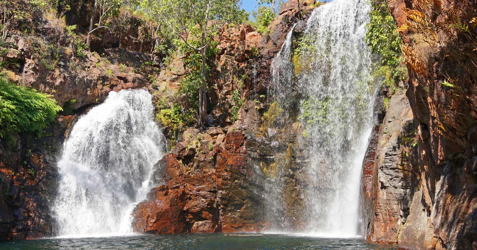
Waterfalls and Landmarks in Litchfield National Park
Litchfield’s best-known landmarks are spread across the park, and each one offers something a little different.
Wangi Falls
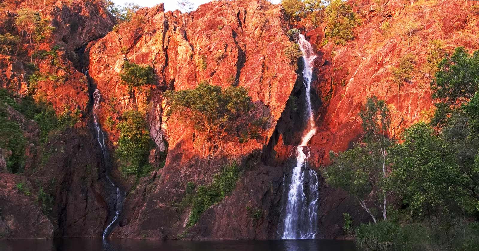
Wangi Falls is one of the park’s most iconic landmarks, with twin falls tumbling from a height of about 50 metres into a plunge pool, which is why it turns up on so many Territory postcards. The area around the falls has picnic facilities, hot showers, and barbecues, and there are several walking tracks, including one to a lookout with views over the surrounding rainforest. Explore the Wangi Falls hike here.
Florence Falls
If you want something quieter than Wangi, Florence Falls is tucked away in lush monsoonal rainforest and tends to draw fewer visitors. The plunge pool sits within shaded forest, and a few walking trails give different perspectives of the falls from above. Discover the Florence Falls hike here.
Sandy Creek Falls (Tjaynera)
Sandy Creek Falls, also known as Tjaynera Falls, takes more effort to reach: it’s accessible only by 4WD, followed by a 1.4 km hike through rainforest. The reward is a swim in cool water below the falls, in a spot that sees far fewer visitors than Wangi or Florence. Learn more about the Sandy Creek Falls hike here.
The Lost City
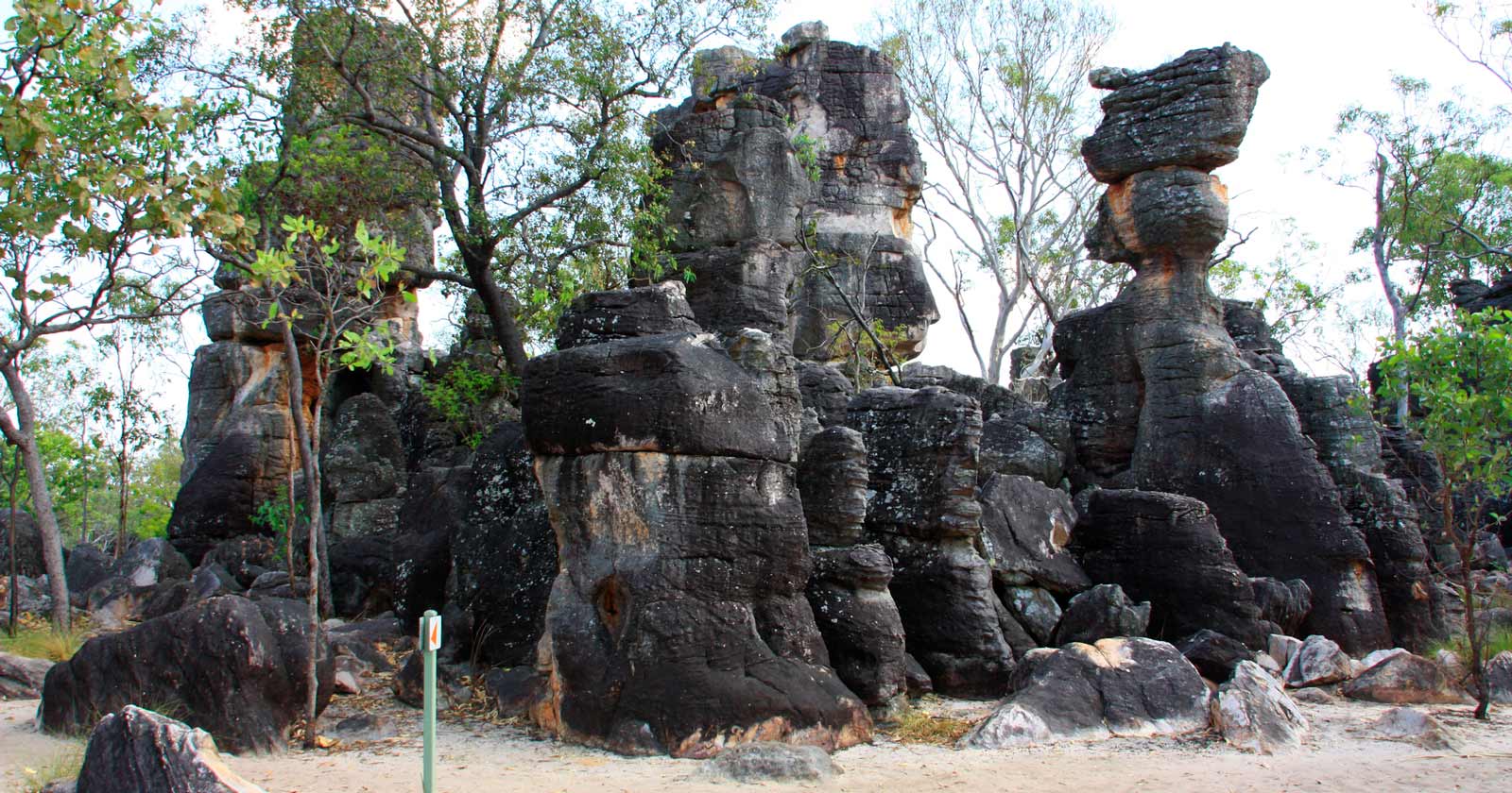
The Lost City is a different kind of attraction: weathered sandstone pillars that resemble the ruins of an ancient city, reached via a 4WD track. It’s worth checking with local authorities on road conditions before heading out, since access can be restricted in certain seasons. Explore the Lost City hike here.
Litchfield Tabletop Track
For a longer hike that takes in most of what the park has to offer, the Litchfield Tabletop Track is a 39-kilometre circuit run over four days through savanna woodland, waterfalls, and swimming holes. It’s accessible via shorter link trails from Florence Falls, Greenant Creek, Wangi Falls, or Walker Creek, so you can join or leave the circuit at a few different points, with chances to cool off at Walker Creek or Florence Falls along the way. Explore the Tabletop Track here.
For more hiking trails and walks across Litchfield National Park and beyond, click here to explore all the options.
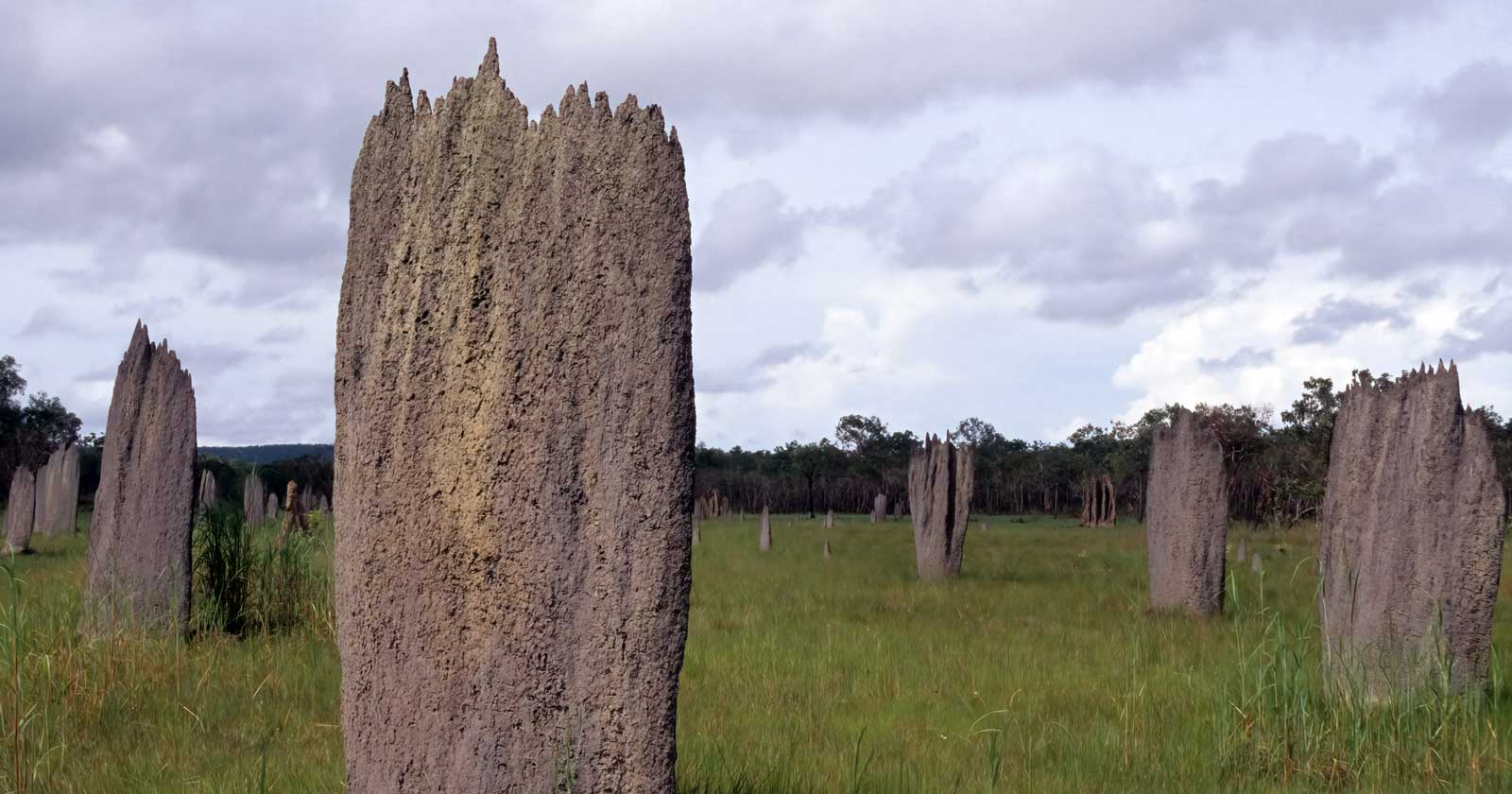
The Magnetic Termite Mounds
One of the most distinctive features of Litchfield National Park is its magnetic termite mounds. These structures, some reaching up to 2 metres in height, are built by termites facing north to south to minimise exposure to the sun. The mounds are up to 100 years old, and they stand as a genuine feat of engineering skills on the part of the termites that built them, set against the backdrop of the park’s wider landscape.
Camping and Accommodation Options
Camping is the only option within Litchfield National Park itself, with campgrounds at Wangi Falls, Florence Falls, and Sandy Creek. These sites have basic amenities, including picnic tables, barbecues, and hot showers, which makes them workable for an overnight stay. For something more comfortable, nearby Batchelor has a selection of cabins, camping, and caravan sites.
Getting There and When to Visit
Litchfield National Park is easily accessible by car, located approximately 120 km south of Darwin. The park is reached via sealed roads from either Batchelor or Cox Peninsula Road. During the wet season (November to April), some roads may be closed, so it’s worth checking the Parks website for current conditions before you go.
The best time to visit is during the dry season (May to September), when temperatures are more moderate and the waterfalls are at their best. Even then, check the weather forecast before heading out, since temperatures can climb above 40°C during the hotter months.
Staying Safe in Litchfield National Park
Litchfield is generally a safe destination, but it pays to be careful, especially when swimming. Crocodiles are known to inhabit some of the park’s waterways, so be Crocwise and swim only in designated safe areas. Park rangers monitor the waters, and signage is posted throughout the park to guide visitors. As with any trip out here, stay aware of your surroundings, carry plenty of water, and protect yourself from the heat.
A Day Trip or Overnight Stay?
Litchfield National Park works well as a day trip from Darwin, but staying overnight lets you get more out of it. Between the swimming holes, the walking tracks, and the landscape itself, it’s a good spot to slow down for a night rather than rushing through in an afternoon.
What’s Next After Litchfield?
If Litchfield leaves you wanting more, the surrounding regions have plenty to offer. To the east, Kakadu National Park and Arnhem Land are known for their ancient cultural significance and landscapes. To the south, Katherine and Nitmiluk National Park are a short drive away, with dramatic gorges, waterfalls, and Indigenous cultural experiences.
Litchfield National Park packs a lot into a relatively small area for the Northern Territory: waterfalls you can swim at, termite mounds that are genuinely strange to look at, and hiking that ranges from an easy walk to a four-day circuit. That makes it a solid choice whether you’ve got a single day out of Darwin or want to build it into a longer NT trip.