Hike at a Glance
Max elevation: 706m
Min elevation: 667m
Total Ascent: 67m
Hike overview
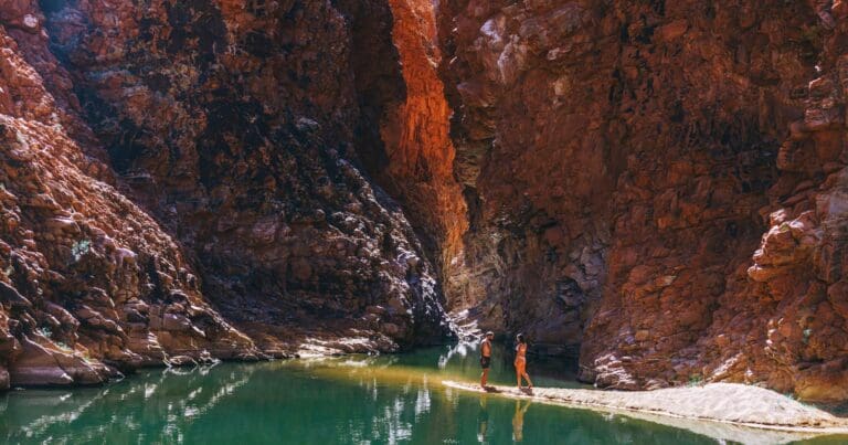
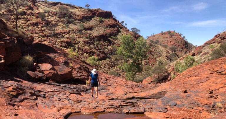
The Ellery Creek Dolomite Circuit is a 2.5km walk located in the heart of West MacDonnell National Park in the Northern Territory. This grade 3 hike is typically completed in around 1.25 hours and offers an excellent opportunity to explore the area's rich geological history.
The walk begins at the Larapinta Trail Information Point, where it briefly follows Section 7 of the Larapinta Trail. The path then veers south, marked by distinctive maroon arrows, which guide you through the varied landscape. As you stroll along the unsealed track, you’ll encounter some steady inclines, providing a good challenge without being too strenuous. The route takes you through a fascinating terrain shaped by millions of years of geological processes, with informative signs along the way explaining the area’s history and the plants that thrive in this unique environment.
One of the highlights of the walk is the striking Snake Rock, an impressive natural formation that’s worth stopping for. Further along the trail, a lookout offers sweeping views over the surrounding landscape, a perfect spot to pause and take in the beauty of the region.
For those looking to extend their adventure, a side trip to Ellery Creek Big Hole is highly recommended. A short detour leads you to the cool, refreshing waters of the creek, ideal for a swim to refresh yourself after the walk. Whether you're a geology enthusiast or simply looking to enjoy a scenic and relatively easy hike, the Ellery Creek Dolomite Circuit offers a memorable experience in the heart of the West MacDonnell Ranges.
Content use
Please don’t copy GPX files or content from this site to AllTrails or other platforms. Each trail has been personally mapped, documented, and refined to support Australia’s bushwalking and hiking community. While some details come from land managers, every listing reflects significant personal effort. This is a free, community-driven initiative—your respect helps keep it that way.
Walk map and GPX file
Max elevation: 706 m
Min elevation: 667 m
Total climbing: 67 m
Total descent: -67 m
Getting there
Getting to the trailhead: West MacDonnell National Park.
To reach the Ellery Creek Dolomite Circuit trailhead, head 80 km west of Alice Springs via Larapinta and Namatjira Drives. The park is accessible by conventional vehicles, though the carpark area is unsealed. Keep in mind that after heavy rain, some of the roads may be impassable for a short period. There is a park entry fee, with the exception of Northern Territory residents who are exempt from paying. While the park can be visited year-round, the cooler months from April to September are generally the most pleasant for hiking and outdoor activities, offering more comfortable temperatures.
Closest towns to this walk: Alice Springs, Glen Helen, Hermannsburg
About the region
Tjoritja West MacDonnell National Park stretches for 161 kilometres west of Alice Springs. Explore and appreciate the scenic beauty and history of the area on foot, swim in a waterhole, or pitch a tent for a longer stay.
Take a dip in the cold waters of one the park's permanent water holes. The larger water holes include Ellery Creek Big Hole, Ormiston Gorge, Redbank Gorge and Glen Helen Gorge.
There are numerous marked walking tracks ranging from leisurely to adventurous. The 223 kilometre Larapinta Trail stretches through the park and offers extended and overnight bushwalks for fit, experienced and well prepared walkers.
The park encompasses an ancient landscape sculpted over time by climatic elements. It is also a refuge for rare and threatened plants as well as wildlife, including the uncommon bird species such as the Peregrine Falcon.
Features of the landscape are significant to the Arrernte people, including the Ochre Pits that have long been a quarry for important ochre pigments.
There are plenty of places to camp in the park, with varied access and facilities. Camping fees apply and overnight visitors should bring their own water supplies. Commercial facilities are available at Glen Helen Resort.
Similar walks nearby
Looking for more walks in or near West MacDonnell National Park? Try these trails with a similar difficulty grade.
Track grade
Grade 3 (Moderate) - Walks for Most Fitness Levels: Grade 3 on the AWTGS represents moderate walking tracks. These are ideal for walkers with some fitness who are comfortable with some hills and uneven terrain. While suitable for most ages, some bushwalking experience is recommended to ensure a safe and enjoyable experience. Tracks may have short, steep hill sections, a rough surface, and many steps. The total distance of a Grade 3 walk can be up to 20 kilometers.
Explore safe
Plan ahead and hike safely! Carry enough water, pack layers for changing conditions, and bring safety gear like a torch, PLB, and reliable communication device. Check official sources for trail updates, closures, and access requirements, and review local weather and bushfire advice. Most importantly, share your plans with someone before you go. Being prepared makes for a safer and more enjoyable hike! Stay Safe, Explore More, and Always #ExploreSafe.
Packing checklists
What you carry in your pack depends on factors like weather, terrain, and your adventure type. Not sure what to bring? My free planning, food, and packing checklists are a great starting point, covering day hikes, overnight trips, and multi-day adventures. Use them to customise your kit and always prioritise safety.
Let someone know
Before heading out, take a moment to fill out your trip intentions form. It’s a quick way to share your hike details with family or friends. If something goes wrong, they can notify emergency services, ensuring a faster response and peace of mind. Stay safe and enjoy your adventure
Suggest an edit
Spotted a change on this trail? Maybe there are new features, the route has shifted, or the trail is permanently closed. Whatever the update, I’d love your input. Your feedback helps fellow hikers stay informed and ensures that our trail info stays fresh and reliable.
Acknowledgement of Country
Trail Hiking Australia acknowledges the Traditional Owners of the lands on which we hike and pay respects to their Elders, past and present, and we acknowledge the First Nations people of other communities who may be here today.
/Ellery-Creek-Dolomite-Circuit-Walk_6.jpg)
/Ellery-Creek-Dolomite-Circuit-Walk_4.jpg)
/Ellery-Creek-Dolomite-Circuit-Walk_3.jpg)
/Ellery-Creek-Dolomite-Circuit-Walk_9.jpg)
/Ellery-Creek-Dolomite-Circuit-Walk_1.jpg)
/Ellery-Creek-Dolomite-Circuit-Walk_5.jpg)
/Ellery-Creek-Dolomite-Circuit-Walk_8.jpg)
/Ellery-Creek-Dolomite-Circuit-Walk_7.jpg)
/Ellery-Creek-Dolomite-Circuit-Walk_2.jpg)


9 Reviews on “Ellery Creek Dolomite Circuit Walk (2.5km)”
Really interesting little hike.