Hike at a Glance
Max elevation: 723m
Min elevation: 567m
Total Ascent: 180m
Hike overview
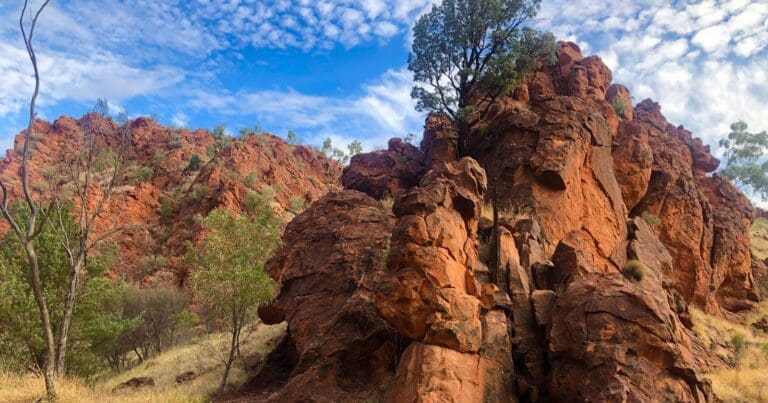
The Heavitree Gap Yeperenye Circuit is a 3-kilometre, grade 3 hike in West MacDonnell National Park, Northern Territory, which typically takes around 1.25 hours to complete. This unofficial and unmarked trail leads to Heavitree Gap, a prominent ridge overlooking Alice Springs, located at the eastern end of Yeperenye / Emily and Jessie Gaps Nature Park.
Heavitree Gap, known as Ntaripe in the Arrernte language, is a significant water gap in the MacDonnell Ranges. It serves as the southern entrance to Alice Springs and is integral to the region's main road and rail access, alongside the Todd River.
The Gap holds cultural importance for the Arrernte people, who traditionally avoided using it as a thoroughfare. It was named by William Mills, the surveyor for the Overland Telegraph line, after his former school in Heavitree, Devon. On the southwest side of the Gap stands the historic Heavitree Gap Police Station. The scenic views and cultural significance of the area have inspired numerous artists, including Albert Namatjira, Oscar Namatjira, Basel Rangea, and John Borrack.
Gallery
Got some great shots from this hike? Upload your photos here to inspire others and show off the beauty of the trail!
Click to view form >>
Submitting your photos doesn’t mean you lose ownership. You can be credited for your contributions, and you can request removal at any time.
Content use
Please don’t copy GPX files or content from this site to AllTrails or other platforms. Each trail has been personally mapped, documented, and refined to support Australia’s bushwalking and hiking community. While some details come from land managers, every listing reflects significant personal effort. This is a free, community-driven initiative—your respect helps keep it that way.
Walk map and GPX file
Max elevation: 723 m
Min elevation: 567 m
Total climbing: 180 m
Total descent: -180 m
Getting there
Getting to the trailhead: Yeperenye / Emily and Jessie Gaps Nature Park.
Access to the trailhead is at the rear of the MacDonnell Range Holiday Park.
Closest towns to this walk: Alice Springs
About the region
Emily and Jessie Gaps, small Gaps in the Heavitree Range are the first features you come to on your trip into the East MacDonnell Ranges. They contain interesting Aboriginal paintings and are important spiritual sites to the Eastern Arrernte Aboriginal people.
Many places in the landscape are associated with the same dreamtime story. Together these places form a 'dreaming trail'. Emily and Jessie Gap are both associated with the caterpillar trail. Emily Gap is probably the most significant, as this is where the caterpillar beings of Mparntwe (Alice Springs) originated. These caterpillars formed Emily Gap and many of the topographic features around Alice Springs, then radiated out to the edge of the Simpson Desert.
Emily Gap (Anthwerrke) is a registered sacred site. A large rock painting depicts the caterpillar dreaming. Please respect the site and do not touch any Aboriginal art.
The first European sighting of Emily and Jessie Gap was in 1871. It was thought that 'Emily' and 'Jessie' were the daughters of Sir Charles Todd, but this was found to be untrue. The basis on which the names are derived is unknown.
Nestled between the East and West MacDonnell Ranges, 'The Alice' (Alice Springs) is famous for its beautiful desert landscapes, colourful outback characters, opportunities for adventure and a strong Aboriginal culture. Alice Springs is a remote town in Australia's Northern Territory, halfway between Darwin and Adelaide, both 1,500km away. It's a popular gateway for exploring the Red Centre, the country's interior desert region.
Similar walks nearby
Looking for more walks in or near Yeperenye / Emily and Jessie Gaps Nature Park? Try these trails with a similar difficulty grade.
Track grade
Grade 3 (Moderate) - Walks for Most Fitness Levels: Grade 3 on the AWTGS represents moderate walking tracks. These are ideal for walkers with some fitness who are comfortable with some hills and uneven terrain. While suitable for most ages, some bushwalking experience is recommended to ensure a safe and enjoyable experience. Tracks may have short, steep hill sections, a rough surface, and many steps. The total distance of a Grade 3 walk can be up to 20 kilometers.
Explore safe
Plan ahead and hike safely! Carry enough water, pack layers for changing conditions, and bring safety gear like a torch, PLB, and reliable communication device. Check official sources for trail updates, closures, and access requirements, and review local weather and bushfire advice. Most importantly, share your plans with someone before you go. Being prepared makes for a safer and more enjoyable hike! Stay Safe, Explore More, and Always #ExploreSafe.
Packing checklists
What you carry in your pack depends on factors like weather, terrain, and your adventure type. Not sure what to bring? My free planning, food, and packing checklists are a great starting point, covering day hikes, overnight trips, and multi-day adventures. Use them to customise your kit and always prioritise safety.
Let someone know
Before heading out, take a moment to fill out your trip intentions form. It’s a quick way to share your hike details with family or friends. If something goes wrong, they can notify emergency services, ensuring a faster response and peace of mind. Stay safe and enjoy your adventure
Suggest an edit
Spotted a change on this trail? Maybe there are new features, the route has shifted, or the trail is permanently closed. Whatever the update, I’d love your input. Your feedback helps fellow hikers stay informed and ensures that our trail info stays fresh and reliable.
Acknowledgement of Country
Trail Hiking Australia acknowledges the Traditional Owners of the lands on which we hike and pay respects to their Elders, past and present, and we acknowledge the First Nations people of other communities who may be here today.


