Hike at a Glance
Max elevation: 447m
Min elevation: 316m
Total Ascent: 434m
Hike overview
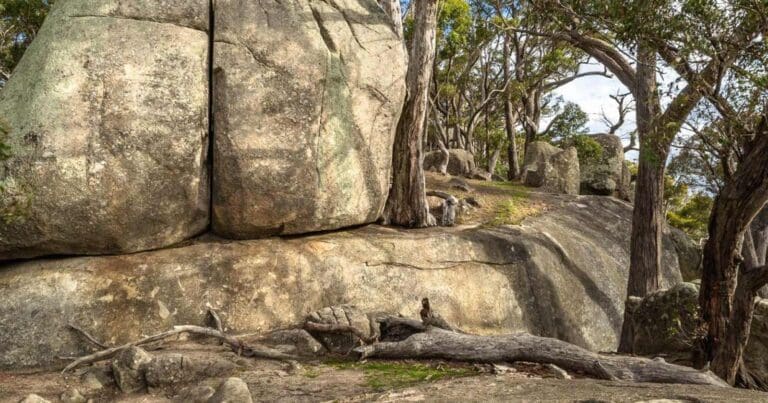
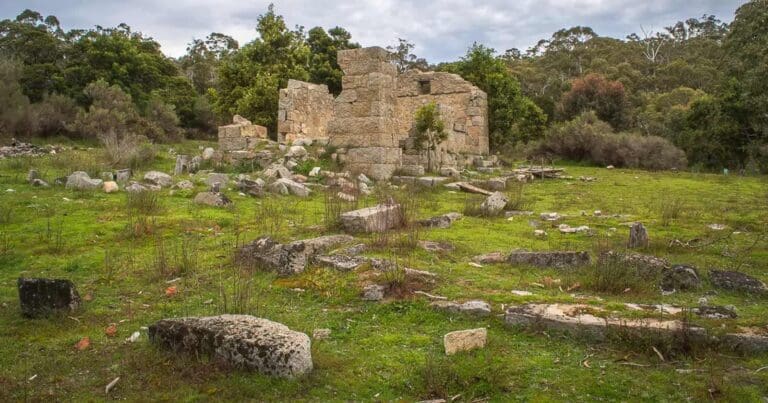
Castlemaine Gold is a 17.5-kilometre hike through the historic Castlemaine Diggings National Heritage Park in Victoria. Taking around six hours to complete, this moderate-grade 3 trail offers a mix of scenic beauty and fascinating history. The hike meanders through some of the park's most significant sites, including the iconic Monk, Eureka, and Spring Gully Mines, each telling a part of the story of the gold rush that once shaped the region.
Part of the Goldfields Track, the hike incorporates several local trails, leading you through areas where the echoes of the past are still very much alive. While the trail isn’t particularly difficult, the distance makes it a more challenging outing. As you walk, you'll pass through diverse landscapes, including lush woodlands and areas that were once central to the gold mining efforts. It’s a great way to immerse yourself in the park's rich history while enjoying the natural surroundings.
Though not a short walk, this hike is accessible for those with a moderate level of fitness and offers plenty of opportunities to stop and appreciate the historical significance of the area. Whether you're drawn by the natural beauty or the intriguing history beneath your feet, the Castlemaine Gold hike is a rewarding experience for those keen to explore Victoria's goldfields.
Gallery
Got some great shots from this hike? Upload your photos here to inspire others and show off the beauty of the trail!
Click to view form >>
Submitting your photos doesn’t mean you lose ownership. You can be credited for your contributions, and you can request removal at any time.
Content use
Please don’t copy GPX files or content from this site to AllTrails or other platforms. Each trail has been personally mapped, documented, and refined to support Australia’s bushwalking and hiking community. While some details come from land managers, every listing reflects significant personal effort. This is a free, community-driven initiative—your respect helps keep it that way.
Walk map and GPX file
Max elevation: 447 m
Min elevation: 316 m
Total climbing: 434 m
Total descent: -434 m
Getting there
Getting to the trailhead: Castlemaine Diggings National Heritage Park.
To reach the Castlemaine Gold trailhead, take the Calder Highway and follow it to the Castlemaine exit at Elphinstone. From there, continue along the Pyrenees Highway for about 13 kilometres until you reach the centre of Castlemaine. Once in town, head towards the southern end of Wheelers Street and park at the bend in the road, where Wheelers Street meets Etty Street. This spot serves as the starting point for your hike through Castlemaine Diggings National Heritage Park.
Closest towns to this walk: Campbells Creek, Castlemaine, Chewton, Elphinstone, Fryerstown, Guildford, Maldon, Newstead, Vaughan
About the region
Castlemaine Diggings National Heritage Park offers a unique glimpse into the history of Victoria's gold rush era, situated in the heart of the state's central goldfields. This park is not just a place to visit, but a journey through time, where the echoes of the past come alive through the remnants of abandoned mines, settlements, and machinery, all set within the peaceful, shady Box-Ironbark woodlands. As you explore, you'll discover traces of a time when the landscape was shaped by the search for gold, and the impact of this rush is still visible today.
The story of Castlemaine began with the discovery of gold in July 1851, an event that would draw tens of thousands of migrants to the area. Within just a few years, Castlemaine became the world’s richest shallow alluvial goldfield. By 1852, its population had swelled to 40,000–60,000 people. Today, the park offers a rare opportunity to explore this fascinating history, with sites that remain largely unchanged from the gold rush days. From the remains of puddling machines to gold mines and gullies where fortunes were once made, the area speaks to the lives of those who sought wealth and adventure. However, the gold rush also had a profound effect on the Dja Dja Wurrung people, whose ancestral lands encompass the park. Their stories are interwoven with the land, though less visible, their impact is equally significant.
The park is not just about history; it offers a range of outdoor activities for visitors to enjoy. Whether you're a keen hiker, cyclist, or someone simply looking for a peaceful day out, there's something for everyone. A scenic drive through the park presents changing landscapes, from rolling hills and dense forests to valleys shaped by sluice mining. Along the way, you'll pass through charming rural communities that add to the park's historic charm. For those keen to get out on foot, the park offers a variety of walking trails, from gentle strolls along the Loddon River to more challenging hikes like the Goldfields Track, which attracts both hikers and mountain bikers alike. There are also heritage walks that provide a deeper look into the area's mining past.
For a more relaxed day, Vaughan Mineral Springs is a popular picnic spot, complete with a shelter, electric barbecues, and spacious grassy areas. Picnic tables are scattered throughout the park, offering plenty of opportunities to enjoy a meal surrounded by nature. Another great spot for a family picnic is Kalimna Point, situated on a ridge just east of Castlemaine. Here, you’ll find a rotunda and picnic tables, along with walking tracks through the Box-Ironbark forest, a habitat for a variety of native species. The diverse birdlife in the park makes it a prime location for birdwatching, with residents and migratory species alike taking advantage of the park’s seasonal blooms. Some of the best spots to see birds include Eureka Reef, Vaughan Springs, Central Spring, and Glenluce Spring.
Castlemaine Diggings National Heritage Park is a place where history and nature come together, offering a rich experience that resonates with visitors seeking both adventure and reflection. As part of the traditional lands of the Dja Dja Wurrung People, the park serves as a reminder of the enduring connection between the land and its first inhabitants.
Similar walks nearby
Looking for more walks in or near Castlemaine Diggings National Heritage Park? Try these trails with a similar difficulty grade.
Track grade
Grade 3 (Moderate) - Walks for Most Fitness Levels: Grade 3 on the AWTGS represents moderate walking tracks. These are ideal for walkers with some fitness who are comfortable with some hills and uneven terrain. While suitable for most ages, some bushwalking experience is recommended to ensure a safe and enjoyable experience. Tracks may have short, steep hill sections, a rough surface, and many steps. The total distance of a Grade 3 walk can be up to 20 kilometers.
Explore safe
Plan ahead and hike safely! Carry enough water, pack layers for changing conditions, and bring safety gear like a torch, PLB, and reliable communication device. Check official sources for trail updates, closures, and access requirements, and review local weather and bushfire advice. Most importantly, share your plans with someone before you go. Being prepared makes for a safer and more enjoyable hike! Stay Safe, Explore More, and Always #ExploreSafe.
Packing checklists
What you carry in your pack depends on factors like weather, terrain, and your adventure type. Not sure what to bring? My free planning, food, and packing checklists are a great starting point, covering day hikes, overnight trips, and multi-day adventures. Use them to customise your kit and always prioritise safety.
Let someone know
Before heading out, take a moment to fill out your trip intentions form. It’s a quick way to share your hike details with family or friends. If something goes wrong, they can notify emergency services, ensuring a faster response and peace of mind. Stay safe and enjoy your adventure
Suggest an edit
Spotted a change on this trail? Maybe there are new features, the route has shifted, or the trail is permanently closed. Whatever the update, I’d love your input. Your feedback helps fellow hikers stay informed and ensures that our trail info stays fresh and reliable.
Acknowledgement of Country
Trail Hiking Australia acknowledges the Traditional Owners of the lands on which we hike and pay respects to their Elders, past and present, and we acknowledge the First Nations people of other communities who may be here today.


4 Reviews on “Castlemaine Gold Hike (17.5km)”
Highly recommend this walk. You can even mix it up with a meal a pub whilst up, or even an overnight stay in one of the accommodation options at Castlemaine. And an extra bonus is you can travel into Castlemaine on the train. Get the most out of the walk by doing some history reading before going. It really is a trip back through time.
Rob Gillespie great suggestions.
Sonia Stocco goals ?
Tracy Lloyd-Walker here’s a good one
When are you free Andrea Westerland??????