Hike at a Glance
Max elevation: 98m
Min elevation: 28m
Total Ascent: 48m
Hike overview
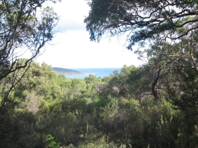
Stretching 3.5 kilometres along the rugged coastline of Western Australia’s southwest, the walk from Cape Naturaliste to Sugarloaf Rock offers a spectacular glimpse into the beauty of the Leeuwin-Naturaliste National Park. This well-designed section of the Cape to Cape Track is a grade 2 walk, taking around 1.5 hours to complete. Beginning near the historic Cape Naturaliste Lighthouse, the trail follows a gently winding path with sweeping views over the Indian Ocean, making it an ideal route for walkers of all abilities. For those wanting a longer walk, returning via the same route creates a rewarding 7-kilometre round trip.
Designed with accessibility in mind, the ‘Access for More’ section of the track features a world-class, levelled, and bitumen-sealed path, along with over a kilometre of timber boardwalk. The gentle gradient, no steeper than 1 in 12, ensures the track is suitable for wheelchair users and those who prefer a less strenuous walk. With road access available at both ends, visitors can choose to complete the entire walk or explore shorter sections at their own pace.
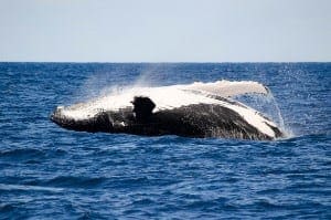
As the trail meanders along the coast, the ever-changing ocean views and striking cliffs provide a stunning backdrop. From June to October, this stretch of coastline is one of the best places to spot migrating whales, as they travel along the warm waters of the Indian Ocean. Sugarloaf Rock, a dramatic granite formation rising from the sea, marks the walk’s end and is particularly striking at sunset, when the rock glows in the fading light.
This scenic and accessible walk blends natural beauty with thoughtful design, allowing more people to enjoy the coastal landscape. Whether you’re looking for a peaceful stroll or a chance to experience the grandeur of the southwest coastline, this section of the Cape to Cape Track is a must-visit.
Gallery
Got some great shots from this hike? Upload your photos here to inspire others and show off the beauty of the trail!
Click to view form >>
Submitting your photos doesn’t mean you lose ownership. You can be credited for your contributions, and you can request removal at any time.
Content use
Please don’t copy GPX files or content from this site to AllTrails or other platforms. Each trail has been personally mapped, documented, and refined to support Australia’s bushwalking and hiking community. While some details come from land managers, every listing reflects significant personal effort. This is a free, community-driven initiative—your respect helps keep it that way.
Walk map and GPX file
Max elevation: 98 m
Min elevation: 28 m
Total climbing: 48 m
Total descent: -118 m
Getting there
Getting to the trailhead: Leeuwin-Naturaliste National Park.
The trailhead for the Cape Naturaliste to Sugarloaf Rock Walk begins at Cape Naturaliste Lighthouse, which is a 15-minute drive north of Dunsborough via Cape Naturaliste Road. The lighthouse is open daily from 9:00 am to 5:00 pm, with guided tours running every hour between 9:30 am and 4:30 pm. As tour group sizes are limited to 10 people, it’s best to book online in advance to secure your spot. There is ample parking at the lighthouse, making it a convenient starting point for the walk.
Closest towns to this walk: Augusta, Busselton, Cowaramup, Dunsborough, Margaret River, Yallingup
About the region
Cape Naturaliste is the northernmost point of the Leeuwin-Naturaliste Ridge and separates the relatively sheltered waters of Geographe Bay from the southern Indian Ocean. Tour the lighthouse and explore coastal scenery around the cape on a network of short walks and lookouts.
Nestled along the striking turquoise waters of Geographe Bay, Dunsborough offers some of the most picturesque coastal walks and bushwalks in Western Australia. Located approximately 251 kilometres—or a 2.5- to 3-hour drive—from Perth, this vibrant town blends natural beauty with a relaxed atmosphere. The sheltered bay, with its crystal-clear waters and white sandy beaches, is linked to the town centre by leafy paths and grassy picnic areas, making it an inviting place for both locals and visitors. The town itself has a lively café culture, boutique shops, and a buzzing evening scene, with brew houses, wine bars, and restaurants offering live music and locally sourced produce.
Walking and hiking trails weave through the landscape, from gentle beachfront paths to more rugged bushwalks that take in the rocky coastline and dense coastal vegetation. The trails within Meelup Regional Park and Leeuwin-Naturaliste National Park offer stunning views of the bay, passing through sheltered coves and pristine bushland. Many of these walks connect to some of the region’s best swimming beaches, while small reefs and rocky outcrops provide excellent spots for snorkelling and kayaking. For those looking to explore further, the Cape to Cape Track begins near the historic Cape Naturaliste Lighthouse, stretching along the dramatic coastline between Cape Naturaliste and Cape Leeuwin.
Dunsborough has long been a favourite holiday destination, originally known for its surf culture and relaxed beachside escapes. Today, it offers a mix of adventure and relaxation, appealing to families, couples, and backpackers alike. Whether you're setting off on a challenging hike, enjoying a casual coastal walk, or simply soaking in the atmosphere of this seaside town, there's something for every traveller.
Similar walks nearby
Looking for more walks in or near Leeuwin-Naturaliste National Park? Try these trails with a similar difficulty grade.
Track grade
Grade 2 (Easy) - A Gentle Introduction to Inclines: Grade 2 on the AWTGS represents easy walking tracks that offer a slightly more challenging experience compared to Grade 1. Similar to Grade 1, no prior bushwalking experience is required. The track surface is typically hardened or compacted and may have gentle hill sections or occasional steps. The total distance of a Grade 2 walk is typically no greater than 10 kilometers. These walks are still suitable for families with a bit more experience or those seeking a gentle introduction to some inclines.
Explore safe
Plan ahead and hike safely! Carry enough water, pack layers for changing conditions, and bring safety gear like a torch, PLB, and reliable communication device. Check official sources for trail updates, closures, and access requirements, and review local weather and bushfire advice. Most importantly, share your plans with someone before you go. Being prepared makes for a safer and more enjoyable hike! Stay Safe, Explore More, and Always #ExploreSafe.
Packing checklists
What you carry in your pack depends on factors like weather, terrain, and your adventure type. Not sure what to bring? My free planning, food, and packing checklists are a great starting point, covering day hikes, overnight trips, and multi-day adventures. Use them to customise your kit and always prioritise safety.
Let someone know
Before heading out, take a moment to fill out your trip intentions form. It’s a quick way to share your hike details with family or friends. If something goes wrong, they can notify emergency services, ensuring a faster response and peace of mind. Stay safe and enjoy your adventure
Suggest an edit
Spotted a change on this trail? Maybe there are new features, the route has shifted, or the trail is permanently closed. Whatever the update, I’d love your input. Your feedback helps fellow hikers stay informed and ensures that our trail info stays fresh and reliable.
Acknowledgement of Country
Trail Hiking Australia acknowledges the Traditional Owners of the lands on which we hike and pay respects to their Elders, past and present, and we acknowledge the First Nations people of other communities who may be here today.


