Hike at a Glance
Max elevation: 0m
Min elevation: 0m
Total Ascent: 0m
Hike overview
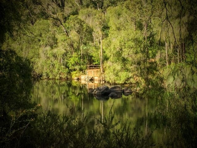
The 19 kilometre Wellington Spur Trail links the Bibbulmun Track to the Wellington Dam recreation area which offers a range of other recreational activities including mountain biking and canoeing. Built with schools and other groups in mind the trail offers a range of walk options.
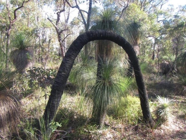
The Wellington Spur Trail links the Bibbulmun Track just south of Collie, to the Wellington Dam recreation area in the Wellington National Park. It is a pretty walk through the Wellington National Park which features WA's unique eucalypt forests of jarrah, marri and yarri (blackbutt). The two group campsites (Lyall's Mill and Arcadia) have undercover areas, tables, toilets and tent sites but no sleeping shelters. The maximum group size is 30. At all other campsites on the Bibbulmun Track the maximum size of any group staying overnight is 17, including leaders. The trail is marked with the same trail marker as the Bibbulmun Track (a stylised Waugal) but with a green background instead of yellow. Day 1. Walk the Bibbulmun Track to Yabberup Campsite which is 19.6km south of Collie. (To shorten the walk, get dropped of at Mungalup Road Bridge 13.7km or Mungalup Road South 10.4km. These vehicle drop-off points are shown on the map.) Lyall's Mill group campsite is approximately 350 metres away from Yabberup campsite (300m from the spur/Track junction). Day 2. The 15km walk from Lyalls Mill campsite to Arcadia Campsite takes you through jarrah forest with occasional valley views. Day 3. A short 3.5km hike to Wellington Dam leaves time to explore the Dam recreation area. Camping is also available in the area. Same itinerary as above but commence your walk at Glen Mervn Dam. Follow the Bibbulmun Track for 6kms to the start of the spur trail. This provides a shorter first day's walk depending on the age of the group and/or the travel time to get to the drop-off/pick-up point. Starting the walk at the Dam into Arcadia campsite and back is a good day walk or overnight option for younger age groups. All groups need to lodge a Notice of Intent (NOI) form with the Bibbulmun Track Foundation. For more information and a host of expedition planning resources visit the Bibbulmun Track Foundation website.
Tips
Start Point: On foot via the Bibbulmun Track (see trail notes) or Wellington Dam, which is 200km (2.5) hours south of Perth
End Point: Wellington Dam
Region: Wellington National Park, South West
For more information, a location map and GPS file please visit Trails WA.
Gallery
Got some great shots from this hike? Upload your photos here to inspire others and show off the beauty of the trail!
Uploading your photos doesn’t mean you lose ownership. You can be credited for your contributions, and you can request removal at any time.
Content use
Please don’t copy GPX files or content from this site to AllTrails or other platforms. Each trail has been personally mapped, documented, and refined to support Australia’s bushwalking and hiking community. While some details come from land managers, every listing reflects significant personal effort. This is a free, community-driven initiative—your respect helps keep it that way.
Walk map and GPX file
It looks like I don’t have a GPX file for this trail yet. If you have one to share, please email it to me! I’ll verify it against official maps before adding it to help other hikers have a safer, easier experience. Thanks for contributing to a better hiking resource.
Getting there
Getting to the trailhead: Wellington National Park.
Closest towns to this walk: Balingup, Boyup Brook, Collie, Dardanup, Donnybrook, Kirup
Similar walks nearby
Looking for more walks in or near Wellington National Park? Try these trails with a similar difficulty grade.
Track grade
Grade 3 (Moderate) - Walks for Most Fitness Levels: Grade 3 on the AWTGS represents moderate walking tracks. These are ideal for walkers with some fitness who are comfortable with some hills and uneven terrain. While suitable for most ages, some bushwalking experience is recommended to ensure a safe and enjoyable experience. Tracks may have short, steep hill sections, a rough surface, and many steps. The total distance of a Grade 3 walk can be up to 20 kilometers.
Explore safe
Plan ahead and hike safely! Carry enough water, pack layers for changing conditions, and bring safety gear like a torch, PLB, and reliable communication device. Check official sources for trail updates, closures, and access requirements, and review local weather and bushfire advice. Most importantly, share your plans with someone before you go. Being prepared makes for a safer and more enjoyable hike! Stay Safe, Explore More, and Always #ExploreSafe.
Packing checklists
What you carry in your pack depends on factors like weather, terrain, and your adventure type. Not sure what to bring? My free planning, food, and packing checklists are a great starting point, covering day hikes, overnight trips, and multi-day adventures. Use them to customise your kit and always prioritise safety.
Let someone know
Before heading out, take a moment to fill out your trip intentions form. It’s a quick way to share your hike details with family or friends. If something goes wrong, they can notify emergency services, ensuring a faster response and peace of mind. Stay safe and enjoy your adventure
Suggest an edit
Spotted a change on this trail? Maybe there are new features, the route has shifted, or the trail is permanently closed. Whatever the update, I’d love your input. Your feedback helps fellow hikers stay informed and ensures that our trail info stays fresh and reliable.
Acknowledgement of Country
Trail Hiking Australia acknowledges the Traditional Owners of the lands on which we hike and pay respects to their Elders, past and present, and we acknowledge the First Nations people of other communities who may be here today.


