Hike at a Glance
Max elevation: 0m
Min elevation: 0m
Total Ascent: 0m
Hike overview
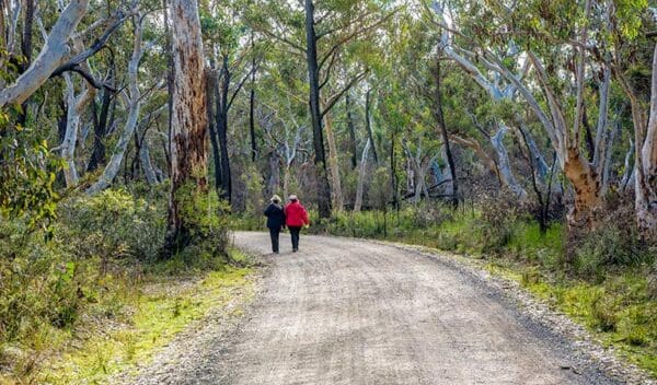
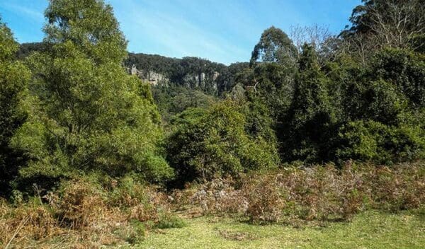
Fit and active visitors looking for a day's adventure won't want to miss Badgerys Spur walking track, a steep and challenging descent through a beautiful eucalyptus forest that skirts the edge of Ettrema Wilderness Area. Given the size of Morton National Park, there's a good chance you won't see many other people around, making this a perfect choice for anybody hoping for a bit of solitude in the wild.
Make sure you're well-prepared for your trip, bringing plenty of water and some sturdy shoes. Don't forget binoculars for a bit of birdwatching along the way. You might even be lucky enough to spot lace monitors and water dragons, too. After twisting down over 1.5km, the track crosses Dungeon Creek and finishes up on the bank of Shoalhaven River, where you can settle down for a leisurely, well-earned lunch, or pull on the swimmers for a dip in the water if temperatures are warm enough.
To extend the walk further, carry a tent into the informal campground by the river and make a night of it. Or consider connecting the walk to other treks in the neighbouring Bungonia National Park and Bungonia State Conservation Area. The possibilities are endless.
Track grade
Grade 5 (Difficult) - Walks for the Most Experienced: Grade 5 represents the most challenging walking tracks on the AWTGS. These are only recommended for very experienced and fit walkers with specialised skills, including navigation and emergency first aid. Tracks are likely to be very rough, very steep, and unmarked. Walks may be more than 20 kilometers. These challenging walks demand a high level of fitness and experience to navigate difficult terrain, significant elevation changes, and potentially unformed paths.
Walk map and GPX file
Do you have a GPX file for this hike? Feel free to email it to me so I can add it to this hikes info.
Click to add your file >>
Content use
Please don’t copy GPX files or content from this site to AllTrails or other platforms. Each trail has been personally mapped, documented, and refined to support Australia’s bushwalking and hiking community. While some details come from land managers, every listing reflects significant personal effort. This is a free, community-driven initiative—your respect helps keep it that way.
Gallery
Got any photos from this hike? Your photos can help others plan. Share shots from along the trail so fellow hikers know what to expect.
Click to add your photos >>
Getting there
Getting to the trailhead: Morton National Park.
To Badgery’s Spur access. Badgerys Spur walking track is in the northern precinct of Morton National Park. To get there:From Sydney:Turn off Hume Highway just before Marulan onto Highland WayDrive to the township of TallongAt Tallong, turn right onto Caoura Road (at the general store on the corner) and follow the road to Badgerys Road. Follow this for 4km to the end.From Canberra:Turn right off Hume Highway just after Marulan onto Highland Way (take the Tallong and Bundanoon exit).At Tallong, turn right onto Caoura Road (at the general store on the corner) and follow the road to Badgerys Road. Follow this for 4km to the end. Park entry points Badgery’s Spur access See on map Parking Parking is available at Badgerys lookout carpark.
Visit NSW National Parks and Wildlife Service for more information on this trail.
The longitude and latitude of the start and end points are approximately only and should not be used for navigation purposes. Please contact me if you know the correct coordinates.
Need a rental car to get you to the hike? Find one here.
Find a place to stay
Wondering where to stay near this hike? Find accommodation close to the trailhead — hotels, cabins and campgrounds nearby. Click the button to view the interactive map.
Closest towns to this walk: Albion Park, Bendeela, Berrima, Berry, Bowral, Bundanoon, Burrier, Culburra Beach, Fitzroy Falls, Kangaroo Valley, Mittagong, Moss Vale, Nowra, Robertson, Wingello
Let someone know
Heading out? Fill in a trip intentions form so someone knows your plans. If things go wrong, they can raise the alarm fast, giving you peace of mind on the trail.
About the region
Easily accessible from Nowra, Morton National Park is great for a daytrip or school excursion. Visit Fitzroy Falls for scenic waterfall views; go mountain biking, walking or enjoy a picnic lunch.
Be enthralled by nature on a grand scale at Morton National Park. If the cascading Fitzroy Falls don't leave you breathless, try the sweeping views from the top of Pigeon House Mountain Didthul.
This enormous park really does have something for everyone; whether you're an experienced bushwalker looking for remote wilderness hiking, a novice mountain biker looking for an easy ride or a keen photographer looking for some scenic waterfalls to capture.
You'll find imposing gorges dissecting the landscape alongside pockets of rainforest that are full of wildlife. There are a number of well equipped picnic areas and numerous informal spots where you can stop for a break to enjoy the view and if you'd like to go camping, head to Gambells Rest campground in the Bundanoon precinct of the park.
The park is easily accessible from Bundanoon, Kangaroo Valley, Nowra and Ulladulla, so it makes for a great day trip or weekend getaway.
Similar walks nearby
Looking for more walks in or near Morton National Park? Try these trails with a similar difficulty grade.
Explore safe
Plan ahead and hike safely! Carry enough water, pack layers for changing conditions, and bring safety gear like a torch, PLB, and reliable communication device. Check official sources for trail updates, closures, and access requirements, and review local weather and bushfire advice. Most importantly, share your plans with someone before you go. Being prepared makes for a safer and more enjoyable hike! Stay Safe, Explore More, and Always #ExploreSafe.
Packing checklists
What you carry in your pack depends on factors like weather, terrain, and your adventure type. Not sure what to bring? My free planning, food, and packing checklists are a great starting point, covering day hikes, overnight trips, and multi-day adventures. Use them to customise your kit and always prioritise safety.
Suggest an edit
Notice something different about this trail? Whether it’s a new feature, a route change, or a closure, share your update so we can keep our info accurate and helpful for fellow hikers.
Click to suggest edits >>
Acknowledgement of Country
Trail Hiking Australia acknowledges the Traditional Owners of the lands on which we hike and pay respects to their Elders, past and present, and we acknowledge the First Nations people of other communities who may be here today.


