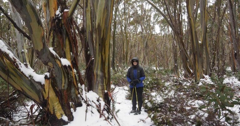
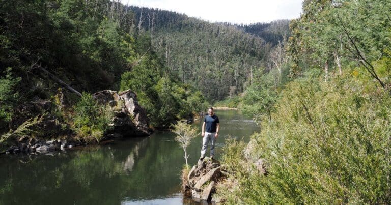
Aberfeldy River is a 7.2km, grade 4 hike located in Baw Baw National Park, Victoria. The hike should take around 3.5 hours to complete.
Hike overview
The Aberfeldy River hike is an adventurous off-trail hike that commences at Barnes Lookout on the Walhalla Road, approximately 9km north of Walhalla. From Barnes Lookout head directly west to the top of a nearby knoll. Locate a broad spur to the south west and follow this long it length to the Aberfeldy River. Note that the spur narrows as you approach the river. On reaching the river, turn north and follow the river bank (or wade along the river) upstream.
After approximately 2km you will arrive at a tunnel that is a seldom visited site in this region. Continue upstream along the river for a further 2km, keeping to the right bank where possible, until reaching an old fire break on a south facing spur. Follow this spur to the top of a broad knoll before turning south west along the ridge line and another spur back to Barnes Lookout. Heading directly east from this knoll will return you to the trail head.
Route and GPX file
Max elevation: 628 m
Min elevation: 298 m
Total climbing: 484 m
Total descent: -486 m
Tips
This is an adventurous off-trail hike. Expect to get wet along the river unless you are able to remain on the banks for the duration. Hiking poles, a towel and a change of clothing will be an advantage.
Trail location
Sorry, no records were found. Please adjust your search criteria and try again.
Sorry, unable to load the Maps API.
Getting there
From Melbourne, take the Monash and Princes freeways to the town of Moe, 130 km East of Melbourne. Take the Moe exit from the Princes Freeway and follow the signs to Erica/Rawson/Walhalla. From Walhalla drive north along the Walhalla Road for approximately 9km until you reach Barnes Lookout to start the walk, 21km from Rawson.
Gallery
If you have any photos from this hike and are happy to share them, please upload your .jpg files here.
Please note: Uploading photos does not transfer ownership of copyright away from you. If requested, you will be credited for any photos you provide and can ask they be deleted at any time.
About the region
The Baw Baw National Park is a national park located on the boundaries between the Central Highlands and Gippsland regions of Victoria, Australia. The 13,530-hectare national park is situated approximately 120 kilometres east of Melbourne and 50 kilometres north of the Latrobe Valley.
Similar trails nearby
Explore Safe
While planning your hike, it’s important to check official government sources for updated information, temporary closures and trail access requirements. Before hitting the trail, check local weather and bushfire advice for planned burns and bushfire warnings and let someone know before you go. Plan ahead and hike safely.
Let someone know
Adventure with peace of mind: Fill out your trip intentions form. Before you hit the trail, fill out an online form to privately send important details about your hike to your family or friends. If you don’t return on time, they can easily alert emergency services, preventing worry and ensuring a swift response. Hike with peace of mind and enjoy your outdoor adventure to the fullest. Be smart, be safe: Register your plans here.
Gear to consider

My free planning, food and packing checklists provide an introduction to things your could consider (as well as the Ten Essentials) on your day, overnight and multi-day adventures. Customise your kit according to your personal needs, always considering safety first.
Suggest an edit
Does this hikes information need updating? Sometimes the route, trail features or access conditions change.
Acknowledgement of Country
Trail Hiking Australia acknowledges the Traditional Owners of the lands on which we hike and pay respects to their Elders, past and present, and we acknowledge the First Nations people of other communities who may be here today.


