Hike at a Glance
Max elevation: 313m
Min elevation: 204m
Total Ascent: 201m
Important info
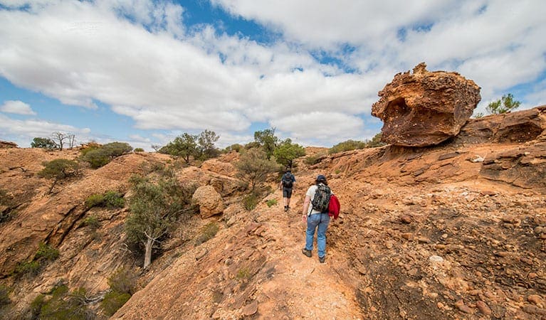
There is No directional signage. The track is very steep, rough and has many obstacles. Recommended for experienced bushwalkers. If you're planning to watch the sunset on Western Ridge walking track, please take a torch with you.
Hike overview
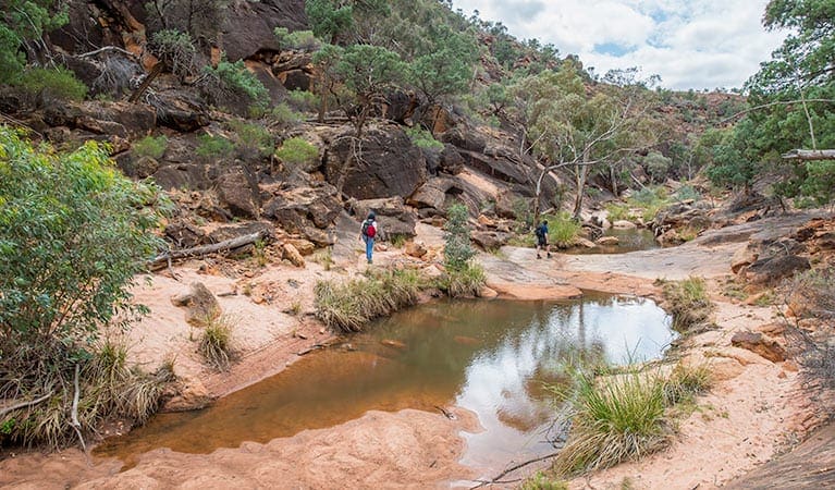
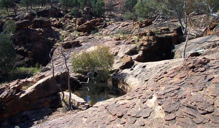
The Western Ridge walking track, also known as the Sunset Ridge trail, promises a spectacular experience for seasoned hikers seeking rugged beauty and panoramic views. Located within Mutawintji National Park, New South Wales, this challenging 8.5-kilometer (grade 5) hike typically takes 3-4 hours to complete.
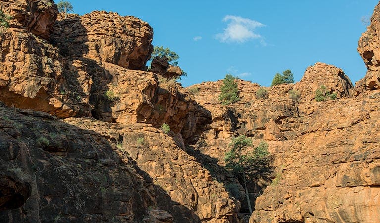
Beginning at the Homestead Creek campground, the trail ascends steeply in sections. However, the breathtaking views that unfold in every direction – the vast desert plains stretching westward and the dramatic gorges and red hues of the Bynguano Range to the east – make the effort worthwhile. To truly capture the magic, consider timing your hike for the afternoon, when the sunset paints the landscape in unforgettable colors.
As you follow the red markers guiding your way along the ridge, keep your eyes peeled for soaring wedge-tailed eagles and vibrant pink cockatoos. Birdwatchers will also delight in the frequent sightings of corellas and finches flitting through the mallee scrub. Reaching the summit, you'll be rewarded with a sense of exhilaration as you take in the expansive panorama – a true feeling of being on top of the world. For those seeking even more panoramic views of the vast sky, consider exploring the Bynguano Range walking track.
Tips
- If you're planning to watch the sunset on Western Ridge walk, please take a torch with you.
- There is No directional signage. The track is very steep, rough and has many obstacles. Recommended for experienced bushwalkers.
- Mutawintji National Park is best visited during spring. Daytime weather is pleasant and the nights are not yet too cold.
- Outback NSW can be very hot in summer. If travelling at this time be well prepared for the extreme conditions.
- In wet weather, access within the park maybe closed, and the public roads are susceptible to weather closures. Please check with the park office before you head out.
- Remember to take your binoculars if you want to bird watch.
- Toilets and picnic facilities are located at the Homestead Creek campground.
Gallery
Got some great shots from this hike? Upload your photos here to inspire others and show off the beauty of the trail!
Click to view form >>
Submitting your photos doesn’t mean you lose ownership. You can be credited for your contributions, and you can request removal at any time.
Content use
Please don’t copy GPX files or content from this site to AllTrails or other platforms. Each trail has been personally mapped, documented, and refined to support Australia’s bushwalking and hiking community. While some details come from land managers, every listing reflects significant personal effort. This is a free, community-driven initiative—your respect helps keep it that way.
Walk map and GPX file
Max elevation: 313 m
Min elevation: 204 m
Total climbing: 201 m
Total descent: -200 m
Getting there
Getting to the trailhead: Mutawintji National Park.
On entering Mutawintji National Park, Western Ridge walk starts near Homestead Creek campground. Parking Parking is available at Homestead Creek campground.
Accessing Mutawintji National Park: Mutawintji National Park is approximately 130 kilometers northeast of Broken Hill. The journey is via an unsealed gravel road, typically well-maintained in dry weather. However, heavy rain can cause closures. Always check road conditions with local authorities before venturing out. Drivers from Broken Hill have two route options: follow the Silver City Highway towards Tibooburra, keeping an eye out for the well-marked Mutawintji National Park turnoff. Alternatively, take the Barrier Highway for 75 kilometers before turning onto the designated park access road.
Upon arrival at the park, Mootwingee Road serves as the main entry point. Parking options include Homestead Creek campground and picnic area. While two-wheel drive (2WD) vehicles can access the park, remember these are unsealed roads. Extreme weather conditions can significantly impact road quality. Park access is restricted to dry weather only, as heavy rain can make the unsealed roads impassable.
Closest towns to this walk: Broken Hill, Ivanhoe, Menindee, Mutawintji, Pooncarie, Silverton, Tibooburra, White Cliffs, Wilcannia
About the region
In the rugged outback of New South Wales, Mutawintji National Park offers a uniquely Australian experience. This ancient landscape, northwest of Broken Hill, boasts a rich Aboriginal heritage spanning millennia. Evidence of their presence can be found throughout the park, from significant cultural sites to famous hand stencil art adorning the vibrant red cliffs of the Bynguano Ranges.
Mutawintji National Park showcases the classic Australian outback. Explore a network of red dirt roads, winding through dramatic gorges and vast deserts. The ever-changing hues of the Bynguano Ranges paint a majestic backdrop, while the expansive saltbush and mulga plains stretch endlessly towards the horizon, offering a true escape from the hustle and bustle of city life.
The park holds deep cultural significance for the traditional owners, the Pantjikali, Wanyuparlku, Wilyakali and Malyangapa people. For thousands of years, Mutawintji has served as a crucial meeting place for Aboriginal communities, hosting gatherings of up to 1,000 people for ceremonies like initiations and rainmaking rituals.
An easy walk, suitable for wheelchairs, leads you to the splendor of Mutawintji's gorges and the rocky overhang known as Thaaklatjika (Wright's Cave). Here, captivating artworks – paintings, stencils, and engravings – depict the rich history of the area, showcasing both pre-colonial and colonial Aboriginal life alongside native animals like kangaroos and emus.
Despite its peaceful ambiance, Mutawintji is teeming with wildlife. Look out for soaring predators like wedge-tailed eagles and peregrine falcons. The air comes alive with the calls of noisy short-billed corellas, zebra finches, budgerigars, apostle birds, and magpies. Keep an eye out for slithering goannas and snakes, and don't miss the chance to spot members of the endangered yellow-footed rock wallaby – the largest and brightest-colored rock-wallaby in Australia, found only on the park's rocky ridges.
Begin your exploration at the Mutawintji Visitor Centre to gather valuable information and park permits. Choose from a variety of campsites, including Homestead Creek campground. Hiking options cater to all abilities, ranging from the easy Thaaklatjika Mingkana walking track to more challenging adventures like the Rockholes Loop walking track or Mutawintji Gorge walking track.
Similar walks nearby
Looking for more walks in or near Mutawintji National Park? Try these trails with a similar difficulty grade.
Track grade
Grade 5 (Difficult) - Walks for the Most Experienced: Grade 5 represents the most challenging walking tracks on the AWTGS. These are only recommended for very experienced and fit walkers with specialised skills, including navigation and emergency first aid. Tracks are likely to be very rough, very steep, and unmarked. Walks may be more than 20 kilometers. These challenging walks demand a high level of fitness and experience to navigate difficult terrain, significant elevation changes, and potentially unformed paths.
Explore safe
Plan ahead and hike safely! Carry enough water, pack layers for changing conditions, and bring safety gear like a torch, PLB, and reliable communication device. Check official sources for trail updates, closures, and access requirements, and review local weather and bushfire advice. Most importantly, share your plans with someone before you go. Being prepared makes for a safer and more enjoyable hike! Stay Safe, Explore More, and Always #ExploreSafe.
Packing checklists
What you carry in your pack depends on factors like weather, terrain, and your adventure type. Not sure what to bring? My free planning, food, and packing checklists are a great starting point, covering day hikes, overnight trips, and multi-day adventures. Use them to customise your kit and always prioritise safety.
Let someone know
Before heading out, take a moment to fill out your trip intentions form. It’s a quick way to share your hike details with family or friends. If something goes wrong, they can notify emergency services, ensuring a faster response and peace of mind. Stay safe and enjoy your adventure
Suggest an edit
Spotted a change on this trail? Maybe there are new features, the route has shifted, or the trail is permanently closed. Whatever the update, I’d love your input. Your feedback helps fellow hikers stay informed and ensures that our trail info stays fresh and reliable.
Acknowledgement of Country
Trail Hiking Australia acknowledges the Traditional Owners of the lands on which we hike and pay respects to their Elders, past and present, and we acknowledge the First Nations people of other communities who may be here today.


4 Reviews on “Western Ridge Walk (8.5km)”
This is a spectacular walk that does require a level of fitness and a bit of navigation confidence as markers are non existent. From the ridge you’ll overlook the vast desert plains and the beautiful Bynguano Range. It’s especially beautiful at sunset. Loved it.
Cheers Grant, sounds like one to add to my list. I see there are other challenging (grade 5) hikes in the same area. Could be a good spot to camp and explore.
https://www.trailhiking.com.au/hikes/region/mutawintji-national-park/