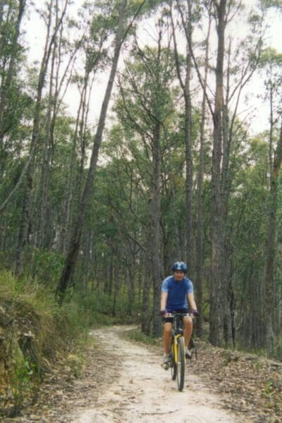
A short rail trail in beautiful mountain countryside, featuring tall forests and the meandering Thomson River. An old mining area with the historic village of Walhalla close by. Walk or cycle through steep cuttings with many twists and turns along the old railway formation.
Gold was discovered at Walhalla in 1863, and created an impetus to build a railway. A campaign started in the 1880's, but it wasn't until 1910 that a narrow guage line was built from Moe to Walhalla. However by the time the line was finished, the gold had started to peter out, and the miners used the railway to leave the area. The line was closed in stages, and the final section from Moe to Erica was closed in 1954.
The wonderful concrete and steel bridge at Thomson was almost used by the army for demolition training, but a campaign by the Walhalla Goldfields Railway group finally succeeded in overturning that decision. The railway is open between Thomson and Walhalla with a collection of completely restored rolling stock, and bikes can be carried on board.
Grade 3 (Moderate) - Walks for Most Fitness Levels: Grade 3 on the
AWTGS represents moderate walking tracks. These are ideal for walkers with some fitness who are comfortable with some hills and uneven terrain. While suitable for most ages, some bushwalking experience is recommended to ensure a safe and enjoyable experience. Tracks may have short, steep hill sections, a rough surface, and many steps. The total distance of a Grade 3 walk can be up to 20 kilometers.
Total distance: 8408 m
Max elevation: 437 m
Min elevation: 233 m
Total climbing: 183 m
Total descent: -345 m
Content use
Please don’t copy GPX files or content from this site to AllTrails or other platforms. Each trail has been personally mapped, documented, and refined to support Australia’s bushwalking and hiking community. While some details come from land managers, every listing reflects significant personal effort. This is a free, community-driven initiative—your respect helps keep it that way.
Gallery
Got any photos from this hike? Your photos can help others plan. Share shots from along the trail so fellow hikers know what to expect.
Click to add your photos >>
Getting there
Getting to the trailhead: Walhalla Historic Area.
Travel via Monash Freeway (M1) and Princes Highway (A1) to the Moe turn off and follow the signs to Erica approximately 170 km east of Melbourne.
Need a rental car to get you to the hike? Find one here.
About the region
Walhalla, a rich gold producer for 50 years, is a remote and picturesque mountain township. It is hard to imagine a more difficult site for a town than the steep, narrow valley of Stringers Creek as it winds down through the dense forests of the Baws Baws. Yet in its heyday, between 1880 and 1895, more than 4000 people lived there. The town is the start of the 650 km Australian Alps Walking Track to the ACT. But most people come to discover the remnants of a community that defied a forbidding environment in its quest for gold. The best way to see the town is on foot.
Let someone know
Heading out? Fill in a trip intentions form so someone knows your plans. If things go wrong, they can raise the alarm fast, giving you peace of mind on the trail.
Similar walks nearby
Looking for more walks in or near Walhalla Historic Area? Try these trails with a similar difficulty grade.
Favourite

Favourite

Favourite

Favourite

Suggest an edit
Notice something different about this trail? Whether it’s a new feature, a route change, or a closure, share your update so we can keep our info accurate and helpful for fellow hikers.
Click to suggest edits >>
Explore safe
Plan ahead and hike safely! Carry enough water, pack layers for changing conditions, and bring safety gear like a torch, PLB, and reliable communication device. Check official sources for trail updates, closures, and access requirements, and review local weather and bushfire advice. Most importantly, share your plans with someone before you go. Being prepared makes for a safer and more enjoyable hike! Stay Safe, Explore More, and Always #ExploreSafe.
Packing checklists
What you carry in your pack depends on factors like weather, terrain, and your adventure type. Not sure what to bring? My free planning, food, and packing checklists are a great starting point, covering day hikes, overnight trips, and multi-day adventures. Use them to customise your kit and always prioritise safety.


