Hike at a Glance
Max elevation: 0m
Min elevation: 0m
Total Ascent: 0m
Hike overview
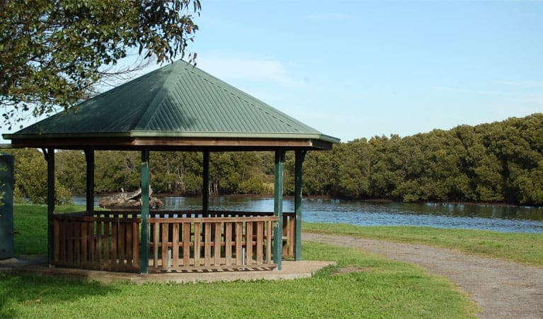
Did you know mangroves are excellent fish nurseries? That there is a plant called sea celery? Or that saltmarsh is classified as an Endangered Ecological Community? You can learn all about these issues and more on The Welcome walk in Hunter Wetlands National Park. Walking along the raised boardwalk, you'll meander above the saltwater wetlands of the Hunter River estuary, maybe spotting a fish or two or crabs.
This short walk is ideal for walking with children. You can set your own gentle pace, peeking and pointing at the wildlife and exploring the intricate world beneath you. Birdwatch as you go - there will be plenty of water birds about - and check out the interesting grasses and aquatic plants within the saltmarsh ecosystem.
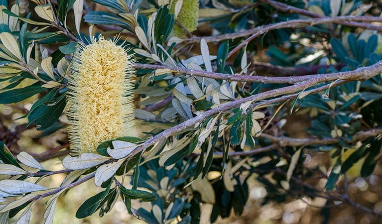
You're bound to get some great photos any time you visit, but many say this walk is at its best in spring, when delicate cream-coloured flowers adorn the mangroves.
Take a virtual tour of The Welcome walk captured with Google Street View Trekker.
Tips
Remember to take your binoculars if you want to birdwatch.
This walk takes you to the Schoolmasters House, which today is used as a base for the Kooragang Wetland Rehabilitation Project (KWRP). The KWRP undertakes conservation projects in the Hunter estuary and has an extensive volunteer program.
Visit NSW National Parks and Wildlife Service for more information on this trail.
The longitude and latitude of the start and end points are approximately only and should not be used for navigation purposes. Please contact me if you know the correct coordinates.
Gallery
Got some great shots from this hike? Upload your photos here to inspire others and show off the beauty of the trail!
Click to view form >>
Submitting your photos doesn’t mean you lose ownership. You can be credited for your contributions, and you can request removal at any time.
Content use
Please don’t copy GPX files or content from this site to AllTrails or other platforms. Each trail has been personally mapped, documented, and refined to support Australia’s bushwalking and hiking community. While some details come from land managers, every listing reflects significant personal effort. This is a free, community-driven initiative—your respect helps keep it that way.
Walk map and GPX file
It looks like I don’t have a GPX file for this trail yet. If you have one to share, please email it to me! I’ll verify it against official maps before adding it to help other hikers have a safer, easier experience. Thanks for contributing to a better hiking resource.
Getting there
Getting to the trailhead: Hunter Wetlands National Park.
To The Welcome Walk carpark. The Welcome walk is in the Ash Island precinct of Hunter Wetlands National Park. To get there:Cross the Ash Island Bridge off the Pacific Highway at HexhamTurn right onto Schoolhouse RoadPark at the information shelters, where the walk begins. Park entry points The Welcome Walk carpark See on map Parking Parking is available at the starting point for The Welcome walk.
Closest towns to this walk: Beresfield, Fletcher, Hexham, Kooragang, Lambton, Maryland, Mayfield, Newcastle, Sandgate, Shortland, Waratah
About the region
Just a short drive from Newcastle is Hunter Wetlands National Park, a wildlife sanctuary with family-friendly walking, cycling, fishing and birdwatching. It's hard to believe Hunter Wetlands National Park, a haven for nature-lovers, is so close to the city of Newcastle. Pop the kids and their bikes in the car and head to Ash Island, where Riverside Park is just the spot for a picnic and easy cycling or walks if you prefer through rainforests and mangroves. You can also meander to the old World War II radar station or explore the ruins of Milham's Farmhouse.
Similar walks nearby
Looking for more walks in or near Hunter Wetlands National Park? Try these trails with a similar difficulty grade.
Track grade
Grade 2 (Easy) - A Gentle Introduction to Inclines: Grade 2 on the AWTGS represents easy walking tracks that offer a slightly more challenging experience compared to Grade 1. Similar to Grade 1, no prior bushwalking experience is required. The track surface is typically hardened or compacted and may have gentle hill sections or occasional steps. The total distance of a Grade 2 walk is typically no greater than 10 kilometers. These walks are still suitable for families with a bit more experience or those seeking a gentle introduction to some inclines.
Explore safe
Plan ahead and hike safely! Carry enough water, pack layers for changing conditions, and bring safety gear like a torch, PLB, and reliable communication device. Check official sources for trail updates, closures, and access requirements, and review local weather and bushfire advice. Most importantly, share your plans with someone before you go. Being prepared makes for a safer and more enjoyable hike! Stay Safe, Explore More, and Always #ExploreSafe.
Packing checklists
What you carry in your pack depends on factors like weather, terrain, and your adventure type. Not sure what to bring? My free planning, food, and packing checklists are a great starting point, covering day hikes, overnight trips, and multi-day adventures. Use them to customise your kit and always prioritise safety.
Let someone know
Before heading out, take a moment to fill out your trip intentions form. It’s a quick way to share your hike details with family or friends. If something goes wrong, they can notify emergency services, ensuring a faster response and peace of mind. Stay safe and enjoy your adventure
Suggest an edit
Spotted a change on this trail? Maybe there are new features, the route has shifted, or the trail is permanently closed. Whatever the update, I’d love your input. Your feedback helps fellow hikers stay informed and ensures that our trail info stays fresh and reliable.
Acknowledgement of Country
Trail Hiking Australia acknowledges the Traditional Owners of the lands on which we hike and pay respects to their Elders, past and present, and we acknowledge the First Nations people of other communities who may be here today.


