Hike at a Glance
Max elevation: 0m
Min elevation: 0m
Total Ascent: 0m
Hike overview
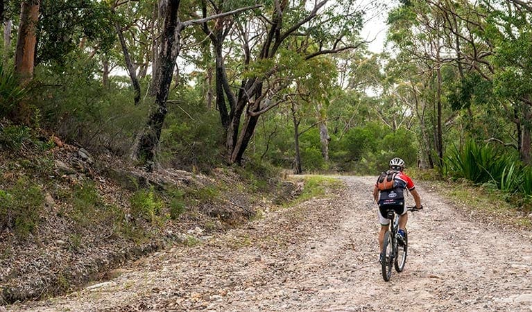
The Coast track can be tackled in sections or, if you're super-fit, in a day. It's best experienced as a 2-day backpack trip with an overnight stop at North Era campground (advance bookings required).
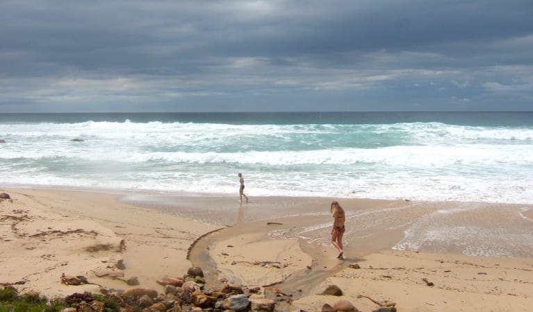
The northern section of the walk covers around 18km from Bundeena to North Era. Allow at least 7hrs to enjoy the rugged beauty of Royal National Park's sandstone escarpments, sandy beaches, coastal heath and forest, as you walk. There are several scenic stops along the way, including Little Marley Beach, Wattamolla, Curracurrang Cove near Eagle Rock lookout, and Garie Beach. Stop for a rest, have a picnic, or cool off with a swim, before continuing to North Era campground for the night.
The southern section of the walk, between North Era and Otford lookout, covers 8km and takes around 3hrs. You'll pass several heritage shacks at South Era, and travel through coastal rainforest of burning palms and palm jungle. Why not stop at Burning Palms Beach, before climbing back atop the headlands. Take in the views from Werrong lookout then push on the last couple of kilometres to Otford lookout.
Plan your walk during whale watching season, May to October, for a chance to spot migrating humpback whales. Take a virtual tour of The Coast track captured with Google Street View Trekker.
Tips
If you plan to walk The Coast track get the interactive Royal National Park map app from Avenza.
You'll need to book North Era campground online if you plan to camp overnight here. It's a popular place so book well in advance, especially from October to March.
You'll need to be well-prepared and bring enough water and food for the journey.
If driving to Bundeena it's a good idea to stop by the Royal National Park Visitor Centre for park information and maps.
Visit NSW National Parks and Wildlife Service for more information on this trail.
The longitude and latitude of the start and end points are approximately only and should not be used for navigation purposes. Please contact me if you know the correct coordinates.
Gallery
Got some great shots from this hike? Upload your photos here to inspire others and show off the beauty of the trail!
Click to view form >>
Submitting your photos doesn’t mean you lose ownership. You can be credited for your contributions, and you can request removal at any time.
Content use
Please don’t copy GPX files or content from this site to AllTrails or other platforms. Each trail has been personally mapped, documented, and refined to support Australia’s bushwalking and hiking community. While some details come from land managers, every listing reflects significant personal effort. This is a free, community-driven initiative—your respect helps keep it that way.
Walk map and GPX file
It looks like I don’t have a GPX file for this trail yet. If you have one to share, please email it to me! I’ll verify it against official maps before adding it to help other hikers have a safer, easier experience. Thanks for contributing to a better hiking resource.
Getting there
Getting to the trailhead: Royal National Park.
To Bundeena. The Coast track starts at Beachcomber Avenue, Bundeena in the Bundeena precinct of Royal National Park. To drive there:From Sydney to Bundeena:Take the Princes Highway south towards WollongongAt Loftus, turn left at the signs for Royal National Park onto Farnell Avenue, which continues onto Audley RoadDrive across Audley Weir and continue along Sir Bertram Stevens Drive for approximately 10kmTurn left onto Bundeena Drive and continue to Bundeena townshipTurn right onto Brighton Street then left onto Scarborough StreetTurn right at Beachcomber Avenue and follow to the endAlternatively, if starting from Otford lookout:At Waterfall, turn off the Princes Highway onto McKell Avenue, and follow to the endTurn right onto Lady Wakehurst DriveOtford lookout is on the left as you reach the coastline Park entry points Show more Bundeena See on map Bundeena Drive carpark See on map Garie Beach carpark See on map Lady Wakehurst Drive, Otford See on map Wattamolla carpark See on map Parking Parking is available in Beachcomber Avenue, Bundeena and at Otford lookout. By public transport Take the Eastern Suburbs and Illawarra train line to Cronulla, then the ferry to Bundeena. It’s a 1.5km walk to the start of The Coast track. Otford train station is on Georges Road, an extra 2km walk from Otford lookout, at the southern end of The Coast track. Take the South Coast train line to Sydney Central Station, or change at Sutherland for trains to Cronulla, then take the ferry across to Bundeena, if you’ve parked your car here.
Closest towns to this walk: Audley, Barden Ridge, Bundeena, Caringbah, Cronulla, Engadine, Heathcote, Helensburgh, Loftus, Maianbar, Menai, Miranda, Otford, Oyster Bay, Stanwell Park, Sutherland, Sylvania, Waterfall, Wattamolla, Wollongong, Woodenbong, Woronora, Woronora Heights
Similar walks nearby
Looking for more walks in or near Royal National Park? Try these trails with a similar difficulty grade.
Track grade
Grade 5 (Difficult) - Walks for the Most Experienced: Grade 5 represents the most challenging walking tracks on the AWTGS. These are only recommended for very experienced and fit walkers with specialised skills, including navigation and emergency first aid. Tracks are likely to be very rough, very steep, and unmarked. Walks may be more than 20 kilometers. These challenging walks demand a high level of fitness and experience to navigate difficult terrain, significant elevation changes, and potentially unformed paths.
Explore safe
Plan ahead and hike safely! Carry enough water, pack layers for changing conditions, and bring safety gear like a torch, PLB, and reliable communication device. Check official sources for trail updates, closures, and access requirements, and review local weather and bushfire advice. Most importantly, share your plans with someone before you go. Being prepared makes for a safer and more enjoyable hike! Stay Safe, Explore More, and Always #ExploreSafe.
Packing checklists
What you carry in your pack depends on factors like weather, terrain, and your adventure type. Not sure what to bring? My free planning, food, and packing checklists are a great starting point, covering day hikes, overnight trips, and multi-day adventures. Use them to customise your kit and always prioritise safety.
Let someone know
Before heading out, take a moment to fill out your trip intentions form. It’s a quick way to share your hike details with family or friends. If something goes wrong, they can notify emergency services, ensuring a faster response and peace of mind. Stay safe and enjoy your adventure
Suggest an edit
Spotted a change on this trail? Maybe there are new features, the route has shifted, or the trail is permanently closed. Whatever the update, I’d love your input. Your feedback helps fellow hikers stay informed and ensures that our trail info stays fresh and reliable.
Acknowledgement of Country
Trail Hiking Australia acknowledges the Traditional Owners of the lands on which we hike and pay respects to their Elders, past and present, and we acknowledge the First Nations people of other communities who may be here today.


