Hike at a Glance
Max elevation: 0m
Min elevation: 0m
Total Ascent: 0m
Hike overview
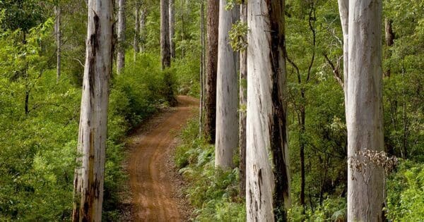
Set amid the karri forest about eight kilometres south of Pemberton, these rocky rapids and surrounds provide a place for an outdoor lunch, a leisurely afternoon stroll, or a few peaceful hours of fly fishing.
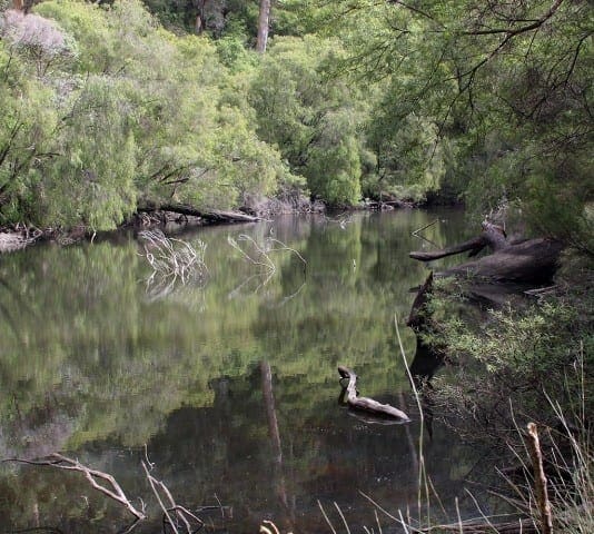
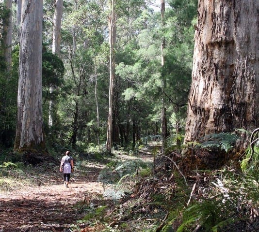
The Cascades are a series of picturesque waterfalls that flow from the Lefroy Brook near Pemberton. Enjoy a lovely day wandering through the forest and fishing at the Cascades. nnNestled in the Gloucester National Park, this tranquil setting is only four hours drive south of Perth. nnJust off the Bibbulmun Track, the walking enthusiast will enjoy the six kilometre walk along the track from Pemberton to the Cascades. There is a trail which allows you to loop around the waterfalls and capture a photo from every angle. The views are magnificent and the natural surrounds refreshing and revitalising. As you wander down to the picnic site from the parking area, listen to the voices of the Birds as they chatter in the trees. Water is always a focus for forest life. From there, its just a few steps to the lookout, or you can get a closer view of the Cascades by stepping down to a Boardwalk that crosses a tributary of Lefroy Brook. Beware of the slippery rocks and stay well back from the water's edge. The loop trail, which starts from the Picnic Area and crosses the Northcliffe tramway, takes you through different types of forest and you will see some lush fern and reed growth near the water. The trail passes through the peppermints and sheoaks. So try to identify the trees or catch a glimpse of a trout or marron in the brook. The national park is home to many of the state's marsupials and wildflowers which can be spotted whilst walking along the trail. Return to Pemberton along the track or alternatively catch the tourist train.
Tips
Start Point: Gloucester Natioanal Park at The Cascades car park
End Point: Gloucester Natioanal Park at The Cascades car park
Region: Gloucester National Park, South West
For more information, a location map and GPS file please visit Trails WA.
Track grade
Grade 2 (Easy) - A Gentle Introduction to Inclines: Grade 2 on the AWTGS represents easy walking tracks that offer a slightly more challenging experience compared to Grade 1. Similar to Grade 1, no prior bushwalking experience is required. The track surface is typically hardened or compacted and may have gentle hill sections or occasional steps. The total distance of a Grade 2 walk is typically no greater than 10 kilometers. These walks are still suitable for families with a bit more experience or those seeking a gentle introduction to some inclines.
Walk map and GPX file
Do you have a GPX file for this hike? Feel free to email it to me so I can add it to this hikes info.
Click to add your file >>
Content use
Please don’t copy GPX files or content from this site to AllTrails or other platforms. Each trail has been personally mapped, documented, and refined to support Australia’s bushwalking and hiking community. While some details come from land managers, every listing reflects significant personal effort. This is a free, community-driven initiative—your respect helps keep it that way.
Gallery
Got any photos from this hike? Your photos can help others plan. Share shots from along the trail so fellow hikers know what to expect.
Click to add your photos >>
Getting there
Getting to the trailhead: Gloucester National Park.
The Gloucester National Park is accessible via sealed roads from Pemberton.
Need a rental car to get you to the hike? Find one here.
About the region
Only 3km from Pemberton, Gloucester National Park is home to Western Australia's most famous karri tree. The Gloucester Tree was once a fire lookout tree and can now be climbed by the public. Those who do venture up the 153 pegs to the top will be rewarded with commanding views of the karri forest and surrounding farmland. The karri forest is home to many native mammal species such as quenda, quokkas, mardos and dunnarts. These animals are shy and rarely seen. Sit quietly in the forest at Cascades and you may be rewarded with the sight of honeyeaters, wrens, fantails and robins flitting around through the undergrowth.
Find a place to stay
Wondering where to stay near this hike? Find accommodation close to the trailhead — hotels, cabins and campgrounds nearby. Click the button to view the interactive map.
Closest towns to this walk: Balingup, Bridgetown, Karri Valley, Manjimup, Nannup, Northcliffe, Pemberton
Let someone know
Heading out? Fill in a trip intentions form so someone knows your plans. If things go wrong, they can raise the alarm fast, giving you peace of mind on the trail.
Similar walks nearby
Looking for more walks in or near Gloucester National Park? Try these trails with a similar difficulty grade.
Suggest an edit
Notice something different about this trail? Whether it’s a new feature, a route change, or a closure, share your update so we can keep our info accurate and helpful for fellow hikers.
Click to suggest edits >>
Explore safe
Plan ahead and hike safely! Carry enough water, pack layers for changing conditions, and bring safety gear like a torch, PLB, and reliable communication device. Check official sources for trail updates, closures, and access requirements, and review local weather and bushfire advice. Most importantly, share your plans with someone before you go. Being prepared makes for a safer and more enjoyable hike! Stay Safe, Explore More, and Always #ExploreSafe.
Packing checklists
What you carry in your pack depends on factors like weather, terrain, and your adventure type. Not sure what to bring? My free planning, food, and packing checklists are a great starting point, covering day hikes, overnight trips, and multi-day adventures. Use them to customise your kit and always prioritise safety.
Acknowledgement of Country
Trail Hiking Australia acknowledges the Traditional Owners of the lands on which we hike and pay respects to their Elders, past and present, and we acknowledge the First Nations people of other communities who may be here today.


