This rail trail is proposed and is not yet open. The alignment is owned by Transport NSW and much of it passes through private property. Trespassing on the alignment is prohibited. This hike is classified as Grade 3 (Moderate) primarily due to its distance exceeding 10km. The terrain itself is relatively easy and suitable for most abilities. However, the longer distance requires some stamina. Feel free to turn back at any point for a shorter adventure.
Envisioned as a multi-stage project, this exciting initiative is bringing new life to disused railway lines in New South Wales. The first leg, connecting Tumbarumba and Rosewood, is already open to the public. Now, the focus shifts westward with the proposed 20km Wagga Wagga to Ladysmith section (stage two).
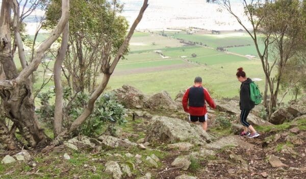
This new trail will bridge the gap between the bustling city of Wagga Wagga and the rural village of Ladysmith. The path winds through open country and lightly-wooded farmlands, offering a scenic escape for cyclists and hikers.
The Wagga Wagga to Ladysmith section is a crucial piece of the puzzle. Its successful construction could pave the way for further development, ultimately connecting Ladysmith to Tarcutta on the Hume Highway and beyond to Humula and Rosewood.
Imagine starting your journey in central Wagga Wagga, where the trail begins. You'll be following the path of a disused government branch line that once linked the city to Tumbarumba. Accessibility is a key priority, with entry points conveniently located near the Wagga Wagga CBD and the Equex Centre sports complex. These access points also connect seamlessly with existing cycleways like Kooringal Rd and Riverside, making it easy to integrate the trail into your cycling network.
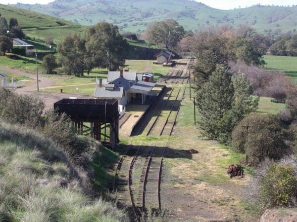
The adventure culminates at the Ladysmith railway station trailhead, marking the end of stage two. The Riverina Highlands Rail Trail is a project brimming with potential, promising scenic escapes, historical connections, and a chance to explore the diverse landscapes of NSW.
Grade 3 (Moderate) - Walks for Most Fitness Levels: Grade 3 on the
AWTGS represents moderate walking tracks. These are ideal for walkers with some fitness who are comfortable with some hills and uneven terrain. While suitable for most ages, some bushwalking experience is recommended to ensure a safe and enjoyable experience. Tracks may have short, steep hill sections, a rough surface, and many steps. The total distance of a Grade 3 walk can be up to 20 kilometers.
Do you have a GPX file for this hike? Feel free to email it to me so I can add it to this hikes info.
Click to add your file >>
Content use
Please don’t copy GPX files or content from this site to AllTrails or other platforms. Each trail has been personally mapped, documented, and refined to support Australia’s bushwalking and hiking community. While some details come from land managers, every listing reflects significant personal effort. This is a free, community-driven initiative—your respect helps keep it that way.
Gallery
Got any photos from this hike? Your photos can help others plan. Share shots from along the trail so fellow hikers know what to expect.
Click to add your photos >>
Find a place to stay
Wondering where to stay near this hike? Find accommodation close to the trailhead — hotels, cabins and campgrounds nearby. Click the button to view the interactive map.
Closest towns to this walk: Albury, Armidale, Bathurst, Coffs Harbour, Cowra, Goulburn, Griffith, Gunnedah, Leeton, Lithgow, Moree, Mudgee, Narrabri, Narrandera, Orange, Parkes, Tamworth, Temora, Wagga Wagga, Wellington
Let someone know
Heading out? Fill in a trip intentions form so someone knows your plans. If things go wrong, they can raise the alarm fast, giving you peace of mind on the trail.
Similar walks nearby
Looking for more walks in or near Country NSW? Try these trails with a similar difficulty grade.
Favourite

Favourite

Favourite

Favourite

Explore safe
Plan ahead and hike safely! Carry enough water, pack layers for changing conditions, and bring safety gear like a torch, PLB, and reliable communication device. Check official sources for trail updates, closures, and access requirements, and review local weather and bushfire advice. Most importantly, share your plans with someone before you go. Being prepared makes for a safer and more enjoyable hike! Stay Safe, Explore More, and Always #ExploreSafe.
Packing checklists
What you carry in your pack depends on factors like weather, terrain, and your adventure type. Not sure what to bring? My free planning, food, and packing checklists are a great starting point, covering day hikes, overnight trips, and multi-day adventures. Use them to customise your kit and always prioritise safety.
Suggest an edit
Notice something different about this trail? Whether it’s a new feature, a route change, or a closure, share your update so we can keep our info accurate and helpful for fellow hikers.
Click to suggest edits >>


