Hike at a Glance
Max elevation: 330m
Min elevation: 22m
Total Ascent: 607m
Important info
This hike is classified as Grade 4 (Hard) due to its significant distance exceeding 20km. While the terrain itself is relatively easy and may be suitable for all abilities, the long distance requires a good level of fitness and preparation. Feel free to turn back at any point for a shorter adventure.
Hike overview
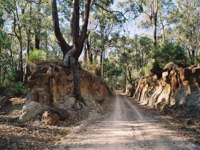
Tracing the path of the old Eastern Railway, the Railway Reserves Heritage Trail is a 41-kilometre loop through the Perth Hills, passing through the communities of Mundaring, Darlington, and Parkerville. Following former railway formations, the trail blends history with natural beauty, offering a mix of terrain, scenic lookouts, and fascinating landmarks.
Starting at Sculpture Park in Mundaring, about 30 kilometres northeast of Perth, the trail extends from Bellevue in the west to Wooroloo in the east. It’s a popular route for walkers, cyclists, and horse riders, though horses are not permitted through John Forrest National Park. With multiple access points, it’s easy to break the journey into shorter sections for a half-day walk or a leisurely ride.
Highlights along the way include the eerie Swan View Tunnel, the Goldfields Pipeline, and seasonal waterfalls that bring the landscape to life in winter and spring. Rest stops, picnic areas, and historic taverns provide opportunities to pause and soak in the surroundings. Interpretive signs and trail markers help navigate the route, while a detailed brochure from the Perth Hills Mundaring Visitor Centre offers maps, distance charts, and elevation profiles to assist with planning.
Whether exploring the full loop over two days or enjoying a shorter section, the Railway Reserves Heritage Trail is a chance to experience Western Australia’s railway history while walking or cycling through ever-changing landscapes. With well-marked tracks and easy road access at various points, it’s a rewarding journey for those seeking a mix of history, nature, and adventure.
Gallery
Got some great shots from this hike? Upload your photos here to inspire others and show off the beauty of the trail!
Click to view form >>
Submitting your photos doesn’t mean you lose ownership. You can be credited for your contributions, and you can request removal at any time.
Content use
Please don’t copy GPX files or content from this site to AllTrails or other platforms. Each trail has been personally mapped, documented, and refined to support Australia’s bushwalking and hiking community. While some details come from land managers, every listing reflects significant personal effort. This is a free, community-driven initiative—your respect helps keep it that way.
Walk map and GPX file
Max elevation: 330 m
Min elevation: 22 m
Total climbing: 607 m
Total descent: -607 m
Getting there
Getting to the trailhead: John Forrest National Park.
The Railway Reserves Heritage Trail has multiple entry points, but the recommended starting point is Sculpture Park in Mundaring, located in the Perth Hills. Just 30 kilometres northeast of Perth, the trailhead is an easy 45-minute drive via Great Eastern Highway. Sculpture Park offers ample parking, making it a convenient place to begin your journey. If using public transport, Transperth buses run to Mundaring from Midland Station, which connects to Perth’s city centre by train. For those preferring a shorter walk or ride, access points along the trail allow for flexible start and end points, with road connections and parking available at several locations.
Closest towns to this walk: Boya, Darlington, Gidgegannup, Glen Forrest, Gooseberry Hill, Greenmount, Helena Valley, Hovea, Kalamunda, Mahogany Creek, Midland, Mundaring, Parkerville, Sawyers Valley, Stoneville, Swan View
About the region
Nestled within the expansive Darling Scarp and just 45 minutes east of Perth City, the Perth Hills is a captivating region known for its charming townships like Mundaring, Kalamunda, Bickley Valley, and Armadale. These towns exude a delightful country charm and offer breathtaking views that are sure to impress any visitor. The area has a rich history of viticulture, with the first vineyards established in the 1880s. Today, the Perth Hills boasts a thriving wine scene, complete with a fantastic food and wine trail as well as cider and brews trails that invite exploration.
This picturesque region is surrounded by national and state forests, providing a perfect backdrop for outdoor activities. With over 40 bike trails, walking paths, and wildflower trails available, there are ample opportunities for adventure. Scenic lookouts and picnic spots enhance the experience, making it easy to enjoy a relaxing day in nature. Notably, the Perth Hills marks the beginning of both the Bibbulmun Track and Munda Biddi Cycle Trail, catering to hikers and cyclists alike.
John Forrest National Park, located just 30 minutes from Perth, is one of the highlights of this area. As the first and oldest national park in Western Australia, it offers an array of scenic views, walking and cycling trails, and historic structures set against a backdrop of diverse wildlife. Upon arrival at the park, visitors can find numerous picturesque locations ideal for picnicking or using one of the available barbecues. The park features two waterfalls that flow during winter and spring—an especially beautiful time to witness the vibrant wildflowers in bloom.
The trails within John Forrest National Park lead adventurers through towering jarrah, marri, flooded gum, swamp peppermint, and paperbark trees. An intriguing feature is the Swan View Tunnel, which adds an element of mystery to your walk. While exploring these paths, you may encounter native wildlife such as western grey kangaroos lounging in their natural habitat. For those who prefer cycling, the Railway Reserves Trail offers an excellent opportunity to explore the area on two wheels. Whether you opt for a hike on one of the many trails or simply visit the lookouts, you’ll have plenty of chances to capture memorable photos showcasing views of Perth and the Swan Coastal Plain.
The cultural history of this region is equally significant. The Nyoongar people have inhabited the Midland to Guildford area long before European settlement. Historical accounts suggest that this area served as a hunting ground and that Jane Brook Valley was an ancient travel route used by the Nyoongar people to navigate across the Darling Scarp towards more open lands in the east. Jane Brook holds cultural importance as well; it is associated with the Dreamtime serpent known as Waugal, with local traditions stating that the rocks along this brook are remnants of this mythical creature.
Similar walks nearby
Looking for more walks in or near John Forrest National Park? Try these trails with a similar difficulty grade.
Track grade
Grade 4 (Hard) - Challenging Walks for Experienced Walkers: Grade 4 on the AWTGS signifies challenging walking tracks. Bushwalking experience is recommended for these tracks, which may be long, rough, and very steep. Directional signage may be limited, requiring a good sense of navigation. These walks are suited for experienced walkers who are comfortable with steeper inclines, rougher terrain, and potentially longer distances.
Explore safe
Plan ahead and hike safely! Carry enough water, pack layers for changing conditions, and bring safety gear like a torch, PLB, and reliable communication device. Check official sources for trail updates, closures, and access requirements, and review local weather and bushfire advice. Most importantly, share your plans with someone before you go. Being prepared makes for a safer and more enjoyable hike! Stay Safe, Explore More, and Always #ExploreSafe.
Packing checklists
What you carry in your pack depends on factors like weather, terrain, and your adventure type. Not sure what to bring? My free planning, food, and packing checklists are a great starting point, covering day hikes, overnight trips, and multi-day adventures. Use them to customise your kit and always prioritise safety.
Let someone know
Before heading out, take a moment to fill out your trip intentions form. It’s a quick way to share your hike details with family or friends. If something goes wrong, they can notify emergency services, ensuring a faster response and peace of mind. Stay safe and enjoy your adventure
Suggest an edit
Spotted a change on this trail? Maybe there are new features, the route has shifted, or the trail is permanently closed. Whatever the update, I’d love your input. Your feedback helps fellow hikers stay informed and ensures that our trail info stays fresh and reliable.
Acknowledgement of Country
Trail Hiking Australia acknowledges the Traditional Owners of the lands on which we hike and pay respects to their Elders, past and present, and we acknowledge the First Nations people of other communities who may be here today.


