Hike at a Glance
Max elevation: 287m
Min elevation: 7m
Total Ascent: 526m
Hike overview
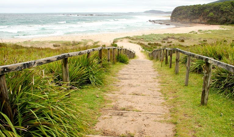
The Pretty Beach to Snake Bay Circuit via Durras Mountain offers a challenging but rewarding 13-kilometer (roundtrip) hike for experienced walkers within Murramarang National Park. This grade 4 circuit is estimated to take approximately 4-5 hours to complete and demands careful planning due to challenging terrain and variable conditions.
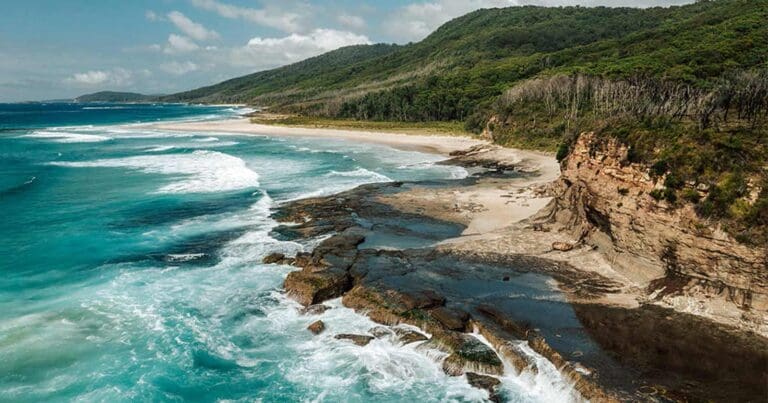
The initial leg from Pretty Beach follows the coastline southward, traversing potentially slippery rock shelves and secluded beaches. These sections are submerged during high tide, so meticulous attention to tidal forecasts and weather conditions is essential. The track is inaccessible during mid to high tide and unsafe in poor weather or during large swells.
Reaching Snake Bay provides a welcome respite. Enjoy a refreshing swim in the crystal-clear waters and savor a picnic lunch on the beach, ensuring your return coincides with the next low tide.
For those seeking a longer adventure, the well-marked Pebbly Beach to Snake Bay walking track connects here. The popular circuit option then continues via Durras Mountain, offering a loop back to Pretty Beach.
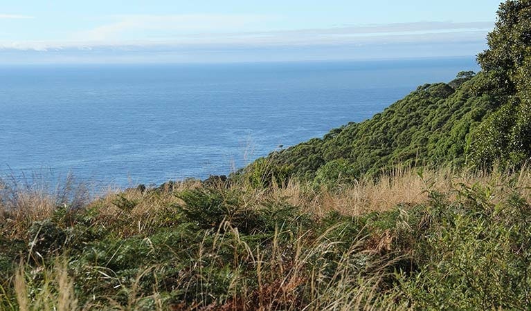
South of Snake Bay, approximately 75 meters from Clear Point, you'll encounter the junction with the Mount Durras track. This section combines the physically demanding yet rewarding climbs of the Pebbly Beach to Durras Mountain and Pretty Beach to Durras Mountain tracks. Allow ample time – 4-5 hours – to complete the entire 13-kilometer loop in either direction.
Gallery
Got some great shots from this hike? Upload your photos here to inspire others and show off the beauty of the trail!
Uploading your photos doesn’t mean you lose ownership. You can be credited for your contributions, and you can request removal at any time.
Content use
Please don’t copy GPX files or content from this site to AllTrails or other platforms. Each trail has been personally mapped, documented, and refined to support Australia’s bushwalking and hiking community. While some details come from land managers, every listing reflects significant personal effort. This is a free, community-driven initiative—your respect helps keep it that way.
Walk map and GPX file
Max elevation: 287 m
Min elevation: 7 m
Total climbing: 526 m
Total descent: -525 m
Getting there
Getting to the trailhead: Murramarang National Park.
Accessible by car, the Pretty Beach to Snake Bay walking track lies within the northern precinct of Murramarang National Park. Travelers can reach the trailhead by turning off the Princes Highway at Termeil. Follow signage directing you towards Bawley Point/Kioloa. After passing Kioloa, continue following signs to Pretty Beach. The route comprises a mix of sealed and unsealed roads, suitable for standard 2WD vehicles in all weather conditions. Convenient parking is available at the Pretty Beach Picnic Area.
Closest towns to this walk: Batemans Bay, Bawley Point, Kioloa, Maloneys Beach, Malua Bay, Milton, Moruya, Narooma, Nelligen, North Durras, Tomakin, Ulladulla
About the region
Murramarang National Park, a nature lover's paradise, stretches along 44 kilometers of dramatic coastline on the NSW south coast, near Batemans Bay. Here, visitors can camp under the shade of spotted gum trees that grow right down to the oceanfront, creating a stunning backdrop for a year-round escape. The park offers a variety of activities. Hike or bike along the trails, explore the cliffs and headlands, or relax on pristine beaches. Take a dip in the ocean, go surfing, or cast a fishing line for your dinner. Keep an eye out for eastern grey kangaroos and the abundant birdlife that call the park home.
The park is particularly famous for the multi-day Murramarang South Coast Walk, a spectacular 3-day adventure for experienced hikers. But there are options for all fitness levels. Explore the Durras Lake discovery trail, perfect for a family outing with children, or rent a canoe to paddle around the calm waters of Durras Lake. Whether you're looking for a day trip or a longer stay, Murramarang National Park has something for everyone. Choose from a variety of camping options, including caravan and motorhome sites with amenities, or book a cabin for a more comfortable stay.
Similar walks nearby
Looking for more walks in or near Murramarang National Park? Try these trails with a similar difficulty grade.
Track grade
Grade 5 (Difficult) - Walks for the Most Experienced: Grade 5 represents the most challenging walking tracks on the AWTGS. These are only recommended for very experienced and fit walkers with specialised skills, including navigation and emergency first aid. Tracks are likely to be very rough, very steep, and unmarked. Walks may be more than 20 kilometers. These challenging walks demand a high level of fitness and experience to navigate difficult terrain, significant elevation changes, and potentially unformed paths.
Explore safe
Plan ahead and hike safely! Carry enough water, pack layers for changing conditions, and bring safety gear like a torch, PLB, and reliable communication device. Check official sources for trail updates, closures, and access requirements, and review local weather and bushfire advice. Most importantly, share your plans with someone before you go. Being prepared makes for a safer and more enjoyable hike! Stay Safe, Explore More, and Always #ExploreSafe.
Packing checklists
What you carry in your pack depends on factors like weather, terrain, and your adventure type. Not sure what to bring? My free planning, food, and packing checklists are a great starting point, covering day hikes, overnight trips, and multi-day adventures. Use them to customise your kit and always prioritise safety.
Let someone know
Before heading out, take a moment to fill out your trip intentions form. It’s a quick way to share your hike details with family or friends. If something goes wrong, they can notify emergency services, ensuring a faster response and peace of mind. Stay safe and enjoy your adventure
Suggest an edit
Spotted a change on this trail? Maybe there are new features, the route has shifted, or the trail is permanently closed. Whatever the update, I’d love your input. Your feedback helps fellow hikers stay informed and ensures that our trail info stays fresh and reliable.
Acknowledgement of Country
Trail Hiking Australia acknowledges the Traditional Owners of the lands on which we hike and pay respects to their Elders, past and present, and we acknowledge the First Nations people of other communities who may be here today.


