Hike at a Glance
Max elevation: 0m
Min elevation: 0m
Total Ascent: 0m
Hike overview
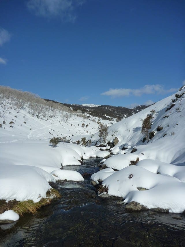
This walk (or mountain bike) follows the Dargals Trail from near the Tooma Reservoir spillway to Paton's Hut. Most of this walk is through tall eucalypt forest before heading down to the edge of the Tooma Plain to find Paton's Hut. The iron hut was originally built in 1934 for grazing and was rebuilt in 2005 after the 2003 fires. The hut provides a great place to camp overnight or just rest before walking back.
Download maps and tracknotes for Paton's Hut hiking track from wildwalks.com.
Gallery
Got some great shots from this hike? Upload your photos here to inspire others and show off the beauty of the trail!
Click to view form >>
Submitting your photos doesn’t mean you lose ownership. You can be credited for your contributions, and you can request removal at any time.
Content use
Please don’t copy GPX files or content from this site to AllTrails or other platforms. Each trail has been personally mapped, documented, and refined to support Australia’s bushwalking and hiking community. While some details come from land managers, every listing reflects significant personal effort. This is a free, community-driven initiative—your respect helps keep it that way.
Walk map and GPX file
It looks like I don’t have a GPX file for this trail yet. If you have one to share, please email it to me! I’ll verify it against official maps before adding it to help other hikers have a safer, easier experience. Thanks for contributing to a better hiking resource.
Getting there
Getting to the trailhead: Kosciuszko National Park.
Closest towns to this walk: Adaminaby, Cabramurra, Cooma, Crackenback, Dalgety, Jindabyne, Khancoban, Perisher Valley, Thredbo, Tumbarumba, Tumut
About the region
Kosciuszko National Park spoils you with snow sports, walks and mountain biking in the Snowy Mountains. Go camping, explore caves, climb Australia's highest mountain, or stay in heritage accommodation. There are 7 areas in this park:
1. Thredbo-Perisher area is your gateway to Mount Kosciuszko. Find NSW's favourite ski resorts, top alpine hikes, mountain bike trails, and endless adventures in the Snowy Mountains.
2. The Lower Snowy River area embraces the wild south of Kosciuszko National Park. Camp by the Snowy River and explore the scenic trails on a walk, bike or horse ride.
3. Khancoban area is the western gateway to Kosciuszko National Park. Discover Geehi and Tom Groggin's camp spots, fishing, and riding. Marvel at the Western Fall views or explore huts and hikes in the Jagungal Wilderness.
4. The Selwyn area is your perfect base to explore the walks, rides, and top fishing spots of central Kosciuszko National Park. Selwyn Snow Resort and historic Kiandra are closed due to severe fire damage.
5. The Yarrangobilly area is a highlight of northern Kosciuszko National Park. Explore jaw-dropping caves on a guided tour and swim in the thermal pool. Stay at historic Caves House and enjoy the walks and wildlife.
6. The Tumut area is your launch pad into northern Kosciuszko National Park. Discover water sports and wildlife at Blowering Reservoir. Camp and explore hidden walks and waterfalls in the foothills of the Snowy Mountains.
7. The High Plains area spoils you with summer walks, horse rides and bike trails to mountain huts, caves, and gorges. Camp, stay in Currango's heritage cottages, and discover Kosciuszko's wild north-east corner.
Similar walks nearby
Looking for more walks in or near Kosciuszko National Park? Try these trails with a similar difficulty grade.
Track grade
Grade 4 (Hard) - Challenging Walks for Experienced Walkers: Grade 4 on the AWTGS signifies challenging walking tracks. Bushwalking experience is recommended for these tracks, which may be long, rough, and very steep. Directional signage may be limited, requiring a good sense of navigation. These walks are suited for experienced walkers who are comfortable with steeper inclines, rougher terrain, and potentially longer distances.
Explore safe
Plan ahead and hike safely! Carry enough water, pack layers for changing conditions, and bring safety gear like a torch, PLB, and reliable communication device. Check official sources for trail updates, closures, and access requirements, and review local weather and bushfire advice. Most importantly, share your plans with someone before you go. Being prepared makes for a safer and more enjoyable hike! Stay Safe, Explore More, and Always #ExploreSafe.
Packing checklists
What you carry in your pack depends on factors like weather, terrain, and your adventure type. Not sure what to bring? My free planning, food, and packing checklists are a great starting point, covering day hikes, overnight trips, and multi-day adventures. Use them to customise your kit and always prioritise safety.
Let someone know
Before heading out, take a moment to fill out your trip intentions form. It’s a quick way to share your hike details with family or friends. If something goes wrong, they can notify emergency services, ensuring a faster response and peace of mind. Stay safe and enjoy your adventure
Suggest an edit
Spotted a change on this trail? Maybe there are new features, the route has shifted, or the trail is permanently closed. Whatever the update, I’d love your input. Your feedback helps fellow hikers stay informed and ensures that our trail info stays fresh and reliable.
Acknowledgement of Country
Trail Hiking Australia acknowledges the Traditional Owners of the lands on which we hike and pay respects to their Elders, past and present, and we acknowledge the First Nations people of other communities who may be here today.


