Hike at a Glance
Max elevation: 0m
Min elevation: 0m
Total Ascent: 0m
Hike overview
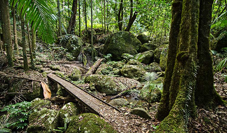
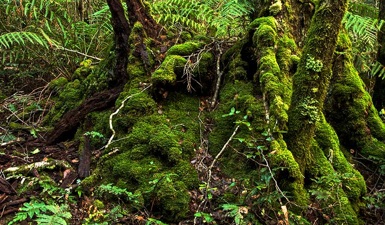
An easy walk through the subtropical rainforest near Sheepstation Creek campground, Palm Forest walking track follows a historic old logging track into the heart of the lush wilderness of Border Ranges National Park. The short track leads through forests of bangalow and piccabeen palms where you'll feel the cool calm of the rainforest descend. The towering brush box in the tall forests that you'll enter, are estimated to be hundreds of years old. If you're into birdwatching, watch for the brightly coloured wompoo fruit-dove or the bell birds with their distinct call.
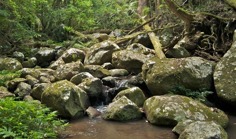
Passing booyong and strangler figs, you'll hear the soothing tinkering of water before arriving at the picturesque Brushbox Falls. Be sure to look for the historic moss-covered carvings, on a sandstone rockface to the north of the creek, where cedar getters carved their names. If the waters are high enough, you can have a refreshing swim in the crystal clear waters and soak in the tranquility.
Take a virtual tour of Palm Forest walking track captured with Google Street View Trekker.
Tips
In order to help protect the delicate balance in the rainforest, ensure you wipe off sunscreen or other chemical creams before you go swimming, they can harm or even kill the local frog communities.
Remember to take your binoculars if you want to bird watch.
Visit NSW National Parks and Wildlife Service for more information on this trail.
The longitude and latitude of the start and end points are approximately only and should not be used for navigation purposes. Please contact me if you know the correct coordinates.
Gallery
Got some great shots from this hike? Upload your photos here to inspire others and show off the beauty of the trail!
Click to view form >>
Submitting your photos doesn’t mean you lose ownership. You can be credited for your contributions, and you can request removal at any time.
Content use
Please don’t copy GPX files or content from this site to AllTrails or other platforms. Each trail has been personally mapped, documented, and refined to support Australia’s bushwalking and hiking community. While some details come from land managers, every listing reflects significant personal effort. This is a free, community-driven initiative—your respect helps keep it that way.
Walk map and GPX file
It looks like I don’t have a GPX file for this trail yet. If you have one to share, please email it to me! I’ll verify it against official maps before adding it to help other hikers have a safer, easier experience. Thanks for contributing to a better hiking resource.
Getting there
Getting to the trailhead: Border Ranges National Park.
Palm Forest walking track is in the Sheepstation Creek precinct of Border Ranges National Park. To get there:From Lismore head north-west and follow signs to Kyogle for approximately 40kmFrom Kyogle, follow the Murwillumbah road for 30km north to Barkers ValeEnter the eastern precinct of the park along the Tweed Range Scenic DriveFollow the signs to Sheepstation Creek campground Road quality Check the weather before you set out as the road to Palm Forest walking track can become boggy when it rains. Parking Parking is available at Sheepstation Creek campground.
Closest towns to this walk: Bonalbo, Kyogle, Lismore, Mount Warning, Murwillumbah, Nimbin, Rathdowney, Richmond Range, Stokers Siding, Tumbulgum, Uki, Woodenbong
About the region
Border Ranges National Park in the North Coast region
Border Ranges National Park is always open but may have to close at times due to poor weather or fire danger.
Similar walks nearby
Looking for more walks in or near Border Ranges National Park? Try these trails with a similar difficulty grade.
Track grade
Grade 3 (Moderate) - Walks for Most Fitness Levels: Grade 3 on the AWTGS represents moderate walking tracks. These are ideal for walkers with some fitness who are comfortable with some hills and uneven terrain. While suitable for most ages, some bushwalking experience is recommended to ensure a safe and enjoyable experience. Tracks may have short, steep hill sections, a rough surface, and many steps. The total distance of a Grade 3 walk can be up to 20 kilometers.
Explore safe
Plan ahead and hike safely! Carry enough water, pack layers for changing conditions, and bring safety gear like a torch, PLB, and reliable communication device. Check official sources for trail updates, closures, and access requirements, and review local weather and bushfire advice. Most importantly, share your plans with someone before you go. Being prepared makes for a safer and more enjoyable hike! Stay Safe, Explore More, and Always #ExploreSafe.
Packing checklists
What you carry in your pack depends on factors like weather, terrain, and your adventure type. Not sure what to bring? My free planning, food, and packing checklists are a great starting point, covering day hikes, overnight trips, and multi-day adventures. Use them to customise your kit and always prioritise safety.
Let someone know
Before heading out, take a moment to fill out your trip intentions form. It’s a quick way to share your hike details with family or friends. If something goes wrong, they can notify emergency services, ensuring a faster response and peace of mind. Stay safe and enjoy your adventure
Suggest an edit
Spotted a change on this trail? Maybe there are new features, the route has shifted, or the trail is permanently closed. Whatever the update, I’d love your input. Your feedback helps fellow hikers stay informed and ensures that our trail info stays fresh and reliable.
Acknowledgement of Country
Trail Hiking Australia acknowledges the Traditional Owners of the lands on which we hike and pay respects to their Elders, past and present, and we acknowledge the First Nations people of other communities who may be here today.


