Hike at a Glance
Max elevation: 0m
Min elevation: 0m
Total Ascent: 0m
Hike overview
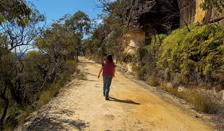
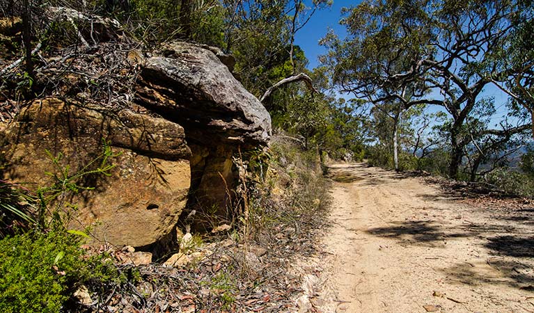
Old Great North Road - World Heritage walk features a historic convict-built, some in chains, road overlooking the Hawkesbury River, in Dharug National Park. Returning via Finchs Line, this moderately steep track is popular with families and history buffs with some bushwalking experience.
Starting on Devines Hill loop, you'll pass the quarry, with historic graffiti carved in the rocks by convicts long gone. You can almost hear the sound of picks striking the blocks and the clinking of leg irons. Marvel at the craftsmanship of the beautifully preserved stonework that includes towering stone buttresses, culverts and even a curved wall. Unpack a picnic along the way and soak up the tranquil bush setting with scenic river views. Round off your day with a night under the stars at Mill Creek campground, only a short drive away.
Download the Convict Road app to learn about the hardships of the convicts who constructed the road. The app features two walks, short films about the convict experience, and expert commentary. Learn more about the World Heritage listing of Old Great North Road.
Take a virtual tour of Old Great North Road - World Heritage walk captured with Google Street View Trekker.
Tips
The weather in this area can be extreme and unpredictable, so please ensure you're well-prepared for your visit.
Bikes need to be walked down Devines Hill and the walking track section of Finchs Line.
Visit NSW National Parks and Wildlife Service for more information on this trail.
The longitude and latitude of the start and end points are approximately only and should not be used for navigation purposes. Please contact me if you know the correct coordinates.
Gallery
Got some great shots from this hike? Upload your photos here to inspire others and show off the beauty of the trail!
Click to view form >>
Submitting your photos doesn’t mean you lose ownership. You can be credited for your contributions, and you can request removal at any time.
Content use
Please don’t copy GPX files or content from this site to AllTrails or other platforms. Each trail has been personally mapped, documented, and refined to support Australia’s bushwalking and hiking community. While some details come from land managers, every listing reflects significant personal effort. This is a free, community-driven initiative—your respect helps keep it that way.
Walk map and GPX file
It looks like I don’t have a GPX file for this trail yet. If you have one to share, please email it to me! I’ll verify it against official maps before adding it to help other hikers have a safer, easier experience. Thanks for contributing to a better hiking resource.
Getting there
Getting to the trailhead: Dharug National Park.
To Devines Hill loop trackhead. Old Great North Road – World Heritage walk starts at Devines Hill, 500m west of Wisemans Ferry, in Dharug National Park. To get there:From GosfordFollow the signs to Wisemans FerryDrive along Wisemans Ferry RoadPass the ferry crossing and drive approximately 500m to the bottom of Devines HillFrom SydneyFollow the signs to Wisemans FerryDriving along Old Northern RoadDrive through the town of Wisemans Ferry and cross the Hawkesbury River on the Wisemans FerryTurn left and drive approximately 500m to the bottom of Devines Hill or alternatively, park on the southern side and take the ferry over on foot. Park entry points Devines Hill loop trackhead See on map Parking Parking is limited near Devines Hill and Finchs Line, especially on weekends. It’s recommended to park at Wisemans Ferry and travel across the ferry as a pedestrian.
Closest towns to this walk: Berowra, Berowra Heights, Bilpin, Cattai, Galston, Glenorie, Grose Vale, Hawkesbury Heights, Hornsby, Kurrajong, Little Hartley, Lower Portland, Maroota, Mount Irvine, Mount Kuring-gai, North Richmond, Richmond, St Albans, Windsor, Wisemans Ferry
About the region
The Dharug National Park is a protected national park that is in the Central Coast region of New South Wales, in eastern Australia. The 14,850-hectare national park is situated approximately 58 kilometres north of the Sydney central business district and 25 kilometres west of Gosford.
Similar walks nearby
Looking for more walks in or near Dharug National Park? Try these trails with a similar difficulty grade.
Track grade
Grade 4 (Hard) - Challenging Walks for Experienced Walkers: Grade 4 on the AWTGS signifies challenging walking tracks. Bushwalking experience is recommended for these tracks, which may be long, rough, and very steep. Directional signage may be limited, requiring a good sense of navigation. These walks are suited for experienced walkers who are comfortable with steeper inclines, rougher terrain, and potentially longer distances.
Explore safe
Plan ahead and hike safely! Carry enough water, pack layers for changing conditions, and bring safety gear like a torch, PLB, and reliable communication device. Check official sources for trail updates, closures, and access requirements, and review local weather and bushfire advice. Most importantly, share your plans with someone before you go. Being prepared makes for a safer and more enjoyable hike! Stay Safe, Explore More, and Always #ExploreSafe.
Packing checklists
What you carry in your pack depends on factors like weather, terrain, and your adventure type. Not sure what to bring? My free planning, food, and packing checklists are a great starting point, covering day hikes, overnight trips, and multi-day adventures. Use them to customise your kit and always prioritise safety.
Let someone know
Before heading out, take a moment to fill out your trip intentions form. It’s a quick way to share your hike details with family or friends. If something goes wrong, they can notify emergency services, ensuring a faster response and peace of mind. Stay safe and enjoy your adventure
Suggest an edit
Spotted a change on this trail? Maybe there are new features, the route has shifted, or the trail is permanently closed. Whatever the update, I’d love your input. Your feedback helps fellow hikers stay informed and ensures that our trail info stays fresh and reliable.
Acknowledgement of Country
Trail Hiking Australia acknowledges the Traditional Owners of the lands on which we hike and pay respects to their Elders, past and present, and we acknowledge the First Nations people of other communities who may be here today.


