Trail Fast Facts
Womerah Range trail is a 48km, grade 4 hike in Parr State Conservation Area, New South Wales. This hike typically takes 2 days to complete.
Hike Overview
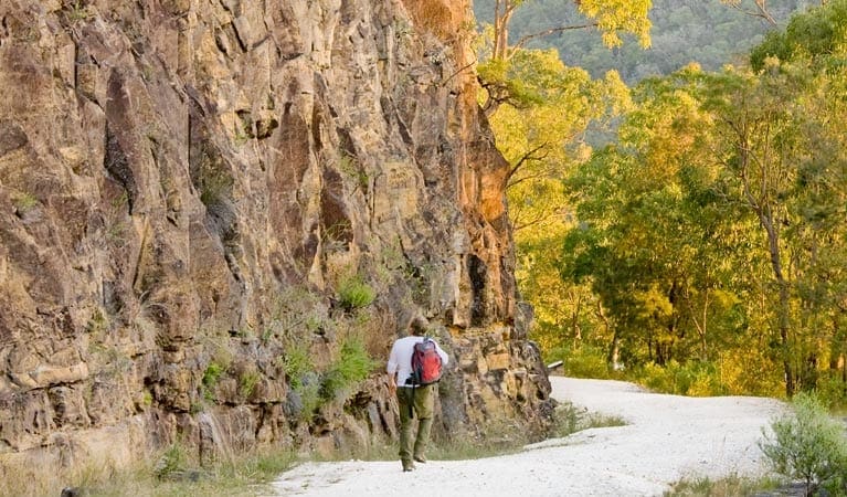
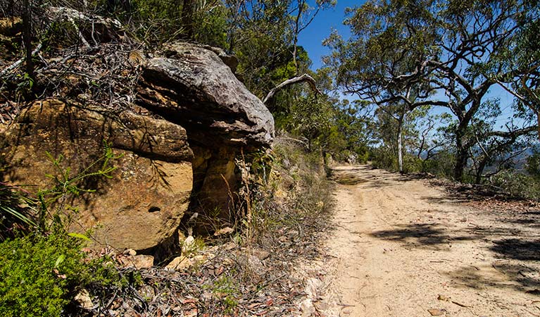
Explore the rugged and remote landscape of Parr State Conservation Area on foot, by mountain bike or in a 4WD along Womerah Range trail. This steep and sometimes sandy track makes for a challenging experience, especially if you're cycling. Enjoy scenic views of cliffs, rocky outcrops and dramatic gorges from this ridgeline track though Hawkesbury sandstone country. Stop for a picnic along the way and gaze out upon McDonald Valley and nearby Yengo National Park.
If you're hiking and want to complete the whole track in two days, why not do a car shuffle and begin at the main entrance off Webbs Creek Road and finish at Parr's western entrance on Putty Road? Otherwise, you could hike in from either entrance, stay overnight at Heartbreak Hill campground then retrace your steps the next day. There are plenty of possibilities.
Track Grade
Grade 4 (Hard) - Challenging Walks for Experienced Walkers: Grade 4 on the AWTGS signifies challenging walking tracks. Bushwalking experience is recommended for these tracks, which may be long, rough, and very steep. Directional signage may be limited, requiring a good sense of navigation. These walks are suited for experienced walkers who are comfortable with steeper inclines, rougher terrain, and potentially longer distances.
Tips
This park is in a remote location, so please ensure you're well-prepared, bring appropriate clothing and equipment and advise a family member or friend of your travel plans.
Drinking water is not available in this park, so it's a good idea to bring your own.
The walking opportunities in this park are suitable for experienced bushwalkers who are comfortable undertaking self-reliant hiking.
There is limited/no mobile reception in this park.
Visit NSW National Parks and Wildlife Service for more information on this trail.
The longitude and latitude of the start and end points are approximately only and should not be used for navigation purposes. Please contact me if you know the correct coordinates.
Map and GPX file
Help fellow hikers navigate with confidence. Share your GPX or KML file for this trail and help build a more comprehensive resource with precise waypoints and elevation profiles. Your contribution will empower adventurers with details they need for a safer and more enjoyable experience. I meticulously verify every file using official maps and surveys, ensuring the highest level of accuracy and reliability. Submit your file now and become a trailblazer for your fellow outdoor enthusiasts.
Trail Location (trailhead)
Sorry, no records were found. Please adjust your search criteria and try again.
Sorry, unable to load the Maps API.
Getting there
To Putty Road. Womerah Range trail is in the northern precinct of Parr State Conservation Area. To get there:From Wisemans Ferry, take the Webbs Creek Ferry and turn right on the other sideFollow St Albans Road for approximately 5kmTurn left in to Webbs Creek Road and continue for approximately 250m up the hillWomerah Range trail begins at the crest on the right hand sideAlternatively, if beginning from Putty Road:From Colo Heights, follow Putty Road northAfter approximately 25km look for the Womerah Range trail on the right Park entry points Putty Road See on map Webbs Creek Road See on map Parking Parking is available at Webbs Creek Road and Putty Road entrances.
Photo gallery
If you have any photos from this hike and are happy to share them, please upload your .jpg files here.
Please note: Uploading photos does not transfer ownership of copyright away from you. If requested, you will be credited for any photos you provide and can ask they be deleted at any time.
About the region
Parr State Conservation Area, in the Hawkesbury region of New South Wales, is a great place for camping, hiking, cycling, guided tours, and 4WD training and touring.
Whether you're a multi-day hiker, keen mountain biker or 4WD fanatic - or aspiring to be one - Parr State Conservation Area is a great place to visit and explore the wilder side of Hawkesbury sandstone country. Womerah Range trail allows you to traverse the area between McDonald Valley and Putty Road and, along the way, enjoy scenic views back across the valley and adjoining Yengo National Park.
Similar trails nearby
Explore Safe
While planning your hike, it’s important to check official government sources for updated information, temporary closures and trail access requirements. Before hitting the trail, check local weather and bushfire advice for planned burns and bushfire warnings and let someone know before you go. Plan ahead and hike safely.
Let someone know
Adventure with peace of mind: Fill out your trip intentions form. Before you hit the trail, fill out an online form to privately send important details about your hike to your family or friends. If you don’t return on time, they can easily alert emergency services, preventing worry and ensuring a swift response. Hike with peace of mind and enjoy your outdoor adventure to the fullest. Be smart, be safe: Register your plans here.
Gear to consider
What you carry in your pack will depend on the weather, terrain, time of year, type of adventure, and personal preferences. Having trouble deciding what gear’s right for you? My free planning, food and packing checklists provide an introduction to things your could consider (as well as the Ten Essentials) on your day, overnight and multi-day adventures. Customise your kit according to your personal needs, always considering safety first.
Suggest an edit
Trail changed? New features discovered? Has the route changed? Trail permanently closed? Help fellow hikers by suggesting edits! Click above to update route descriptions, GPX file, trail features (like boardwalks), or access conditions (like parking availability). Help me keep the trails info fresh!
Weather
Acknowledgement of Country
Trail Hiking Australia acknowledges the Traditional Owners of the lands on which we hike and pay respects to their Elders, past and present, and we acknowledge the First Nations people of other communities who may be here today.


