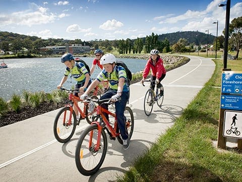
The Natone Hill Circuit Track is a 2.7km, grade 2 hike situated in Geilston Bay, Tasmania, typically requiring about 1.5 hours to complete.
This shaded, mostly flat trail offers scenic views of both water and mountains, making for a delightful approximately 45-minute walk. Tianna Road offers an alternative cycling route, avoiding the uphill climb between the Zig Zag track and Rowitta Rd.
For those seeking a bit more adventure, there's the option to extend the hike to the summit via the Selfs Point View Track, Nubeena St track, or Zig Zag Track. At the top, hikers are rewarded with panoramic views and the opportunity to explore wartime bunkers constructed by army reservists during World War II as part of a training exercise.
Got some great shots from this hike? Upload your photos here to inspire others and show off the beauty of the trail!
Submitting your photos doesn’t mean you lose ownership. You can be credited for your contributions, and you can request removal at any time.
Please don’t copy GPX files or content from this site to AllTrails or other platforms. Each trail has been personally mapped, documented, and refined to support Australia’s bushwalking and hiking community. While some details come from land managers, every listing reflects significant personal effort. This is a free, community-driven initiative—your respect helps keep it that way.
Total distance: 2920 m
Max elevation: 80 m
Min elevation: 40 m
Total climbing: 73 m
Total descent: -73 m
For more information on this trail, visit Greater Hobart Trails
Getting there
Getting to the trailhead: Geilston Bay.
Start at Tianna Rd, Lindisfarne.
Closest towns to this walk: Bellerive, Clarence, Howrah, Lauderdale, Lindisfarne, Montagu Bay, Rokeby, Seven Mile Beach, Tranmere
About the region
Geilston Bay is a suburb of Hobart between Risdon Vale, Shag Bay, and Lindisfarne, in the City of Clarence located on the Eastern Shore of the Derwent River.
Similar walks nearby
Looking for more walks in or near Geilston Bay? Try these trails with a similar difficulty grade.
Favourite

Favourite

Favourite

Favourite

Track grade
Grade 2 (Easy) - A Gentle Introduction to Inclines: Grade 2 on the
AWTGS represents easy walking tracks that offer a slightly more challenging experience compared to Grade 1. Similar to Grade 1, no prior bushwalking experience is required. The track surface is typically hardened or compacted and may have gentle hill sections or occasional steps. The total distance of a Grade 2 walk is typically no greater than 10 kilometers. These walks are still suitable for families with a bit more experience or those seeking a gentle introduction to some inclines.
Explore safe
Plan ahead and hike safely! Carry enough water, pack layers for changing conditions, and bring safety gear like a torch, PLB, and reliable communication device. Check official sources for trail updates, closures, and access requirements, and review local weather and bushfire advice. Most importantly, share your plans with someone before you go. Being prepared makes for a safer and more enjoyable hike! Stay Safe, Explore More, and Always #ExploreSafe.
Packing checklists
What you carry in your pack depends on factors like weather, terrain, and your adventure type. Not sure what to bring? My free planning, food, and packing checklists are a great starting point, covering day hikes, overnight trips, and multi-day adventures. Use them to customise your kit and always prioritise safety.
Let someone know
Before heading out, take a moment to fill out your trip intentions form. It’s a quick way to share your hike details with family or friends. If something goes wrong, they can notify emergency services, ensuring a faster response and peace of mind. Stay safe and enjoy your adventure
Suggest an edit
Spotted a change on this trail? Maybe there are new features, the route has shifted, or the trail is permanently closed. Whatever the update, I’d love your input. Your feedback helps fellow hikers stay informed and ensures that our trail info stays fresh and reliable.


