Hike at a Glance
Max elevation: 0m
Min elevation: 0m
Total Ascent: 0m
Hike overview
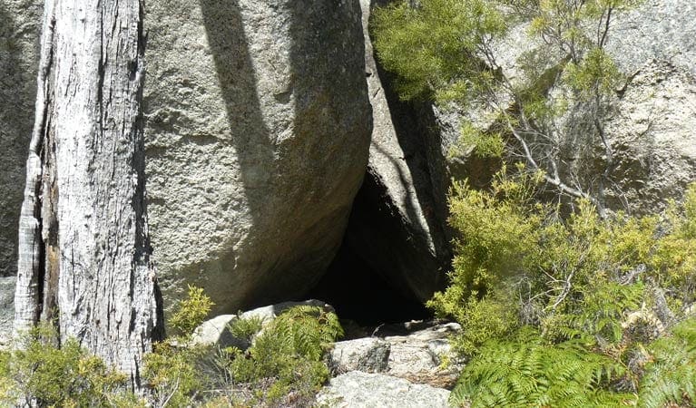
The Mystery Face walking track takes you through open woodland and past remarkable granite rock formations. Awaken your imagination and see what shapes and figures you can see along the way.
The Mystery Face itself will be revealed towards the end of the loop track. Worn over time by erosion or created by humans, we're not sure, but it serves as a fascinating reminder of the ancient Aboriginal heritage of this area.
As you admire the rock formations, keep a look out for small geckos and lizards which are often found in and around the rocky areas during the summer. In spring and summer, you'll be treated to colourful wildflowers of purples and yellows which are scattered throughout the bush.
For those interested in birdwatching there is also plenty of birdlife to see along the way. You might be lucky to spot the brown treecreeper or the bright red-breasted flame robin dotted amongst the trees.
Gallery
Got some great shots from this hike? Upload your photos here to inspire others and show off the beauty of the trail!
Click to view form >>
Submitting your photos doesn’t mean you lose ownership. You can be credited for your contributions, and you can request removal at any time.
Content use
Please don’t copy GPX files or content from this site to AllTrails or other platforms. Each trail has been personally mapped, documented, and refined to support Australia’s bushwalking and hiking community. While some details come from land managers, every listing reflects significant personal effort. This is a free, community-driven initiative—your respect helps keep it that way.
Walk map and GPX file
It looks like I don’t have a GPX file for this trail yet. If you have one to share, please email it to me! I’ll verify it against official maps before adding it to help other hikers have a safer, easier experience. Thanks for contributing to a better hiking resource.
Getting there
Getting to the trailhead: Torrington State Conservation Area.
On entering Torrington State Conservation Area:Follow the Mystery Face signpost and take a right turn at the old pub into Silent Grove RoadDrive for approximately 2.5km to the Butlers Road turnoff on the left, where the road becomes unsealed.Follow Butlers Road and the signposts for about 4.5km Road quality Check the weather before you set out as the road to Mystery Face walking track can become boggy when it rains. Parking Parking is available nearby at the Mystery Face picnic area.
Visit NSW National Parks and Wildlife Service for more information on this trail.
The longitude and latitude of the start and end points are approximately only and should not be used for navigation purposes. Please contact me if you know the correct coordinates.
Closest towns to this walk: Deepwater, Emmaville, Glen Innes, Guyra, Mount Mitchell, Torrington
About the region
Get off the beaten track and experience the serenity of Torrington State Conservation Area. It has dramatic views and granite formations, secluded camping and peaceful picnic spots.
Whether you're a keen bush walker, birdwatcher, fossicker, 4WD enthusiast or just a nature lover who likes to get away from it all, Torrington State Conservation Area has options for pretty much everyone.
Sprawling across the rugged Mole Tableland, the dry forests and woodlands are scattered with scenic rock outcrops and balancing boulders, gorges, swamps and small creeks. From September to March the bush becomes a blaze of colour with spectacular wildflower displays.
Similar walks nearby
Looking for more walks in or near Torrington State Conservation Area? Try these trails with a similar difficulty grade.
Track grade
Grade 3 (Moderate) - Walks for Most Fitness Levels: Grade 3 on the AWTGS represents moderate walking tracks. These are ideal for walkers with some fitness who are comfortable with some hills and uneven terrain. While suitable for most ages, some bushwalking experience is recommended to ensure a safe and enjoyable experience. Tracks may have short, steep hill sections, a rough surface, and many steps. The total distance of a Grade 3 walk can be up to 20 kilometers.
Explore safe
Plan ahead and hike safely! Carry enough water, pack layers for changing conditions, and bring safety gear like a torch, PLB, and reliable communication device. Check official sources for trail updates, closures, and access requirements, and review local weather and bushfire advice. Most importantly, share your plans with someone before you go. Being prepared makes for a safer and more enjoyable hike! Stay Safe, Explore More, and Always #ExploreSafe.
Packing checklists
What you carry in your pack depends on factors like weather, terrain, and your adventure type. Not sure what to bring? My free planning, food, and packing checklists are a great starting point, covering day hikes, overnight trips, and multi-day adventures. Use them to customise your kit and always prioritise safety.
Let someone know
Before heading out, take a moment to fill out your trip intentions form. It’s a quick way to share your hike details with family or friends. If something goes wrong, they can notify emergency services, ensuring a faster response and peace of mind. Stay safe and enjoy your adventure
Suggest an edit
Spotted a change on this trail? Maybe there are new features, the route has shifted, or the trail is permanently closed. Whatever the update, I’d love your input. Your feedback helps fellow hikers stay informed and ensures that our trail info stays fresh and reliable.
Acknowledgement of Country
Trail Hiking Australia acknowledges the Traditional Owners of the lands on which we hike and pay respects to their Elders, past and present, and we acknowledge the First Nations people of other communities who may be here today.


