Hike at a Glance
Max elevation: 469m
Min elevation: 252m
Total Ascent: 289m
Hike overview
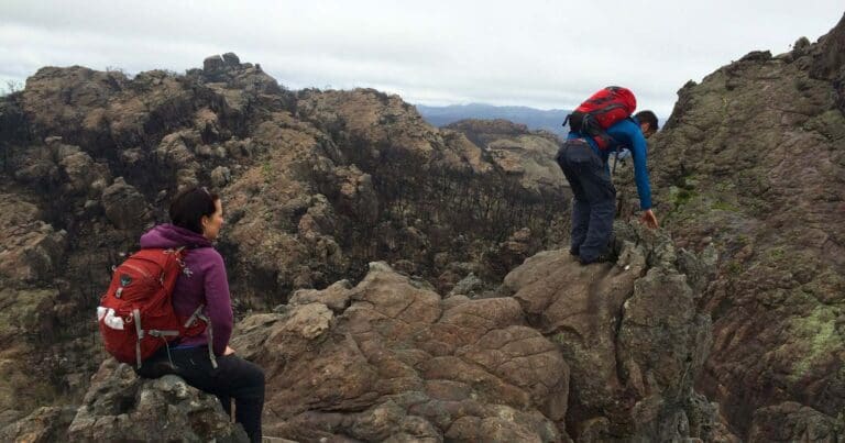
The Mount Stapylton (Gunigalg) Loop Walk is a challenging 4km hike in Grampians National Park, Victoria. This grade 4 trail is suited to experienced hikers with a good level of fitness. Expect the 2-hour circuit to involve water crossings, potentially slippery surfaces, rock hopping, scrambling sections, and unassisted climbs through caves.
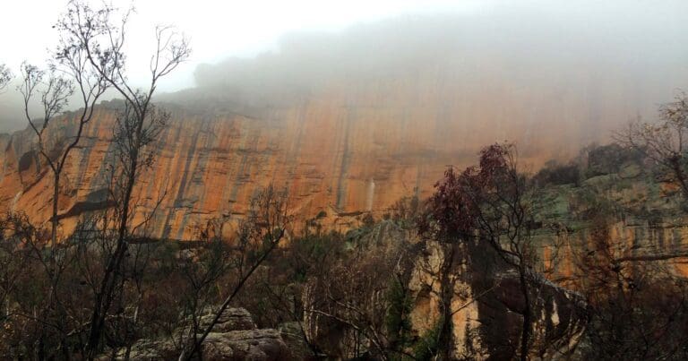
The well-marked track leads you up the steep slope of Flat Rock, rewarding you with a stunning vantage point over a natural amphitheatre. After a brief descent, you'll reach the base of the imposing Taipan Wall. The path then continues its steady climb along terraces until reaching a marked intersection.
The final ascent to the summit requires close attention to signage and markers, with sections involving rock hopping and scrambling past a wind-scoured cave. The effort is rewarded with breathtaking panoramic views encompassing a vast expanse of the Grampians National Park and surrounding plains. Descend via the same route, taking in the scenery once again.
This hike offers a glimpse of diverse landscapes, including iron-stained cliffs, rocky outcrops, densely vegetated gullies, and woodlands rich in banksias, grass trees, native pines, and eucalyptus trees. Be aware that the challenging nature of this trail makes it unsuitable for casual walkers.
Content use
Please don’t copy GPX files or content from this site to AllTrails or other platforms. Each trail has been personally mapped, documented, and refined to support Australia’s bushwalking and hiking community. While some details come from land managers, every listing reflects significant personal effort. This is a free, community-driven initiative—your respect helps keep it that way.
Walk map and GPX file
Max elevation: 469 m
Min elevation: 252 m
Total climbing: 289 m
Total descent: -289 m
Getting there
Getting to the trailhead: Grampians National Park.
From Melbourne, follow the Western Highway through Stawell (235km) to Dadswells Bridge (and the big Koala). Continue on for 10.8km to turn left along Dadswell Bridge Road (signposted for Mount Zero). Follow the sealed road for 3km to turn left on unsealed Flat Rock Road. Drive for 3km to a t-intersection. Turn right on the Mount Zero-Halls Gap Road and follow it or 2.4km to turn left into the Mount Zero Picnic Area.
Closest towns to this walk: Ararat, Cavendish, Dadswells Bridge, Dunkeld, Halls Gap, Horsham, Landsborough, Pomonal, Stawell, Warracknabeal, Wartook, Wartook Valley
About the region
Renowned for rugged mountain ranges, rich cultural heritage and breathtaking scenic views, the 168,000 hectare park is ideal for a wide range of outdoor activities. The many walking tracks will take you on a journey to waterfall views, ancient geological rock features and forests. There are guided tours, and with a large network of roads available, car touring is a great way to explore. Renowned as the major attraction in the region, the Grampians National Park is a must-visit destination for all travellers, backpackers and day-trippers in Victoria. The spectacular setting of the mountainous landscape boasts a wide array of attractions and activities for visitors to the region. The Grampians National Park (also Gariwerd), commonly referred to as The Grampians, is a national park in the Grampians region of Victoria, Australia. The 167,219-hectare (413,210-acre) national park is situated between Stawell and Horsham on the Western Highway and Dunkeld on the Glenelg Highway, 260 kilometres west of Melbourne and 460 kilometres east of Adelaide.
Similar walks nearby
Looking for more walks in or near Grampians National Park? Try these trails with a similar difficulty grade.
Track grade
Grade 4 (Hard) - Challenging Walks for Experienced Walkers: Grade 4 on the AWTGS signifies challenging walking tracks. Bushwalking experience is recommended for these tracks, which may be long, rough, and very steep. Directional signage may be limited, requiring a good sense of navigation. These walks are suited for experienced walkers who are comfortable with steeper inclines, rougher terrain, and potentially longer distances.
Explore safe
Plan ahead and hike safely! Carry enough water, pack layers for changing conditions, and bring safety gear like a torch, PLB, and reliable communication device. Check official sources for trail updates, closures, and access requirements, and review local weather and bushfire advice. Most importantly, share your plans with someone before you go. Being prepared makes for a safer and more enjoyable hike! Stay Safe, Explore More, and Always #ExploreSafe.
Packing checklists
What you carry in your pack depends on factors like weather, terrain, and your adventure type. Not sure what to bring? My free planning, food, and packing checklists are a great starting point, covering day hikes, overnight trips, and multi-day adventures. Use them to customise your kit and always prioritise safety.
Let someone know
Before heading out, take a moment to fill out your trip intentions form. It’s a quick way to share your hike details with family or friends. If something goes wrong, they can notify emergency services, ensuring a faster response and peace of mind. Stay safe and enjoy your adventure
Suggest an edit
Spotted a change on this trail? Maybe there are new features, the route has shifted, or the trail is permanently closed. Whatever the update, I’d love your input. Your feedback helps fellow hikers stay informed and ensures that our trail info stays fresh and reliable.
Acknowledgement of Country
Trail Hiking Australia acknowledges the Traditional Owners of the lands on which we hike and pay respects to their Elders, past and present, and we acknowledge the First Nations people of other communities who may be here today.
/Mount-Stapylton-Walk_2.jpg)
/Mount-Stapylton-Walk_5.jpg)
/Mount-Stapylton-Walk_13.jpg)
/Mount-Stapylton-Walk_11.jpg)
/Mount-Stapylton-Walk_14.jpg)
/Mount-Stapylton-Walk_6.jpg)
/Mount-Stapylton-Walk_10.jpg)
/Mount-Stapylton-Walk_4.jpg)
/Mount-Stapylton-Walk_1.jpg)
/Mount-Stapylton-Walk_3.jpg)
/Mount-Stapylton-Walk_7.jpg)
/Mount-Stapylton-Walk_12.jpg)
/Mount-Stapylton-Walk_9.jpg)
/Mount-Stapylton-Walk_8.jpg)
/Mount-Stapylton-Walk_15.jpg)


7 Reviews on “Mount Stapylton Walk (4km)”
Jenni Kauter
David Sando
Des Shillabeer
Another great walking destination described in Take A Walk in Victoria’s National Parks
This is a great hike for kids or anyone who enjoys a bit of a rock scrambling. My boys loved it.
Great walk.
I thought Mt Stapleton walk was closed at the present?
Or this one Melinda Ignatenko