Hike at a Glance
Max elevation: 1898m
Min elevation: 1608m
Total Ascent: 942m
Important info
The walk to Mount Feathertop along the Razorback is a challenging and rewarding journey that requires careful preparation and respect for the conditions. It is essential for walkers to be fit and equipped, as the weather can change unexpectedly, especially in higher altitudes. The area is known for its rapidly shifting weather patterns, so walkers should be prepared for sudden changes in temperature, rain, or snow. In winter, the terrain becomes even more demanding, and only experienced parties should consider skiing in the area due to the increased risks posed by snow and ice.
Hike overview
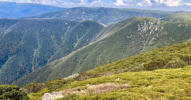
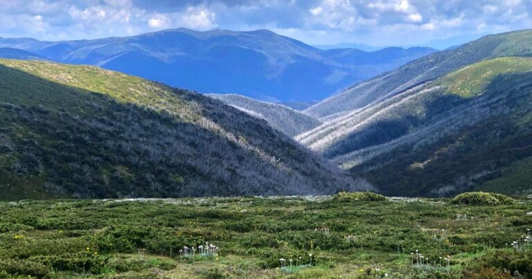
The Mount Feathertop - Razorback hike takes you to the summit of Mount Feathertop, the second highest mountain in Victoria and one of the state’s most striking peaks. The mountain is connected to Mount Hotham by The Razorback, a narrow ridge that offers panoramic views along the way. Unlike many nearby mountains, Mount Feathertop features steep slopes all the way to the summit, giving it a rugged, distinctive profile. Its dramatic appearance, combined with its challenging terrain, makes it one of the most appealing peaks in the Victorian High Country.
The hike is popular in both summer and winter, though it’s important to approach it with respect for the conditions. In summer, it offers fantastic hiking opportunities, while in winter, it transforms into a venue for mountaineering and extreme skiing. However, it’s important to note that the area can be dangerous, particularly in winter. Cornices and rapidly changing weather conditions have led to fatalities, so it’s essential to treat the mountain with caution and be well-prepared.
The Razorback Walking Track begins at Diamantina Hut, located 2.5 km on the Harrietville side of the Hotham Village. The track crosses the exposed high ridge linking Mount Hotham and Mount Feathertop, offering excellent views for most of the hike. The ridge is very exposed, so it is important to avoid crossing it in bad or unsettled weather. The track meets the Bungalow Spur Track at The Cross, about 1.5 km from the summit. From there, the final ascent to the top is steep but rewarding. If you’ve made transport arrangements, you can descend to Harrietville via the Bungalow Spur Track, otherwise, you’ll return along the same route.
The Razorback Walk is one of Victoria’s most iconic hikes, traversing a high alpine ridge to the summit of Mount Feathertop, which at 1922 metres, offers some of the most spectacular views in the state.
Overnight hike for kids
This overnight hike is a great choice for kids, offering a manageable challenge while introducing them to the beauty of the Victorian Alps. The track includes a few steep sections, but they are short and not overly strenuous. Federation Hut, the campsite for the night, is well-equipped with a wood fire and a water tank, providing a comfortable base. There are also several excellent campsites outside the hut, as camping inside is not permitted. For added convenience, a composting toilet is located nearby. This hike provides a wonderful opportunity for kids to experience nature in a safe and accessible way.
Tips
The best map for this hike is the Mount Feathertop - Hotham 1:30,000 2nd edition, published by Rooftop in 2009.
Trail features
- Alpine Region
- Scenic Viewpoints
- Alpine Huts
- Exposed Ledges
- Steep Terrain
- Untreated Water
- Overnight Campsites
Content use
Please don’t copy GPX files or content from this site to AllTrails or other platforms. Each trail has been personally mapped, documented, and refined to support Australia’s bushwalking and hiking community. While some details come from land managers, every listing reflects significant personal effort. This is a free, community-driven initiative—your respect helps keep it that way.
Walk map and GPX file
Max elevation: 1898 m
Min elevation: 1608 m
Total climbing: 942 m
Total descent: -942 m
Getting there
Getting to the trailhead: Alpine National Park.
To reach the trailhead for the Razorback Walking Track, drive to Hotham Village and continue on the Great Alpine Road towards Harrietville. The track begins at Diamantina Hut, which is located 2.5 km on the Harrietville side of the village. From the village, follow the road carefully, and look for the signposting to Diamantina Hut, where the trailhead is situated. It’s advisable to check road conditions, especially in winter, as snow and weather can impact access.
Closest towns to this walk: Benalla, Bright, Dinner Plain, Falls Creek, Harrietville, Hotham Heights, Mansfield, Mitta Mitta, Mount Beauty, Mount Hotham, Myrtleford, Omeo, Porepunkah, Tawonga South, Wangaratta
About the region
Exploring Australia's Alpine National Park
The Alpine National Park offers a range of exciting outdoor activities that cater to all levels of adventure. Located in Victoria, this park is home to some of the state's highest mountain ranges, making it a popular destination for bushwalkers, hikers, and nature lovers. The park’s stunning landscapes are perfect for exploring on foot, on horseback, or even by mountain bike, with plenty of world-class trails to enjoy.
For a truly memorable experience, try the Falls to Hotham Alpine Crossing, which takes you across towering alpine ridgelines and through lush river valleys, all set against breathtaking alpine scenery. If you're looking to learn about the region's history, you can drive along the Wonnangatta Four-wheel Drive route, where you'll uncover the stories of the past while taking in rugged bushland and mountain views. For those keen on a challenge, the Razorback Ridge hike leads to Victoria’s second-highest peak, Mount Feathertop, offering some of the most spectacular views of the Great Dividing Range.
Adventurers can also take on the challenge of climbing Mount Bogong, the highest peak in Victoria, or explore the historic huts scattered across the Bogong High Plains, once home to legendary cattlemen. For a thrill of a different kind, white-water rafting trips on the Mitta Mitta River or skiing across the park’s varied terrain can help you experience the park’s wild side. Whether you prefer downhill runs or cross-country trails, the Alpine National Park offers some of the best ski touring opportunities in the state.
The park is also an important part of the Aboriginal cultural landscape, with traditional Country belonging to the Taungurung and Gunaikurnai Peoples.
Want to find the best trails in Alpine National Park for an adventurous hike, casual walk, or a family trip? Trail Hiking Australia has the best trails for walking, hiking, running, and more.
Similar walks nearby
Looking for more walks in or near Alpine National Park? Try these trails with a similar difficulty grade.
Track grade
Grade 4 (Hard) - Challenging Walks for Experienced Walkers: Grade 4 on the AWTGS signifies challenging walking tracks. Bushwalking experience is recommended for these tracks, which may be long, rough, and very steep. Directional signage may be limited, requiring a good sense of navigation. These walks are suited for experienced walkers who are comfortable with steeper inclines, rougher terrain, and potentially longer distances.
Explore safe
Plan ahead and hike safely! Carry enough water, pack layers for changing conditions, and bring safety gear like a torch, PLB, and reliable communication device. Check official sources for trail updates, closures, and access requirements, and review local weather and bushfire advice. Most importantly, share your plans with someone before you go. Being prepared makes for a safer and more enjoyable hike! Stay Safe, Explore More, and Always #ExploreSafe.
Packing checklists
What you carry in your pack depends on factors like weather, terrain, and your adventure type. Not sure what to bring? My free planning, food, and packing checklists are a great starting point, covering day hikes, overnight trips, and multi-day adventures. Use them to customise your kit and always prioritise safety.
Let someone know
Before heading out, take a moment to fill out your trip intentions form. It’s a quick way to share your hike details with family or friends. If something goes wrong, they can notify emergency services, ensuring a faster response and peace of mind. Stay safe and enjoy your adventure
Suggest an edit
Spotted a change on this trail? Maybe there are new features, the route has shifted, or the trail is permanently closed. Whatever the update, I’d love your input. Your feedback helps fellow hikers stay informed and ensures that our trail info stays fresh and reliable.
Acknowledgement of Country
Trail Hiking Australia acknowledges the Traditional Owners of the lands on which we hike and pay respects to their Elders, past and present, and we acknowledge the First Nations people of other communities who may be here today.
/Mount-Feathertop-The-Razorback-Hike_68.jpg)
/Mount-Feathertop-The-Razorback-Hike_125.jpg)
/Mount-Feathertop-The-Razorback-Hike_164.jpg)
/Mount-Feathertop-The-Razorback-Hike_152.jpg)
/Mount-Feathertop-The-Razorback-Hike_19.jpg)
/Mount-Feathertop-The-Razorback-Hike_147.jpg)
/Mount-Feathertop-The-Razorback-Hike_92.jpg)
/Mount-Feathertop-The-Razorback-Hike_15.jpg)
/Mount-Feathertop-The-Razorback-Hike_117.jpg)
/Mount-Feathertop-The-Razorback-Hike_88.jpg)
/Mount-Feathertop-The-Razorback-Hike_120.jpg)
/Mount-Feathertop-The-Razorback-Hike_56.jpg)
/Mount-Feathertop-The-Razorback-Hike_24.jpg)
/Mount-Feathertop-The-Razorback-Hike_47.jpg)
/Mount-Feathertop-The-Razorback-Hike_82.jpg)


5 Reviews on “Mount Feathertop: The Razorback Hike (22km)”
One of the Vic Alps classics. Have hiked this route many times and it been different on every occasion. Loved doing this as an overnight hike with my two boys when they were 6 and 8 years old.
Better start with upping the hike training Di ??
Maybe the grade is seasonal. More of a 4 in Winter… amazing mountain, to be respected.
Glenn Shaw
Did this hike last week! Still a little snow on Feathertop
Suzie Sharp, Joelene Gordon-Cooke would you do this one? Although there’ll be no cutting open of hands this time pkease Joelene ?
Geoff Murray loved this hike – brilliant!
Rebecca Fogarty?
Such an awesome track! I would rate it an absolutely must do 5/5.