Hike at a Glance
Max elevation: 1898m
Min elevation: 528m
Total Ascent: 2790m
Hike overview
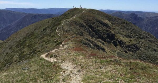
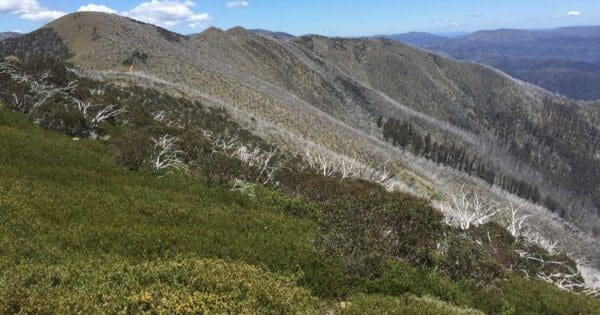
The Mount Feathertop - Bon Accord Spur hike offers a memorable journey to the summit of Mount Feathertop, Victoria’s second-highest and most scenic peak. This distinctive mountain, with its steep slopes reaching directly up to the summit, stands apart from the typically rounded peaks of the surrounding region. Its dramatic ridgelines and rugged terrain attract hikers year-round, with popular routes linking it to the nearby Mount Hotham ski resort via The Razorback—a high, narrow ridge that leads to breathtaking views of the alpine landscape.
The Bon Accord Spur trail, spanning 46 kilometres and graded as 4, was once the primary route for walkers, horse riders, and pack horses to reach Mount Hotham before the construction of the Great Alpine Road. Today, it serves as a challenging yet rewarding multi-day hiking route. Hikers typically complete this trail in two to three days, with the option to camp at Federation Hut, which lies along the Bungalow Spur Track. The hut is a 500-metre detour west from the Razorback Track junction and offers an open camping area with basic toilet facilities, making it an ideal stop for those planning an overnight stay before or after reaching the summit.
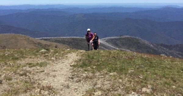
The hike to Mount Feathertop can be rigorous, particularly in winter when conditions become unpredictable and the risk of cornice-related accidents increases. Extra caution is essential, as the mountain has a history of fatalities, primarily in winter. The Bon Accord Spur trail’s steep ascents require stamina and sure footing, especially on the descent. Summer brings its own set of challenges, as the trek is physically demanding even without the added risks of snow and ice, so proper preparation is key.
Water sources are available along the trail, though it’s wise to carry a purification method or enough water for the hike, as conditions may vary. You can collect creek water from Stoney Creek near the lower sections of the trail. Further along, untreated spring water is available at the MUMC Hut and a natural spring can be found between MUMC Hut and the Razorback Track. Federation Hut also has an untreated water tank, as well as another natural spring located along the Bungalow Spur.
For navigation, the Mount Feathertop - Hotham 1:30,000 map (2nd edition, Rooftop, 2009) is considered one of the most accurate and helpful resources for this area. A reliable map is essential, as GPS can be unreliable in adverse weather conditions. This detailed topographic map assists with trail junctions and steep sections, making it a valuable tool for anyone tackling this ambitious but unforgettable journey to Mount Feathertop.
Track grade
Grade 4 (Hard) - Challenging Walks for Experienced Walkers: Grade 4 on the AWTGS signifies challenging walking tracks. Bushwalking experience is recommended for these tracks, which may be long, rough, and very steep. Directional signage may be limited, requiring a good sense of navigation. These walks are suited for experienced walkers who are comfortable with steeper inclines, rougher terrain, and potentially longer distances.
Walk map and GPX file
Max elevation: 1898 m
Min elevation: 528 m
Total climbing: 2790 m
Total descent: -2790 m
Content use
Please don’t copy GPX files or content from this site to AllTrails or other platforms. Each trail has been personally mapped, documented, and refined to support Australia’s bushwalking and hiking community. While some details come from land managers, every listing reflects significant personal effort. This is a free, community-driven initiative—your respect helps keep it that way.
Gallery
Got any photos from this hike? Your photos can help others plan. Share shots from along the trail so fellow hikers know what to expect.
Click to add your photos >>
Getting there
Getting to the trailhead: Alpine National Park.
To reach the Bon Accord Spur trailhead, drive towards Hotham and take the first left after the Snowline Hotel in Harrietville. Continue along the road for 1 kilometre until you reach the signposted start of the walk. From here, follow the Ovens River – East Branch for 5 kilometres, where you’ll encounter a bridge at Washington Creek. The steep climb up the spur begins at this bridge. The Bon Accord Hut ruin is located 9.5 kilometres from the trailhead, and from there, it’s another 2 kilometres to the Razorback, followed by a 0.5-kilometre stretch to the Great Alpine Road.
Need a rental car to get you to the hike? Find one here.
Find a place to stay
Wondering where to stay near this hike? Find accommodation close to the trailhead — hotels, cabins and campgrounds nearby. Click the button to view the interactive map.
Closest towns to this walk: Benalla, Bright, Dinner Plain, Falls Creek, Harrietville, Hotham Heights, Mansfield, Mitta Mitta, Mount Beauty, Mount Hotham, Myrtleford, Omeo, Porepunkah, Tawonga South, Wangaratta
Let someone know
Heading out? Fill in a trip intentions form so someone knows your plans. If things go wrong, they can raise the alarm fast, giving you peace of mind on the trail.
About the region
Exploring Australia's Alpine National Park
The Alpine National Park offers a range of exciting outdoor activities that cater to all levels of adventure. Located in Victoria, this park is home to some of the state's highest mountain ranges, making it a popular destination for bushwalkers, hikers, and nature lovers. The park’s stunning landscapes are perfect for exploring on foot, on horseback, or even by mountain bike, with plenty of world-class trails to enjoy.
For a truly memorable experience, try the Falls to Hotham Alpine Crossing, which takes you across towering alpine ridgelines and through lush river valleys, all set against breathtaking alpine scenery. If you're looking to learn about the region's history, you can drive along the Wonnangatta Four-wheel Drive route, where you'll uncover the stories of the past while taking in rugged bushland and mountain views. For those keen on a challenge, the Razorback Ridge hike leads to Victoria’s second-highest peak, Mount Feathertop, offering some of the most spectacular views of the Great Dividing Range.
Adventurers can also take on the challenge of climbing Mount Bogong, the highest peak in Victoria, or explore the historic huts scattered across the Bogong High Plains, once home to legendary cattlemen. For a thrill of a different kind, white-water rafting trips on the Mitta Mitta River or skiing across the park’s varied terrain can help you experience the park’s wild side. Whether you prefer downhill runs or cross-country trails, the Alpine National Park offers some of the best ski touring opportunities in the state.
The park is also an important part of the Aboriginal cultural landscape, with traditional Country belonging to the Taungurung and Gunaikurnai Peoples.
Want to find the best trails in Alpine National Park for an adventurous hike, casual walk, or a family trip? Trail Hiking Australia has the best trails for walking, hiking, running, and more.
Similar walks nearby
Looking for more walks in or near Alpine National Park? Try these trails with a similar difficulty grade.
Explore safe
Plan ahead and hike safely! Carry enough water, pack layers for changing conditions, and bring safety gear like a torch, PLB, and reliable communication device. Check official sources for trail updates, closures, and access requirements, and review local weather and bushfire advice. Most importantly, share your plans with someone before you go. Being prepared makes for a safer and more enjoyable hike! Stay Safe, Explore More, and Always #ExploreSafe.
Packing checklists
What you carry in your pack depends on factors like weather, terrain, and your adventure type. Not sure what to bring? My free planning, food, and packing checklists are a great starting point, covering day hikes, overnight trips, and multi-day adventures. Use them to customise your kit and always prioritise safety.
Suggest an edit
Notice something different about this trail? Whether it’s a new feature, a route change, or a closure, share your update so we can keep our info accurate and helpful for fellow hikers.
Click to suggest edits >>
Acknowledgement of Country
Trail Hiking Australia acknowledges the Traditional Owners of the lands on which we hike and pay respects to their Elders, past and present, and we acknowledge the First Nations people of other communities who may be here today.


