Hike at a Glance
Max elevation: 1898m
Min elevation: 508m
Total Ascent: 2279m
Hike overview
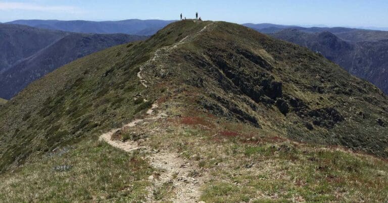
The Mount Feathertop - Bon Accord and Bungalow Spurs hike is a 35km, grade 4 circuit in the Alpine National Park, Victoria, typically taking 2-3 days to complete. This hike offers a varied and scenic route, summiting Mount Feathertop, the second highest peak in Victoria. Known for its striking beauty, Mount Feathertop is connected to the Mount Hotham ski resort by The Razorback, a narrow ridge that cuts across the alpine landscape. The peak itself is surrounded by steep slopes that rise sharply to the summit, unlike the rounded, more gentle domes of nearby mountains. Its rugged terrain provides an exhilarating challenge, especially for those looking to experience the mountain's striking wilderness.
The hike takes in both Bon Accord and Bungalow Spurs, with the Bungalow Spur being the most popular approach. This track is well-graded and offers shelter for most of the way, making it relatively easy to follow. The Bungalow Spur was originally built for pack horses and tractors, which serviced a now-abandoned hotel at the top. At the summit, you’ll find the modern Federation Hut, a spacious and well-insulated building with a stove that can keep you warm through the night. To start the track, head to Harrietville, where you'll turn left off the Great Alpine Road, just before the school bridge over the Ovens River. From there, follow the road for 0.5km to the parking area and notice board.
Along the way, there are several places to camp overnight. The Federation Hut offers a convenient campsite 500m west of the Razorback Track junction, equipped with basic facilities, including toilets. Another small campsite sits along the Bon Accord Spur, around 5km from Harrietville, right by the Ovens River East Branch. This site is small, suitable for 2-3 tents. A further campsite can be found near the Bon Accord Hut ruins, about 2km west of the Razorback Track junction.
Water is readily available for those camping along the trail. There’s a natural spring approximately 500m along the North West Spur Track from Feathertop Track, located on the right-hand side. You can also find water in the river along the Ovens River East Branch, about 5km from Harrietville.
For navigation, the most accurate and helpful map is the Mount Feathertop - Hotham 1:30,000, 2nd edition, by Rooftop, published in 2009. This map will guide you through the terrain, ensuring you stay on track as you explore this stunning part of Victoria’s high country.
Gallery
Got some great shots from this hike? Upload your photos here to inspire others and show off the beauty of the trail!
Click to view form >>
Submitting your photos doesn’t mean you lose ownership. You can be credited for your contributions, and you can request removal at any time.
Content use
Please don’t copy GPX files or content from this site to AllTrails or other platforms. Each trail has been personally mapped, documented, and refined to support Australia’s bushwalking and hiking community. While some details come from land managers, every listing reflects significant personal effort. This is a free, community-driven initiative—your respect helps keep it that way.
Walk map and GPX file
Max elevation: 1898 m
Min elevation: 508 m
Total climbing: 2279 m
Total descent: -2279 m
Getting there
Getting to the trailhead: Alpine National Park.
To reach the trailhead, head to the end of Feathertop Lane in Harrietville. From the Great Alpine Road, turn left just before the school bridge over the Ovens River. Follow Feathertop Lane for about 0.5 km, where you’ll find the parking area and a notice board marking the start of the track.
Closest towns to this walk: Benalla, Bright, Dinner Plain, Falls Creek, Harrietville, Hotham Heights, Mansfield, Mitta Mitta, Mount Beauty, Mount Hotham, Myrtleford, Omeo, Porepunkah, Tawonga South, Wangaratta
About the region
Exploring Australia's Alpine National Park
The Alpine National Park offers a range of exciting outdoor activities that cater to all levels of adventure. Located in Victoria, this park is home to some of the state's highest mountain ranges, making it a popular destination for bushwalkers, hikers, and nature lovers. The park’s stunning landscapes are perfect for exploring on foot, on horseback, or even by mountain bike, with plenty of world-class trails to enjoy.
For a truly memorable experience, try the Falls to Hotham Alpine Crossing, which takes you across towering alpine ridgelines and through lush river valleys, all set against breathtaking alpine scenery. If you're looking to learn about the region's history, you can drive along the Wonnangatta Four-wheel Drive route, where you'll uncover the stories of the past while taking in rugged bushland and mountain views. For those keen on a challenge, the Razorback Ridge hike leads to Victoria’s second-highest peak, Mount Feathertop, offering some of the most spectacular views of the Great Dividing Range.
Adventurers can also take on the challenge of climbing Mount Bogong, the highest peak in Victoria, or explore the historic huts scattered across the Bogong High Plains, once home to legendary cattlemen. For a thrill of a different kind, white-water rafting trips on the Mitta Mitta River or skiing across the park’s varied terrain can help you experience the park’s wild side. Whether you prefer downhill runs or cross-country trails, the Alpine National Park offers some of the best ski touring opportunities in the state.
The park is also an important part of the Aboriginal cultural landscape, with traditional Country belonging to the Taungurung and Gunaikurnai Peoples.
Want to find the best trails in Alpine National Park for an adventurous hike, casual walk, or a family trip? Trail Hiking Australia has the best trails for walking, hiking, running, and more.
Similar walks nearby
Looking for more walks in or near Alpine National Park? Try these trails with a similar difficulty grade.
Track grade
Grade 4 (Hard) - Challenging Walks for Experienced Walkers: Grade 4 on the AWTGS signifies challenging walking tracks. Bushwalking experience is recommended for these tracks, which may be long, rough, and very steep. Directional signage may be limited, requiring a good sense of navigation. These walks are suited for experienced walkers who are comfortable with steeper inclines, rougher terrain, and potentially longer distances.
Explore safe
Plan ahead and hike safely! Carry enough water, pack layers for changing conditions, and bring safety gear like a torch, PLB, and reliable communication device. Check official sources for trail updates, closures, and access requirements, and review local weather and bushfire advice. Most importantly, share your plans with someone before you go. Being prepared makes for a safer and more enjoyable hike! Stay Safe, Explore More, and Always #ExploreSafe.
Packing checklists
What you carry in your pack depends on factors like weather, terrain, and your adventure type. Not sure what to bring? My free planning, food, and packing checklists are a great starting point, covering day hikes, overnight trips, and multi-day adventures. Use them to customise your kit and always prioritise safety.
Let someone know
Before heading out, take a moment to fill out your trip intentions form. It’s a quick way to share your hike details with family or friends. If something goes wrong, they can notify emergency services, ensuring a faster response and peace of mind. Stay safe and enjoy your adventure
Suggest an edit
Spotted a change on this trail? Maybe there are new features, the route has shifted, or the trail is permanently closed. Whatever the update, I’d love your input. Your feedback helps fellow hikers stay informed and ensures that our trail info stays fresh and reliable.
Acknowledgement of Country
Trail Hiking Australia acknowledges the Traditional Owners of the lands on which we hike and pay respects to their Elders, past and present, and we acknowledge the First Nations people of other communities who may be here today.


8 Reviews on “Mount Feathertop: Bon Accord & Bungalow Spurs Hike (35km)”
Done!
We did Bon Accord downhill
It’s treacherous
Doesn’t live up to the meaning of its name…
I was ready to punch anyone who told me it’s easy in the mouth ??
great hike! I have lost count how many times I have done this one!
Hi Sharlene. We are hiking to Mt Feathertop this weekend via Bungalow. What was the water supply like around Federation hut ? Was the water in the springs ?
Cheers !
I did from town bon accord up hill it was very hard . May be l m getting old ).be careful. )
I’m in
Luka Seradi ditto!!! Never enjoyed a beer so much in life as I did after that slog!!!
Just a heads up that some of the signage at the beginning of the trail still marks a camping spot next to the bridge on the Bon Accord, about 5k out from Harrretville, but it has since been washed away.
Mark Read
I hiked Bungalow spur to federation hut, then along the Razorback ridge earlier this year. It was spectacular (even in foggy weather)…
Love it.
Was thinking overnighter 🙂
Would this be okay to complete in a day? Assuming you hiked from early morning and didn’t have heavy packs to slow you down (aside from water and food).