Hike at a Glance
Max elevation: 0m
Min elevation: 0m
Total Ascent: 0m
Hike overview
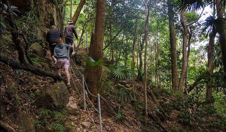
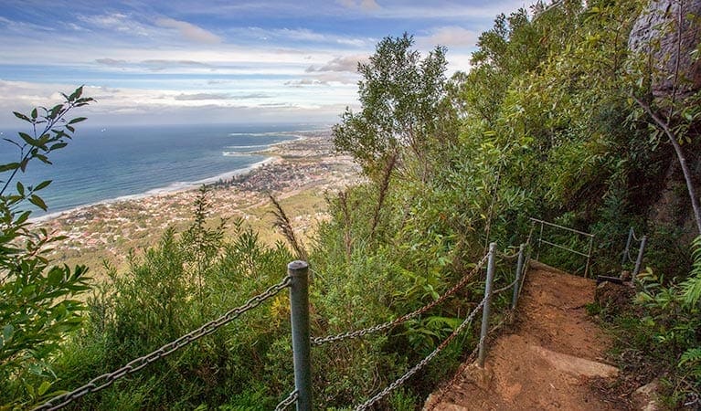
Circling Mount Keira in an engaging loop, the ring track is a terrific setting for a casual hike or an energetic run. Expect to encounter a lush parade of forests and terrain, from cool sub-tropical bush to lofty red cedars and rocky outcrops. Catbirds call in the rainforest as you trace the old route of an early colonial road.
You'll find the track-head by following the trail from the car park to the Girl Guide Camp entrance road. Cross the road, rejoining the trail on the other side. The ring track is just a short distance away.
If you want to make a day of it, pack a picnic. Byarong Park picnic area is a terrific spot to settle down for a relaxing barbecue or an afternoon ball game. Take a virtual tour of Mount Keira Ring track captured with Google Street View Trekker.
Tips
The northern section of this track is closed between Mount Pleasant track up to the stairs leading to Queen Elizabeth Drive.
All areas of the park between Mount Keira Ring track to Mount Keira summit are closed, (except for Dave Walsh track and the rock-climbing area on the western face of Mount Keira).
For your own safety, please don't enter the track if signage on the ground indicates that it's closed.
Visit NSW National Parks and Wildlife Service for more information on this trail.
The longitude and latitude of the start and end points are approximately only and should not be used for navigation purposes. Please contact me if you know the correct coordinates.
Gallery
Got some great shots from this hike? Upload your photos here to inspire others and show off the beauty of the trail!
Click to view form >>
Submitting your photos doesn’t mean you lose ownership. You can be credited for your contributions, and you can request removal at any time.
Content use
Please don’t copy GPX files or content from this site to AllTrails or other platforms. Each trail has been personally mapped, documented, and refined to support Australia’s bushwalking and hiking community. While some details come from land managers, every listing reflects significant personal effort. This is a free, community-driven initiative—your respect helps keep it that way.
Walk map and GPX file
It looks like I don’t have a GPX file for this trail yet. If you have one to share, please email it to me! I’ll verify it against official maps before adding it to help other hikers have a safer, easier experience. Thanks for contributing to a better hiking resource.
Getting there
Getting to the trailhead: Illawarra Escarpment State Conservation Area.
Byarong Park picnic area, where the track begins, is in the Mount Keira precinct of Illawarra Escarpment State Conservation Area. To get there:Heading south on the Southern Freeway from Waterfall towards Wollongong, exit at Figtree.Turn left onto the Princes HighwayAfter 0.5km, turn left again onto Mount Keira Road. It is 3km to Byarong Park. Parking Parking is available at Byarong Park. It can be a busy place on the weekend, so parking might be limited.
Closest towns to this walk: Albion Park, Austinmer, Bulli, Dapto, Helensburgh, Kiama, Shellharbour, Stanwell Park, Thirroul, Wollongong, Woonona
About the region
Illawarra Escarpment State Conservation Area in the South Coast region
Illawarra Escarpment State Conservation Area is always open but may have to close at times due to poor weather or fire danger. However, it is recommended that bushwalking only be undertaken during daylight hours because of the presence of cliff edges and other hazards.
Similar walks nearby
Looking for more walks in or near Illawarra Escarpment State Conservation Area? Try these trails with a similar difficulty grade.
Track grade
Grade 4 (Hard) - Challenging Walks for Experienced Walkers: Grade 4 on the AWTGS signifies challenging walking tracks. Bushwalking experience is recommended for these tracks, which may be long, rough, and very steep. Directional signage may be limited, requiring a good sense of navigation. These walks are suited for experienced walkers who are comfortable with steeper inclines, rougher terrain, and potentially longer distances.
Explore safe
Plan ahead and hike safely! Carry enough water, pack layers for changing conditions, and bring safety gear like a torch, PLB, and reliable communication device. Check official sources for trail updates, closures, and access requirements, and review local weather and bushfire advice. Most importantly, share your plans with someone before you go. Being prepared makes for a safer and more enjoyable hike! Stay Safe, Explore More, and Always #ExploreSafe.
Packing checklists
What you carry in your pack depends on factors like weather, terrain, and your adventure type. Not sure what to bring? My free planning, food, and packing checklists are a great starting point, covering day hikes, overnight trips, and multi-day adventures. Use them to customise your kit and always prioritise safety.
Let someone know
Before heading out, take a moment to fill out your trip intentions form. It’s a quick way to share your hike details with family or friends. If something goes wrong, they can notify emergency services, ensuring a faster response and peace of mind. Stay safe and enjoy your adventure
Suggest an edit
Spotted a change on this trail? Maybe there are new features, the route has shifted, or the trail is permanently closed. Whatever the update, I’d love your input. Your feedback helps fellow hikers stay informed and ensures that our trail info stays fresh and reliable.
Acknowledgement of Country
Trail Hiking Australia acknowledges the Traditional Owners of the lands on which we hike and pay respects to their Elders, past and present, and we acknowledge the First Nations people of other communities who may be here today.


