Hike at a Glance
Max elevation: 581m
Min elevation: 269m
Total Ascent: 729m
Hike overview
This circuit offers a rewarding introduction to Kinglake National Park, bringing together a dramatic waterfall, quiet forest pools and well placed picnic areas. It is the kind of walk that gives a genuine sense of the park’s character without feeling rushed or overwhelming, making it a great option for those wanting a solid half day hike close to Melbourne.
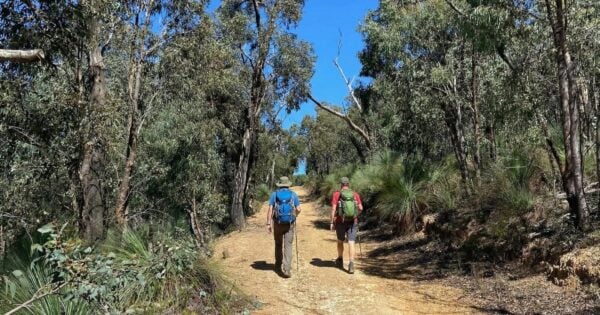
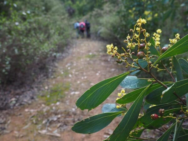
The Masons Falls Circuit is a 16 kilometre, Grade 3 walk in Kinglake National Park, Victoria, and usually takes around four and a half hours to complete. The track passes through regenerating bushland that clearly reflects the impact of the Black Saturday fires, with striking contrasts between areas that were heavily affected and others that appear to have escaped. This mix of recovery and resilience adds depth to the walk and gives a real appreciation of the landscape’s ongoing renewal.
Masons Falls is the standout feature and well worth the visit. The falls plunge from a rocky escarpment and are viewed from a raised platform near the top. While you cannot access the base, the height and setting make it an impressive sight, particularly after good rainfall. At drier times the flow can be modest, but the surrounding forest and rock formations still make it a memorable stop.
Kinglake National Park is the largest national park close to Melbourne and supports a rich diversity of wildlife, including more than 40 native mammal species and around 90 bird species. Keep an eye out along the track, especially in quieter sections where the forest feels more enclosed and alive with birdsong.
This version of the circuit begins at the Masons Falls Picnic Area. From here, follow the clearly marked trail to the falls, which are only a short distance away. After taking in the views, continue on towards Running Creek, where the track follows the water before climbing steeply up Mount Sugarloaf. At the junction with Sugarloaf Ridge Track, a short detour to the summit is worthwhile and makes an excellent spot for a lunch break.
From the summit, retrace your steps to the junction and then descend via Sugarloaf Track towards the lower car park near the park entrance. The loop continues by following Wallaby Track to rejoin the Masons Falls track and return to the picnic area. An alternative option is to take Boundary Track, depending on conditions and personal preference.
As with any waterfall walk, natural hazards can be present, including slippery surfaces and sudden changes in water flow. Take care near creeks and lookouts, and follow water safety advice to ensure your visit to Masons Falls is safe, enjoyable and memorable.
Track grade
Grade 3 (Moderate) - Walks for Most Fitness Levels: Grade 3 on the AWTGS represents moderate walking tracks. These are ideal for walkers with some fitness who are comfortable with some hills and uneven terrain. While suitable for most ages, some bushwalking experience is recommended to ensure a safe and enjoyable experience. Tracks may have short, steep hill sections, a rough surface, and many steps. The total distance of a Grade 3 walk can be up to 20 kilometers.
Walk map and GPX file
Max elevation: 582 m
Min elevation: 267 m
Total climbing: 637 m
Total descent: -637 m
Content use
Please don’t copy GPX files or content from this site to AllTrails or other platforms. Each trail has been personally mapped, documented, and refined to support Australia’s bushwalking and hiking community. While some details come from land managers, every listing reflects significant personal effort. This is a free, community-driven initiative—your respect helps keep it that way.
Getting there
Getting to the trailhead: Kinglake National Park.
The walk can be started from either the main park entrance or from the top of Mount Sugarloaf, depending on how you choose to tackle the circuit. Most walkers begin at the Masons Falls Picnic Area, which provides clear signage and easy access to the track.
From Melbourne, travel to Whittlesea, then follow Yea Road for around 13 kilometres to Kinglake West. Turn right onto Whittlesea–Kinglake Road and continue for about 4 kilometres. From here, turn right onto National Park Road, which is signposted to Masons Falls, and follow it for roughly 4 kilometres to the park entrance. Once inside the park, turn right and continue along the road to reach the Masons Falls Picnic Area, where parking and facilities are available.
Need a rental car to get you to the hike? Find one here.
Find a place to stay
Wondering where to stay near this hike? Find accommodation close to the trailhead — hotels, cabins and campgrounds nearby. Click the button to view the interactive map.
Closest towns to this walk: Flowerdale, Glenburn, Hurstbridge, Kinglake, St Andrews, Whittlesea, Yarra Glen, Yea
Let someone know
Heading out? Fill in a trip intentions form so someone knows your plans. If things go wrong, they can raise the alarm fast, giving you peace of mind on the trail.
About the region
Kinglake National Park sits on the traditional Country of the Taungurung and Wurundjeri Peoples, whose connection to this landscape stretches back thousands of years. Visiting the park offers not only time in nature, but also an opportunity to acknowledge and respect the long history of people who have cared for this country.
Set along the slopes of the Great Dividing Range, Kinglake National Park is an easy drive from Melbourne yet feels a world away once you are among the forested ridgelines. The park is known for its mix of tall eucalypt forest, fern gullies and open ridges, with many walking tracks and picnic areas scattered throughout. On clear days, elevated points within the park offer sweeping outlooks across Melbourne, Port Phillip Bay, the Yarra Valley and even as far as the You Yangs.
Wildlife is a constant presence here, especially birdlife. Sulphur-crested Cockatoos are often heard before they are seen, while patient walkers may spot Superb Lyrebirds scratching through the leaf litter. King Parrots and colourful rosellas are also common, adding movement and colour to the forest. For those who enjoy riding, Bowden Spur is a popular mountain biking destination, with a challenging downhill trail that features rock gardens, dirt jumps, flowing berms and off camber sections that reward confident riders.
Mount Sugarloaf is another highlight and easily reached by car. From the top, the surrounding forest drops away to reveal broad views back towards the city skyline, offering a striking contrast between bushland and suburbia. It is a good place to pause, take photos or enjoy a quiet moment before heading back into the trees.
Picnic and barbecue areas are dotted throughout the park, often set among tall eucalypts that provide welcome shade. Masons Falls is a short walk from its nearby picnic area and is one of the park’s most popular stops. Here, water spills over sheer mudstone walls formed from ancient fossilised sea beds, creating a dramatic drop into the gully below, particularly after rain.
For those wanting to stay longer, The Gums Camping Area offers a peaceful base within tall eucalypt forest beside a gentle mountain stream. It is suitable for tents, caravans and camper trailers, making it a comfortable option for an overnight stay or a relaxed weekend exploring the many tracks and attractions of Kinglake National Park.
Similar walks nearby
Looking for more walks in or near Kinglake National Park? Try these trails with a similar difficulty grade.
Explore safe
Plan ahead and hike safely! Carry enough water, pack layers for changing conditions, and bring safety gear like a torch, PLB, and reliable communication device. Check official sources for trail updates, closures, and access requirements, and review local weather and bushfire advice. Most importantly, share your plans with someone before you go. Being prepared makes for a safer and more enjoyable hike! Stay Safe, Explore More, and Always #ExploreSafe.
Packing checklists
What you carry in your pack depends on factors like weather, terrain, and your adventure type. Not sure what to bring? My free planning, food, and packing checklists are a great starting point, covering day hikes, overnight trips, and multi-day adventures. Use them to customise your kit and always prioritise safety.
Suggest an edit
Notice something different about this trail? Whether it’s a new feature, a route change, or a closure, share your update so we can keep our info accurate and helpful for fellow hikers.
Click to suggest edits >>
Acknowledgement of Country
Trail Hiking Australia acknowledges the Traditional Owners of the lands on which we hike and pay respects to their Elders, past and present, and we acknowledge the First Nations people of other communities who may be here today.
/Masons-Falls-Circuit-Hike_6.jpg)
/Masons-Falls-Circuit-Hike_7.jpg)
/Masons-Falls-Circuit-Hike_12.jpg)
/Masons-Falls-Circuit-Hike_1.jpg)
/Masons-Falls-Circuit-Hike_4.jpg)
/Masons-Falls-Circuit-Hike_11.jpg)
/Masons-Falls-Circuit-Hike_16.jpg)
/Masons-Falls-Circuit-Hike_8.jpg)
/Masons-Falls-Circuit-Hike_13.jpg)
/Masons-Falls-Circuit-Hike_2.jpg)
/Masons-Falls-Circuit-Hike_3.jpg)
/Masons-Falls-Circuit-Hike_14.jpg)
/Masons-Falls-Circuit-Hike_17.jpg)
/Masons-Falls-Circuit-Hike_9.jpg)
/Masons-Falls-Circuit-Hike_15.jpg)


2 Reviews on “Masons Falls Circuit Hike (16km)”
Hiked this with some friends yesterday, absolutely beautiful starting the walk in rain and ending it in beautiful sunshine with a BBQ. Mostly quite mild but a couple of ascents that got us sweating. Shame the peak is a carpark! Still a great walk though, we took it very leisurely and finished in about 5.5 hours.
Helen Panayi This looks good!
I did this hike on 20th January this year and learned a lot about walking in Australia. I am from Scotland and a week earlier was climbing our 10th highest mountain in -ve deg temperatures. The heat really took it out of me. However that said I managed the trail in just under three hours and was amazed at the scenery that I hiked through. There are some tough ascents, especially in the heat but this was a tremendous walk. The path is well marked and trodden so little chance of getting lost and filling you hat with water from the waterfall at the end was amazing and really refreshing
James Harris
Janeta Marton we should do this!!
Joshua Gerrard Atherton this the place you were talking about?
Lara Cowan have you heard of this hike? It sounds good. I’d be keen to do it at some stage ?
Liv Oudemeilink I miss you more xx
Liv Oudemeilink you and me it’s a date!! ¸
Nah, but it’s close
Robert Marcak
Ryan Payne this is a good site. It has some good hikes on it ?
Sally Kenny absolutely! ??
Start racking ’em up!
Tasma Oude Meilink I bloody miss you
Tasma Oude Meilink I need a hiking buddy for this !!!
We walked this last Saturday. Walking in forest most of way on OK vehicle tracks. Sheltered from wind. Bit steep ascending to ridge but nice walk.
What a great little circuit