Hike at a Glance
Max elevation: 1620m
Min elevation: 1183m
Total Ascent: 1530m
Important info
The bushwalk has been graded as a 5 due to the final 7km on the last day, where there are no human-made trails or markers, and the route is a mix of bush and animal trails, making navigation difficult and requiring more advanced skills.
Hike overview
The Long Plain Circuit is a challenging 40km, grade 4-5 bushwalk located in the stunning Kosciuszko National Park, New South Wales. This hike typically takes 4 days to complete and offers adventurers a chance to immerse themselves in the beauty of the Australian Alps. The route takes you through remote bushland, with plenty of opportunities to explore historical sites, enjoy breathtaking views, and spot wild brumbies along the way. Whether you're navigating fire trails, brumby paths, or rugged terrain, the Long Plain Circuit is sure to test your endurance and reward you with unforgettable landscapes.
Day 1: Drive to Cooinbal Hut
Approximately 6 hours from Sydney.
It's best to go via Tumut where you can stock up on some last minute fresh groceries. The best maps are Rules Point 8626-4S and Peppercorn 8626-4N. Camp the first night in the hut.
Day 2: Cooinbal Hut to Blue Waterholes
Approximately 14km | Grade 4 (Hard)
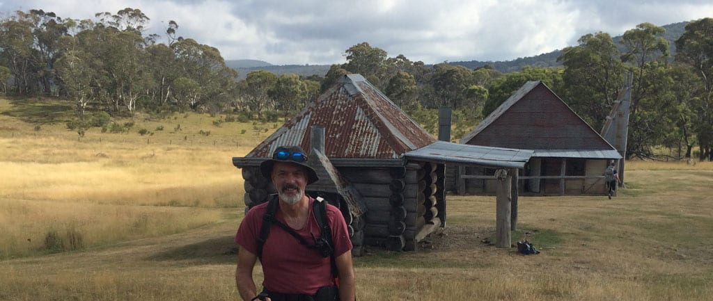
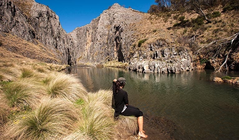
Follow the brumby trails from behind the hut around the wooded hill. Go up over the saddle (463 567) then drop down to Harris Hut. It's only old ruins but a good spot the stop for lunch. From here, you can either follow the fire trail to Blue Waterholes via Bill Jones Hut, or cross the fire trail to the creek. Follow the creek to (509 563), there are a few horse trails, to Murray's Cave. After exploring the caves, it's a short distance to the campground where you can have a wash in the creek, but be warned the water very cold.
Day 3: Blue Waterholes to Pockets Hut
Approximately 6km | Grade 4 (Hard)
From Blue Waterholes to Pockets Hut it's an easy walk along the fire trail, or you could spend the day exploring Coolamine Homestead or downstream to the waterfall (take your crocs and gaiters). Blue Waterholes to Pockets Hut is about 6km. Alternatively to save a day, you could walk directly to Old Currango via Bill Jones Hut, about 13km. Stop at Bill Jones for morning tea and lunch at (513 514)

Day 4: Pockets Hut to Old Currango
Approximately 6km | Grade 4 (Hard)
Best to stay up high around the tree line and avoid the marsh. If you are feeling fit, climb over Howells Peak for some spectacular views. Join the fire trail on the other side and you can almost see Old Currango. There are spectacular views across the plain with wild brumbies.

Day 5: Old Currango to Cooinbal Hut via Skaines Mountain
Approximately 12km | Grade 5 (Difficult) | Requires more advanced navigations skills.
Follow the fire trail back to the junction of the fire trail from Bill Jones/Blue Waterholes. Turn left and walk up hill. When you get to the top (Harrys Gap) you will need to head off trail (475 527) heading NW. Cross the creek at (465 534) and bush bash up Skaines Mountain. Just head uphill. The going is easier on the west side as there are a few brumby trails. This is a good spot for lunch and you may get some mobile reception. Continue NNW back to Cooibal Hut, you will need to take a bearing and follow your compass. The going can be a bit tough at times.
Contributed by Ian Thomas
Cooinbil Hut Campground
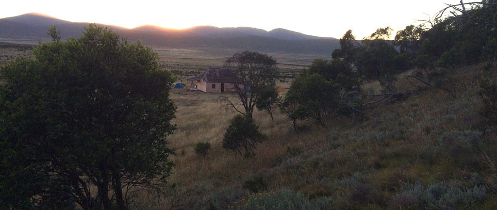
Cooinbil Hut stands as a testament to the life of early pastoralists who once roamed the high plains of Kosciuszko National Park in the early 1900s. Situated on the vast, treeless expanse of Long Plain, with views stretching over the headwaters of the Murrumbidgee River, it offers a peaceful and picturesque setting. Now, the hut is the focal point of Cooinbil Hut campground, which is open to all and serves as a gateway for those wishing to explore the northern reaches of the national park.
The campground offers plenty to keep you occupied. You can take your time exploring the area on foot, enjoying the expansive views and diverse landscape. If you enjoy fishing, the nearby streams provide opportunities to cast a line. For those who prefer a more relaxed experience, setting up a picnic by the river or wandering through the local heritage sites is a perfect way to spend the day. And if you're after something a little more adventurous, pack your mountain bike for a thrilling ride through the surrounding grassy woodlands.
For equestrians, Cooinbil Hut is also a great place to visit, with facilities to accommodate horses and large vehicles. The campground features loading ramps for easy access, and if you're planning a longer stay, you can also head to Ghost Gully campground, which offers additional horse-friendly amenities like portable yards. The high plains landscape here is ideal for horse riding, with wide open spaces to explore.
The area around the campground is characterised by a scattering of snow gums, and in spring, it comes alive with rare wildflowers, including the vibrant monaro golden daisies and the distinctive Australian anchor plant. Birdwatchers will also find plenty to enjoy—gang-gang cockatoos and crimson rosellas are common sights throughout the year, making it worthwhile to bring along a good pair of binoculars for a closer look. Whether you're looking to relax, explore, or seek adventure, Cooinbil Hut campground provides a great base for your next outdoor escape.
Tips
- There is significant walking across tussocks, so wear sturdy boots and gaiters.
- You can cut across from Pockets Hut to Old Currango, but stay high and follow the tree line.
- Climbing Skaines Mountain is difficult and requires good navigation skills, with limited trails. To make it easier, keep to the left side.
Gallery
Got some great shots from this hike? Upload your photos here to inspire others and show off the beauty of the trail!
Click to view form >>
Submitting your photos doesn’t mean you lose ownership. You can be credited for your contributions, and you can request removal at any time.
Content use
Please don’t copy GPX files or content from this site to AllTrails or other platforms. Each trail has been personally mapped, documented, and refined to support Australia’s bushwalking and hiking community. While some details come from land managers, every listing reflects significant personal effort. This is a free, community-driven initiative—your respect helps keep it that way.
Walk map and GPX file
Max elevation: 1620 m
Min elevation: 1183 m
Total climbing: 1530 m
Total descent: -1502 m
Getting there
Getting to the trailhead: Kosciuszko National Park.
To reach Cooinbal Hut, drive approximately 6 hours from Sydney, taking the route via Gundagai and Tumut. It’s recommended to stop in Tumut to pick up any last-minute groceries before heading into the more remote areas. For the best navigation, use the Rules Point 8626-4S and Peppercorn 8626-4N maps. Once you arrive, set up camp and spend your first night at the hut, ready to begin your hike the following day.
Closest towns to this walk: Adaminaby, Cabramurra, Cooma, Crackenback, Dalgety, Jindabyne, Khancoban, Perisher Valley, Thredbo, Tumbarumba, Tumut
About the region
Kosciuszko National Park spoils you with snow sports, walks and mountain biking in the Snowy Mountains. Go camping, explore caves, climb Australia's highest mountain, or stay in heritage accommodation. There are 7 areas in this park:
1. Thredbo-Perisher area is your gateway to Mount Kosciuszko. Find NSW's favourite ski resorts, top alpine hikes, mountain bike trails, and endless adventures in the Snowy Mountains.
2. The Lower Snowy River area embraces the wild south of Kosciuszko National Park. Camp by the Snowy River and explore the scenic trails on a walk, bike or horse ride.
3. Khancoban area is the western gateway to Kosciuszko National Park. Discover Geehi and Tom Groggin's camp spots, fishing, and riding. Marvel at the Western Fall views or explore huts and hikes in the Jagungal Wilderness.
4. The Selwyn area is your perfect base to explore the walks, rides, and top fishing spots of central Kosciuszko National Park. Selwyn Snow Resort and historic Kiandra are closed due to severe fire damage.
5. The Yarrangobilly area is a highlight of northern Kosciuszko National Park. Explore jaw-dropping caves on a guided tour and swim in the thermal pool. Stay at historic Caves House and enjoy the walks and wildlife.
6. The Tumut area is your launch pad into northern Kosciuszko National Park. Discover water sports and wildlife at Blowering Reservoir. Camp and explore hidden walks and waterfalls in the foothills of the Snowy Mountains.
7. The High Plains area spoils you with summer walks, horse rides and bike trails to mountain huts, caves, and gorges. Camp, stay in Currango's heritage cottages, and discover Kosciuszko's wild north-east corner.
Similar walks nearby
Looking for more walks in or near Kosciuszko National Park? Try these trails with a similar difficulty grade.
Track grade
Grade 5 (Difficult) - Walks for the Most Experienced: Grade 5 represents the most challenging walking tracks on the AWTGS. These are only recommended for very experienced and fit walkers with specialised skills, including navigation and emergency first aid. Tracks are likely to be very rough, very steep, and unmarked. Walks may be more than 20 kilometers. These challenging walks demand a high level of fitness and experience to navigate difficult terrain, significant elevation changes, and potentially unformed paths.
Explore safe
Plan ahead and hike safely! Carry enough water, pack layers for changing conditions, and bring safety gear like a torch, PLB, and reliable communication device. Check official sources for trail updates, closures, and access requirements, and review local weather and bushfire advice. Most importantly, share your plans with someone before you go. Being prepared makes for a safer and more enjoyable hike! Stay Safe, Explore More, and Always #ExploreSafe.
Packing checklists
What you carry in your pack depends on factors like weather, terrain, and your adventure type. Not sure what to bring? My free planning, food, and packing checklists are a great starting point, covering day hikes, overnight trips, and multi-day adventures. Use them to customise your kit and always prioritise safety.
Let someone know
Before heading out, take a moment to fill out your trip intentions form. It’s a quick way to share your hike details with family or friends. If something goes wrong, they can notify emergency services, ensuring a faster response and peace of mind. Stay safe and enjoy your adventure
Suggest an edit
Spotted a change on this trail? Maybe there are new features, the route has shifted, or the trail is permanently closed. Whatever the update, I’d love your input. Your feedback helps fellow hikers stay informed and ensures that our trail info stays fresh and reliable.
Acknowledgement of Country
Trail Hiking Australia acknowledges the Traditional Owners of the lands on which we hike and pay respects to their Elders, past and present, and we acknowledge the First Nations people of other communities who may be here today.


1 Review on “Long Plain Circuit Hike (40km)”
This is a beautiful few days in the high plains. Done in early autumn, it’s warm but not scorching, with great landmarks along the way – the caves on Nichols Gorge walk are a welcome respite from the sun. Plenty of natural water around even at the end of summer (obviously treat your water before drinking). Recommend picking up water about 900 metres before Old Currango homestead if it’s dry, as the last couple of creeks were low.
I seriously endorse the recommendation to wear proper gaiters, there is a *lot* of bush bashing and walking through high grass. The gpx file does a pretty good job of leading you along brumby and wombat trails, but those trails are only going to deteriorate in coming years, with fewer brumbies walking the tracks. Consider taking relatively strong trousers: my knees got cut up pretty well on Skaine’s.
Thanks for contributing this circuit, Ian!
Thanks so much for your feedback Frank. Glad you had a couple of great days in the high plains. Great comments and recommendations too. Very much appreciated. Quick question, with all the off-trail sections, do you feel that a Grade 4 rating is accurate?
Hi Darren, everything up to Old Currango is grade 4: it’s either on marked trails or open plains where you can pretty comfortably follow brumby trails. The last 7 or so km on the final day is grade 5. Once you turn off the fire trail there are no human-made trails, no markers. In that last 7 km it’s probably 50% animal trails, 50% pure bush.
Thanks so much Frank. I will update the overall grade to 5 and then mention on the other days that they are grade 4. The AWTGS requires a track to be graded to the most challenging aspect. Really appreciated.