Hike at a Glance
Max elevation: 1639m
Min elevation: 871m
Total Ascent: 1329m
Hike overview
Lake Tali Karng is a hidden jewel nestled deep in the mountains of Gippsland, fed by snowmelt waters of the Wellington Plains. The lake is believed to have been formed about 1500 years ago when a massive rock slide collapsed into the valley damming the waters of Nigothoruk Creek above Wellington River. The water runs underground from the lake to emerge as the infant Wellington River 150m below in the Valley of Destruction.
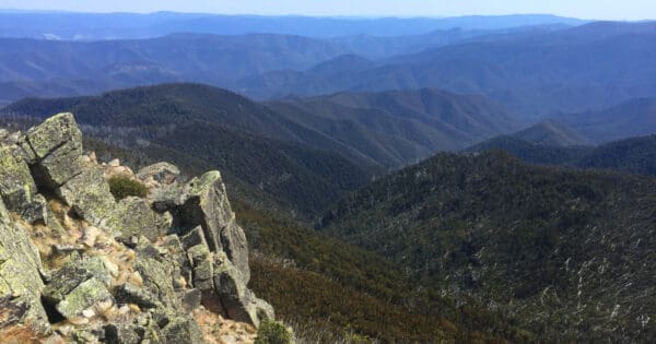
The views and landscape of Tali Karng and its surrounds are so magnificent it is easy to appreciate its special cultural significance. With a depth of up to 50 metres and fed by the Snowden and Nigothoruk Creeks and by the melted snow that runs off the Wellington Plains, the water in the lake is very cold.
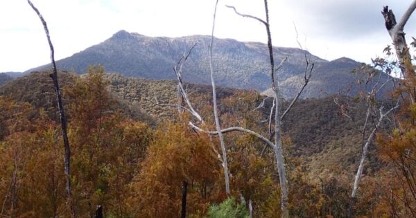
Day 1: The easiest route to Lake Tali Karng begins at McFarlane Saddle Carpark on the Moroka Road, 60 km from Licola. The walk follows the well defined Wellington Plains Walking Track across Wellington Plains for approximately 6km to Moroka Gap. Here you can drop your packs and take a short 4km return walk to the summit of Mount Wellington.
After returning to Moroka Gap, continue along the Wellington Plains Walking Track as it slowly descends south-west towards Nyimba Camp. Make camp at Nyimba Camp near the southern end of the Wellington Plains Walking Track. Nyimba Camp has toilets and fireplaces.
To access Lake Tali Karng, follow Millers Hut Track west from Nyimba Camp, turning south onto Gillios track after approximately 500m. The track then descends rather steeply towards Lake Tali Karng. Tali Karng is the only natural lake within the Victorian Alps. Held behind a rock barrier created thousands of years ago, the underground stream it feeds emerges at the infant Wellington River 150m below in the Valley of Destruction.
Day 2: From Lake Tali Karng, you will need to locate Echo Point Track on the north-west side of the lake. The track steeply ascends away from the lake for approximately 1km before reaching the junction of Riggall Spur Track. Turn right (north-east) and follow this track for approximately 3.5km to the junction of Millers Hut Track. From here, you can either retrace your steps from day 1 and follow the Wellington Plains Walking Track back to the trailhead or head north (then north-east) along the Spion Kopje Walking Track.
After approximately 8km, the Spion Kopje Walking Track will rejoin the Wellington Plains Walking Track which will lead you back to the trailhead.
Traditional Owners
The first occupiers of this area were the Gunaikurnai people, most likely member of the Brayakaulung clan. Aboriginal people guided many European explorers and gold miners through the mountains along well used pathways, which eventually formed some of today’s road and track network. Tali Karng is a sacred place to the Gunaikurnai and in keeping with their law, Aboriginal people are forbidden to go there. Aboriginal people do not oppose non-indigenous people visiting Tali Karng as long as they treat the area with respect. Camping at the lake is disrespectful to Aboriginal people, so please treat the area with care as you pass by the lake and camp elsewhere.
Respecting the Culture
The Gunaikurnai people welcome respectful visitors to Tali Karng. Camping at the lake is disrespectful, similar to camping in a cathedral. Please treat the area with care as you visit. Campgrounds are available nearby, as detailed in the "Camping and Facilities" section below.
Camping and Facilities
Walkers should respect the Gunaikurnai people by not camping at the lake itself. Nyimba Camp is the recommended campsite above the lake at the southern end of the Wellington Plains. Below the lake, there are numerous informal campsites at the base of the Valley of Destruction and along the Wellington River. It's a reasonable walk from Nyimba Camp to Tali Karng and back without heavy packs.
Tali Karng is a fuel stove only area. Campfires are not permitted within a 1km radius of the lake. Fires are allowed within fireplaces at Nyimba campsite (near Riggall Old Hut site) and at designated fireplaces along the Wellington River. Always supervise fires and extinguish them completely with water before leaving.
Firewood supplies are limited, especially in the alpine areas. Camping stoves are preferred. There are no toilet facilities at the lake or nearby campgrounds. Nigothoruk Creek is a nearby water source, but always treat all water before consumption.
Planning Your Trip
The best time to visit is November through to April. Always carry and know how to use a map and compass, as weather conditions can change rapidly in alpine areas. Snow can fall any time of year, and water can be scarce. Be prepared with:
- Warm clothing
- Wind and waterproof jacket
- Gloves, hat, sunglasses, and sturdy footwear
- First-aid kit and sunscreen
- Plenty of food and water
- Compass and topographical map
Before you go, inform someone of your trip itinerary and expected return date. Keep your group size small (4-8 people) and register your trip in the intentions book at the trailhead. Larger groups must register with Parks Victoria's Heyfield office by calling 13 1963.
Trail features
- Trail Running
- Alpine Region
- Lakes
- Rivers
- Scenic Viewpoints
- Exposed Ledges
- Rock Scrambling
- Steep Terrain
- River Crossings
- Untreated Water
- Overnight Campsites
Track grade
Grade 4 (Hard) - Challenging Walks for Experienced Walkers: Grade 4 on the AWTGS signifies challenging walking tracks. Bushwalking experience is recommended for these tracks, which may be long, rough, and very steep. Directional signage may be limited, requiring a good sense of navigation. These walks are suited for experienced walkers who are comfortable with steeper inclines, rougher terrain, and potentially longer distances.
Walk map and GPX file
Max elevation: 1639 m
Min elevation: 871 m
Total climbing: 1329 m
Total descent: -1329 m
Content use
Please don’t copy GPX files or content from this site to AllTrails or other platforms. Each trail has been personally mapped, documented, and refined to support Australia’s bushwalking and hiking community. While some details come from land managers, every listing reflects significant personal effort. This is a free, community-driven initiative—your respect helps keep it that way.
Getting there
Getting to the trailhead: Alpine National Park.
Starting at McFarlane’s Saddle on the Moroka Rd, the walk across the Wellington Plain to Nyimba Camp and Riggall Old Hut site is approximately 9km on a gentle gradient. Walkers with 4WD vehicles may choose to start their walk at Millers Hut. From Millers Hut it is approximately one hour walk to Nyimba Camp. From Nyimba Camp to Tali Karng via Gillios Track is about 4.5km with a descent of almost 600m and will take the average walker about two hours with light packs (allow 2.5 – 3 hours for the return walk uphill, climbing almost 600m).
Riggall Spur Track and Echo Point Track provide an alternative route between Nyimba Camp and Tali Karng. The distance is a little longer but on a slightly easier grade.
The route to Tali Karng from the south leaves the Tamboritha Road and follows the Wellington River Walking Track then either Clive Lanigan Track (through Valley of Destruction) or via Riggall Spur Track and Echo Point Track to the lake. This route includes some 16 river crossings so use care and do not attempt to cross if river levels are high following recent rain.
The difficult route to Tali Karng via Mount Margaret is unmaintained and poorly defined for much of its length between Tamboritha Road and Dolodrook River. Remote navigation skills are required and thick vegetation makes progress slow. From the Dolodrook River it follows a 4WD track past the Chromite Mine then Brandy Pinch Track to join the Clive Lanigan Walking Track below the Valley of Destruction.
Horse riders can use Wellington Plains, Millers Hut, Riggall Spur and Echo Point Tracks. Horses are not permitted within 200m of the Lake and a horse-yard is provided on Echo Point Track. Horses are not permitted on the Clive Lanigan or Gillios Walking Tracks and Wellington River Walking Track is currently unsuitable for horses.
Need a rental car to get you to the hike? Find one here.
Find a place to stay
Wondering where to stay near this hike? Find accommodation close to the trailhead — hotels, cabins and campgrounds nearby. Click the button to view the interactive map.
Closest towns to this walk: Benalla, Bright, Dinner Plain, Falls Creek, Harrietville, Hotham Heights, Mansfield, Mitta Mitta, Mount Beauty, Mount Hotham, Myrtleford, Omeo, Porepunkah, Tawonga South, Wangaratta
Let someone know
Heading out? Fill in a trip intentions form so someone knows your plans. If things go wrong, they can raise the alarm fast, giving you peace of mind on the trail.
About the region
The Alpine National Park is a national park in the Central Highlands and Alpine regions of Victoria, Australia. The 646,000-hectare national park is located northeast of Melbourne. It is the largest National Park in Victoria, and covers much of the higher areas of the Great Dividing Range in Victoria, including Victoria's highest point, Mount Bogong at 1,986 metres and the associated subalpine woodland and grassland of the Bogong High Plains. The park's north-eastern boundary is along the border with New South Wales, where it abuts the Kosciuszko National Park.
The Alpine National Park is an adventure-lover’s dream. Hike Victoria’s highest mountain ranges, explore wildflower draped landscapes on horseback or head out on world-class mountain bike trails. Run wild rapids on white-water rafting trips, four-wheel drive the secluded reaches of the park or cross-country ski through tangled snow gum forests.
Similar walks nearby
Looking for more walks in or near Alpine National Park? Try these trails with a similar difficulty grade.
Explore safe
Plan ahead and hike safely! Carry enough water, pack layers for changing conditions, and bring safety gear like a torch, PLB, and reliable communication device. Check official sources for trail updates, closures, and access requirements, and review local weather and bushfire advice. Most importantly, share your plans with someone before you go. Being prepared makes for a safer and more enjoyable hike! Stay Safe, Explore More, and Always #ExploreSafe.
Packing checklists
What you carry in your pack depends on factors like weather, terrain, and your adventure type. Not sure what to bring? My free planning, food, and packing checklists are a great starting point, covering day hikes, overnight trips, and multi-day adventures. Use them to customise your kit and always prioritise safety.
Suggest an edit
Notice something different about this trail? Whether it’s a new feature, a route change, or a closure, share your update so we can keep our info accurate and helpful for fellow hikers.
Click to suggest edits >>
Acknowledgement of Country
Trail Hiking Australia acknowledges the Traditional Owners of the lands on which we hike and pay respects to their Elders, past and present, and we acknowledge the First Nations people of other communities who may be here today.
/Lake-Tali-Karng-Hidden-Lake-Circuit-Hike_33.jpg)
/Lake-Tali-Karng-Hidden-Lake-Circuit-Hike_23.jpg)
/Lake-Tali-Karng-Hidden-Lake-Circuit-Hike_55.jpg)
/Lake-Tali-Karng-Hidden-Lake-Circuit-Hike_35.jpg)
/Lake-Tali-Karng-Hidden-Lake-Circuit-Hike_13.jpg)
/Lake-Tali-Karng-Hidden-Lake-Circuit-Hike_53.jpg)
/Lake-Tali-Karng-Hidden-Lake-Circuit-Hike_30.jpg)
/Lake-Tali-Karng-Hidden-Lake-Circuit-Hike_1.jpg)
/Lake-Tali-Karng-Hidden-Lake-Circuit-Hike_54.jpg)
/Lake-Tali-Karng-Hidden-Lake-Circuit-Hike_45.jpg)
/Lake-Tali-Karng-Hidden-Lake-Circuit-Hike_26.jpg)
/Lake-Tali-Karng-Hidden-Lake-Circuit-Hike_61.jpg)
/Lake-Tali-Karng-Hidden-Lake-Circuit-Hike_6.jpg)
/Lake-Tali-Karng-Hidden-Lake-Circuit-Hike_58.jpg)
/Lake-Tali-Karng-Hidden-Lake-Circuit-Hike_7.jpg)


2 Reviews on “Lake Tali Karng: Hidden Lake Circuit Hike (31km)”
June 2025
Path taken, McFarlane to nyimba, to lake Tali Karng, and retraced steps to McFarlane.
Recent snow coverage. Trail still relatively frequently used with footprints in snow from day before. Spion Kopje section per GPX doesn’t seem to be used anymore. First orange marker from the riggal spur track (to spion) was pointed to the ground. Found the second orange marker but area seemed really overgrown.
Unfortunately some 4×4’s were in the beginning of the hiking only section which chewed up heaps of the track.
Great track, plains are lovely.
Thanks for sharing your trip update — really helpful! Sounds like a stunning hike with a good dusting of snow to add to the atmosphere. It’s a shame to hear about the 4WD damage at the start of the hiking-only section — that’s always frustrating to come across. Appreciate the note on the Spion Kopje section too; sounds like it’s becoming less trafficked and an even more overgrown. Hopefully Parks Vic can take a look at those trail markers soon. Great to hear you still enjoyed the plains — such a beautiful part of the world!
Fantastic overnight hike. Tough and steep with limited water. We were fortunate we had plenty with us and managed to find a bit running in the creek.
Thanks for the comment — glad to hear you had a great hike! It’s definitely a tough one with those steep sections and limited water access, so great call being well prepared. Good to know there was at least a bit of flow in the creek. Always a rewarding adventure when it all comes together!
We did it as 2 day hike, Macfarlane’s to Wellington river. Pretty tough going along the steep section down to the lake. Day 2 heading to Wellington river was difficult at first, the trail went parallel to Barrier creek for a good distance, but never came close. Just a series of hills and valleys crossing dry creek beds. Once it started crossing the river, it was much more scenic and pleasant. BTW, the road was rough but fine for our Camry. The biggest challenge was moving to the side to avoid 4×4’s who own the road, and don’t want to move the side in case they hit some rough bits!
Thanks so much for sharing your experience — and apologies for the very delayed reply! Really valuable insight, especially about that tough descent to the lake and the challenging terrain near Barrier Creek. It’s definitely a rugged area that can surprise people with how demanding it is. Great to hear it became more scenic once the river crossings started — always a rewarding shift. Also appreciate the Camry update! Good to know it’s doable in a 2WD with care (and a bit of patience around 4WD traffic). Hope the hike left you with some lasting memories!
Did this hike over 2 days. Started on the 1st March 2021.
From the trail start to Nyimba camp sight is pretty easy. trail is slightly overgrown and a few downed trees in a couple spots. But pretty easy to navigate. The camp sight has had a fire recently so the toilet facilities are no longer there.
From the camp to the lake, watch out for spider webs across the path. We descended down to the lake via Gillos track. It gets very steep towards the lake!
Riggal Spur track was our way out, its an old 4wd track with some large fallen trees in spots and rather overgrown too. It is steep in some sections, but not as steep as the decent to the lake. Its a longer walk but possibly a gentler way out.
Very Nice lake. Take plenty of water and be prepared for the hike out.
Thanks for sharing such a helpful trip report! Your notes about the overgrowth, downed trees, and especially that steep descent via Gillos Track are spot on — it’s definitely a challenging section. Riggal Spur is a solid way out, especially for those wanting a slightly less intense climb (even if it’s longer). Also worth highlighting for others: as you mentioned, the toilets at Nyimba Camp were destroyed in a fire and still haven’t been rebuilt, so be prepared for that. And yes — bringing plenty of water is a must! Great to hear you enjoyed the lake — it’s a truly beautiful reward at the end.
This is completely unsubstantiated, but the fella working at the general store in Licola told me the track described in this post is now closed, and the only access up to the lake is the Wellington River track. I didn’t go up to McFarlane’s saddle to check this, just walked up the river instead.
The river track is fine, the water was only ankle to shin deep for the 16 river crossings, but the path through the Valley of Destruction is pretty overgrown. Gaiters wouldn’t be a bad idea.
Appreciate you sharing your experience — and totally understand how local info like that can influence your plans. Just to clarify for others reading: the track from McFarlane’s Saddle is definitely open (and has remained so). It’s always good to check the most recent Parks Vic updates or official maps when in doubt. Thanks also for the heads-up about the Wellington River route — sounds like the crossings were manageable, but that overgrowth in the Valley of Destruction is no joke! Gaiters definitely sound like a smart call. Hope you still had a great hike!