Hike at a Glance
Max elevation: 1594m
Min elevation: 864m
Total Ascent: 1075m
Hike overview
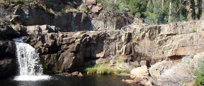
Tali Karng is a hidden jewel nestled deep in the mountains of Gippsland, fed by snowmelt waters of the Wellington Plains. The lake is believed to have been formed about 1500 years ago when a massive rock slide collapsed into the valley damming the waters of Nigothoruk Creek above Wellington River. The water runs underground from the lake to emerge as the infant Wellington River 150m below in the Valley of Destruction.
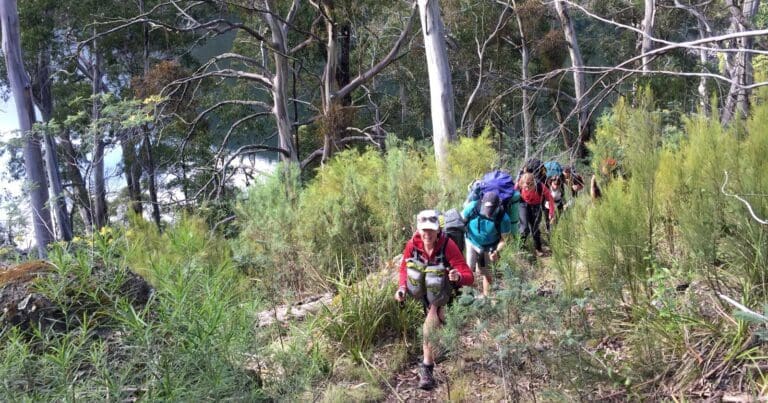
The easiest route to Lake Tali Karng begins at McFarlane Saddle Carpark on the Moroka Road, 60 km from Licola. The walk follows a well defined track across Wellington Plains for 9 km before reaching Gillios Track branching off to the south. This track is about 4 km long, and although steep is well graded down to the Lake.
First people
The first occupiers of this area were the Gunaikurnai tribe, most likely member of the Brayakaulung clan. Evidence of their presence can be found in many places, from stone quarries, stone tools and flake scatters, to a system of ancient pathways. Aboriginal people guided many European explorers and gold miner through the mountains along these pathways - pathways which eventually formed the basis of some of today's road and track network.
Tali Karng is a sacred place to the Gunaikurnai and in keeping with their law, aboriginal people are forbidden to go there. Although Johnny Snowden, an aboriginal stockman wouldn't visit the lake, he guided his employer Edward Riggall near the lake and showed him where it lay.
Camping and facilities
Walkers should respect the Gunaikurnai people of Gippsland by not camping at the lake itself. Nyimba Camp has been provided as the recommended campsite above the lake at the southern end of the Wellington Plains. Below the lake there are numerous informal campsites at the base of the Valley of Destruction and along the Wellington River. It is a good day walk from Nyimba Camp to Tali Karng and return without heavy packs.
Tali Karng is a fuel stove only area and no fires are permitted within a 1km radius of the lake. Fires are permitted within fireplaces at Nyimba campsite (near Riggall Old Hut site) at the southern end of the Wellington Plains. Fires are also permitted within fireplaces at informal campsites along the Wellington River. Fires must not be left unattended and should be extinguished with cold water until embers are cold to the touch.
Firewood supplies are limited especially in the alpine and sub alpine areas, so the use of camping stoves is preferred.
There are no toilet facilities at the lake. There are toilet facilities at the Nyimba Camp and Nigothoruk Creek nearby is a source of water.
The best time to visit is November through to April. Always carry and know how to use a map and compass and be prepared that weather conditions can change rapidly in alpine areas. Snowfalls can be experienced at any time of the year and water can be extremely scarce, so always be prepared with:
- warm clothing
- wind and waterproof jacket
- gloves, hat, sunglasses and strong footwear
- first aid kit and sunscreen
- energy food and water
- compass and relevant topographical map
Before you go, let someone know where you are going, and when you expect to return. Also, please keep your group small (4 - 8 people) and complete your details in the intentions book at the trail heads. Larger groups must register with Parks Victoria's Heyfield office. Call 13 1963 for details.
Respect for culture
Aboriginal people are tolerant of non-indigenous people visiting Tali Karng as long as they treat the area with respect. When people camp at the lake however, to aboriginal people it is disrespectful, like someone camping in a cathedral. To show respect for the Gunaikurnai people of Gippsland, please treat the area with care as you pass by the lake.
Rather than camping at the lake, please camp at Nyimba Camp near Riggalls Old Hut Site at the southern end of the Wellington Plains or below the lake in the Valley of Destruction along the Wellington River. It is a good day walk from Nyimba Camp to Tali Karng and return without heavy packs.
Gallery
Got some great shots from this hike? Upload your photos here to inspire others and show off the beauty of the trail!
Click to view form >>
Submitting your photos doesn’t mean you lose ownership. You can be credited for your contributions, and you can request removal at any time.
Content use
Please don’t copy GPX files or content from this site to AllTrails or other platforms. Each trail has been personally mapped, documented, and refined to support Australia’s bushwalking and hiking community. While some details come from land managers, every listing reflects significant personal effort. This is a free, community-driven initiative—your respect helps keep it that way.
Walk map and GPX file
Max elevation: 1594 m
Min elevation: 864 m
Total climbing: 1075 m
Total descent: -1075 m
Getting there
Getting to the trailhead: Alpine National Park.
Starting at McFarlane’s Saddle on the Moroka Rd, the walk across the Wellington Plain to Nyimba Camp and Riggall Old Hut site is approximately 9km on a gentle gradient. Walkers with 4WD vehicles may choose to start their walk at Millers Hut. From Millers Hut it is approximately one hour walk to Nyimba Camp. From Nyimba Camp to Tali Karng via Gillios Track is about 4.5km with a descent of almost 600m and will take the average walker about two hours with light packs (allow 2.5 – 3 hours for the return walk uphill, climbing almost 600m).
Riggall Spur Track and Echo Point Track provide an alternative route between Nyimba Camp and Tali Karng. The distance is a little longer but on a slightly easier grade.
The route to Tali Karng from the south leaves the Tamboritha Road and follows the Wellington River Walking Track then either Clive Lanigan Track (through Valley of Destruction) or via Riggall Spur Track and Echo Point Track to the lake. This route includes some 16 river crossings so use care and do not attempt to cross if river levels are high following recent rain.
The difficult route to Tali Karng via Mount Margaret is unmaintained and poorly defined for much of its length between Tamboritha Road and Dolodrook River. Remote navigation skills are required and thick vegetation makes progress slow. From the Dolodrook River it follows a 4WD track past the Chromite Mine then Brandy Pinch Track to join the Clive Lanigan Walking Track below the Valley of Destruction.
Horse riders can use Wellington Plains, Millers Hut, Riggall Spur and Echo Point Tracks. Horses are not permitted within 200m of the Lake and a horse-yard is provided on Echo Point Track. Horses are not permitted on the Clive Lanigan or Gillios Walking Tracks and Wellington River Walking Track is currently unsuitable for horses.
Closest towns to this walk: Benalla, Bright, Dinner Plain, Falls Creek, Harrietville, Hotham Heights, Mansfield, Mitta Mitta, Mount Beauty, Mount Hotham, Myrtleford, Omeo, Porepunkah, Tawonga South, Wangaratta
About the region
The Alpine National Park is a national park in the Central Highlands and Alpine regions of Victoria, Australia. The 646,000-hectare national park is located northeast of Melbourne. It is the largest National Park in Victoria, and covers much of the higher areas of the Great Dividing Range in Victoria, including Victoria's highest point, Mount Bogong at 1,986 metres and the associated subalpine woodland and grassland of the Bogong High Plains. The park's north-eastern boundary is along the border with New South Wales, where it abuts the Kosciuszko National Park.
Similar walks nearby
Looking for more walks in or near Alpine National Park? Try these trails with a similar difficulty grade.
Track grade
Grade 4 (Hard) - Challenging Walks for Experienced Walkers: Grade 4 on the AWTGS signifies challenging walking tracks. Bushwalking experience is recommended for these tracks, which may be long, rough, and very steep. Directional signage may be limited, requiring a good sense of navigation. These walks are suited for experienced walkers who are comfortable with steeper inclines, rougher terrain, and potentially longer distances.
Explore safe
Plan ahead and hike safely! Carry enough water, pack layers for changing conditions, and bring safety gear like a torch, PLB, and reliable communication device. Check official sources for trail updates, closures, and access requirements, and review local weather and bushfire advice. Most importantly, share your plans with someone before you go. Being prepared makes for a safer and more enjoyable hike! Stay Safe, Explore More, and Always #ExploreSafe.
Packing checklists
What you carry in your pack depends on factors like weather, terrain, and your adventure type. Not sure what to bring? My free planning, food, and packing checklists are a great starting point, covering day hikes, overnight trips, and multi-day adventures. Use them to customise your kit and always prioritise safety.
Let someone know
Before heading out, take a moment to fill out your trip intentions form. It’s a quick way to share your hike details with family or friends. If something goes wrong, they can notify emergency services, ensuring a faster response and peace of mind. Stay safe and enjoy your adventure
Suggest an edit
Spotted a change on this trail? Maybe there are new features, the route has shifted, or the trail is permanently closed. Whatever the update, I’d love your input. Your feedback helps fellow hikers stay informed and ensures that our trail info stays fresh and reliable.
Acknowledgement of Country
Trail Hiking Australia acknowledges the Traditional Owners of the lands on which we hike and pay respects to their Elders, past and present, and we acknowledge the First Nations people of other communities who may be here today.


4 Reviews on “Lake Tali Karng: McFarlane Saddle & Wellington Plains Hike (24km)”
Shudder…