Hike at a Glance
Max elevation: 787m
Min elevation: 744m
Total Ascent: 99m
Hike overview
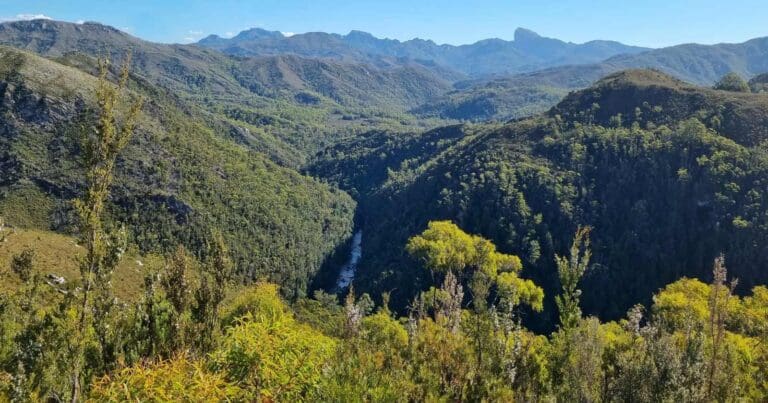
The Lake St Clair Walk is a 4.7km, grade 2 hike in Cradle Mountain-Lake St Clair National Park, Tasmania, and usually takes around 1.5 hours to complete. This walk is made up of three shorter tracks, with the shortest being 2.4km return. When combined, these tracks form a figure-of-eight loop that stretches 4.7km, allowing you to experience different aspects of this beautiful area. The hike is an excellent introduction to the park, offering a mix of easy walking and a range of natural sights.
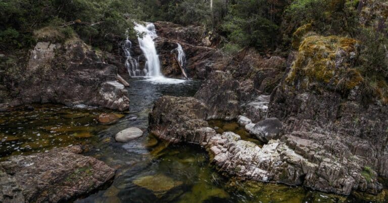
One of the highlights of the walk is the Watersmeet track. This easy, 1.7km each-way route takes you to the point where the Hugel and Cuvier Rivers meet. The track follows an old logging road, originally built after bushfires in the 1960s, and offers a peaceful walk through a diverse landscape. The area’s history, combined with the tranquil riverside setting, makes for a pleasant and reflective experience.
Another standout on the route is the Larmairremener tabelti walk, an Aboriginal cultural heritage trail. This track is designed to introduce you to the Larmairremener people, who were part of the Big River Nation. The path is lined with interpretive panels that provide insight into the indigenous people of the region and their seasonal travels. The walk takes you through a variety of vegetation types, from banksias and tea-tree thickets to rainforest ferns and eucalypt stags. As you follow the moraines formed by retreating glaciers, you'll be treated to diverse landscapes and a peaceful atmosphere. The track leads you to a viewpoint above the Hugel River before descending into a rainforest area, where it rejoins the Watersmeet Track.
For those hoping to catch a glimpse of the elusive platypus, the Platypus Bay track offers a 30-minute return walk. This trail follows the Cuvier River to its mouth at the lake, where it curves around the edge of the water. Platypuses are sometimes seen in this area, especially in the early morning or late afternoon, making it a great spot for a quiet, wildlife-filled experience. The combination of scenic views, peaceful tracks, and the chance to encounter wildlife makes this hike a truly enjoyable way to explore the Lake St Clair area.
Tips
- Park entry fees apply. (Self registration park entrance.)
- Visitor centre, restaurant and accommodation.
- Supervise children , tracks subject to severe weather conditions all year round, weather may change quickly, tracks are difficult to navigate when covered in snow and may be impassable.
- No pets, firearms or bicycles.
Gallery
Got some great shots from this hike? Upload your photos here to inspire others and show off the beauty of the trail!
Click to view form >>
Submitting your photos doesn’t mean you lose ownership. You can be credited for your contributions, and you can request removal at any time.
Content use
Please don’t copy GPX files or content from this site to AllTrails or other platforms. Each trail has been personally mapped, documented, and refined to support Australia’s bushwalking and hiking community. While some details come from land managers, every listing reflects significant personal effort. This is a free, community-driven initiative—your respect helps keep it that way.
Walk map and GPX file
Max elevation: 787 m
Min elevation: 744 m
Total climbing: 99 m
Total descent: -99 m
Getting there
Getting to the trailhead: Cradle Mountain-Lake St Clair National Park.
To reach the Lake St Clair trailhead, head for the Lake St Clair Visitor Centre at Cynthia Bay, located 2.5 hours from Hobart via the A10 Lyell Highway, or a similar distance from Launceston via the B11 Marlborough Highway and then the A10. From the A10, take the turnoff at Derwent Bridge and turn right onto Lake St Clair Road (C193), which will lead you directly to the visitor centre. As you drive through the area, be mindful of local wildlife, especially at night. Native animals often roam the roads, so it’s important to drive slowly and stay alert to ensure both your safety and that of the wildlife.
Closest towns to this walk: Burnie, Cradle Mountain, Deloraine, Derwent Bridge, Devonport, Dove Lake, Lake St Clair, Launceston, Moina, Mole Creek, Queenstown, Rosebery, Sheffield, Strahan, Tullah, Waratah
About the region
Exploring Cradle Mountain-Lake St Clair National Park
Cradle Mountain-Lake St Clair National Park, located in the heart of Tasmania, is an extraordinary destination within the Tasmanian World Heritage Area. Just over two hours’ drive (150 km) from Launceston and around four hours (250 km) from Hobart, this park is celebrated for its striking landscapes, diverse ecosystems, and abundance of wildlife. Whether you're a seasoned hiker or simply enjoy the serenity of nature, this park has something to offer.
The park is a showcase of nature's diversity, from glacial lakes and alpine moorlands to dense rainforests and dramatic peaks. Its seasonal transformations are equally captivating. Winter blankets the terrain with snow, while autumn brings vibrant hues as the deciduous fagus turns shades of yellow, orange, and red. In spring, the bushland comes alive with joeys and echidnas, while summer invites visitors to wade into crystal-clear lakes framed by blooming wildflowers.
Cradle Mountain itself is an icon of the park, offering a network of walking tracks for all levels. Easy strolls take you through lush forests and past tranquil streams, while more challenging hikes, such as the renowned Overland Track, traverse rugged terrain. Spanning 80 kilometres and typically completed in 5-6 days, the Overland Track is a must for experienced bushwalkers, offering a journey through breathtaking alpine scenery. For those who prefer shorter walks, the park’s well-maintained trails make exploring its wonders accessible to everyone.
Lake St Clair, situated at the southern end of the park, is equally enchanting. Known as leeawuleena—‘sleeping water’—by the Aboriginal people, the lake exudes tranquillity, particularly on calm days when its glassy surface reflects the surrounding landscape. Lake St Clair is the endpoint of the Overland Track, making it a rewarding finish line for hikers who’ve traversed the park’s diverse terrain.
Beyond the iconic multi-day hike, Lake St Clair offers an array of bushwalks and trails. Short tracks wind through ancient rainforests, while longer paths lead to stunning mountain summits and secluded alpine lakes. Each trail promises an immersive experience, with the chance to encounter wildlife like wombats, platypus, Tasmanian devils, and the distinctive black currawong along the way.
Cradle Mountain-Lake St Clair National Park combines natural beauty, adventure, and opportunities for reflection, ensuring every visit is unforgettable. Whether you're seeking an adventurous hike, a casual walk, or a family-friendly outing, this park provides it all.
Want to find the best trails in Cradle Mountain-Lake St Clair National Park for an adventurous hike, casual walk, or a family trip? Trail Hiking Australia has the best trails for walking, hiking, running, and more.
Similar walks nearby
Looking for more walks in or near Cradle Mountain-Lake St Clair National Park? Try these trails with a similar difficulty grade.
Track grade
Grade 2 (Easy) - A Gentle Introduction to Inclines: Grade 2 on the AWTGS represents easy walking tracks that offer a slightly more challenging experience compared to Grade 1. Similar to Grade 1, no prior bushwalking experience is required. The track surface is typically hardened or compacted and may have gentle hill sections or occasional steps. The total distance of a Grade 2 walk is typically no greater than 10 kilometers. These walks are still suitable for families with a bit more experience or those seeking a gentle introduction to some inclines.
Explore safe
Plan ahead and hike safely! Carry enough water, pack layers for changing conditions, and bring safety gear like a torch, PLB, and reliable communication device. Check official sources for trail updates, closures, and access requirements, and review local weather and bushfire advice. Most importantly, share your plans with someone before you go. Being prepared makes for a safer and more enjoyable hike! Stay Safe, Explore More, and Always #ExploreSafe.
Packing checklists
What you carry in your pack depends on factors like weather, terrain, and your adventure type. Not sure what to bring? My free planning, food, and packing checklists are a great starting point, covering day hikes, overnight trips, and multi-day adventures. Use them to customise your kit and always prioritise safety.
Let someone know
Before heading out, take a moment to fill out your trip intentions form. It’s a quick way to share your hike details with family or friends. If something goes wrong, they can notify emergency services, ensuring a faster response and peace of mind. Stay safe and enjoy your adventure
Suggest an edit
Spotted a change on this trail? Maybe there are new features, the route has shifted, or the trail is permanently closed. Whatever the update, I’d love your input. Your feedback helps fellow hikers stay informed and ensures that our trail info stays fresh and reliable.
Acknowledgement of Country
Trail Hiking Australia acknowledges the Traditional Owners of the lands on which we hike and pay respects to their Elders, past and present, and we acknowledge the First Nations people of other communities who may be here today.


