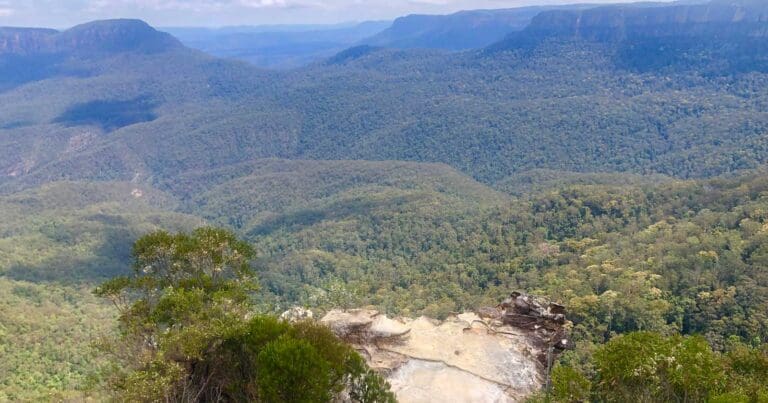
This walk provides the shortest access to Lady Darley Lookout from the road. Starting from Panorama Dr in Katoomba the walk heads down a hill with stairs to the lookout. The lookout is on the Prince Henry Cliff walk and provides great views of the Kedumba Valley. Although popular this is much less busy than the nearby Echo point lookout.
Got some great shots from this hike? Upload your photos here to inspire others and show off the beauty of the trail!
Submitting your photos doesn’t mean you lose ownership. You can be credited for your contributions, and you can request removal at any time.
Please don’t copy GPX files or content from this site to AllTrails or other platforms. Each trail has been personally mapped, documented, and refined to support Australia’s bushwalking and hiking community. While some details come from land managers, every listing reflects significant personal effort. This is a free, community-driven initiative—your respect helps keep it that way.
Total distance: 227 m
Max elevation: 979 m
Min elevation: 925 m
Total climbing: 54 m
Total descent: -53 m
Download maps and tracknotes for Lady Darley Lookout Track hiking track from wildwalks.com.
Getting there
Getting to the trailhead: Blue Mountains National Park.
From Panorama Drive, Katoomba (about 100m along from Lilianfells Park), this walk heads through the gap in the wooden fence, near the ticket machine. The track heads down the hill, initially passing some information signs, and down some steps to the bottom, where it comes to ‘Lady Darley Lookout’.
Closest towns to this walk: Blackheath, Bullaburra, Hazelbrook, Katoomba, Lawson, Leura, Lithgow, Mount Victoria, Springwood, Wentworth Falls, Woodford
About the region
Blue Mountains National Park in the Sydney and surrounds and Country NSW regions
Blue Mountains National Park is always open but may have to close at times due to poor weather or fire danger. Some parts of the park close overnight; details are provided for specific attractions.
9am to 4.30pm daily. Closed Christmas Day.
Similar walks nearby
Looking for more walks in or near Blue Mountains National Park? Try these trails with a similar difficulty grade.
Favourite

Blue Mountains National Park
Favourite

Blue Mountains National Park
Favourite

Blue Mountains National Park
Favourite

Blue Mountains National Park
Track grade
Grade 3 (Moderate) - Walks for Most Fitness Levels: Grade 3 on the
AWTGS represents moderate walking tracks. These are ideal for walkers with some fitness who are comfortable with some hills and uneven terrain. While suitable for most ages, some bushwalking experience is recommended to ensure a safe and enjoyable experience. Tracks may have short, steep hill sections, a rough surface, and many steps. The total distance of a Grade 3 walk can be up to 20 kilometers.
Explore safe
Plan ahead and hike safely! Carry enough water, pack layers for changing conditions, and bring safety gear like a torch, PLB, and reliable communication device. Check official sources for trail updates, closures, and access requirements, and review local weather and bushfire advice. Most importantly, share your plans with someone before you go. Being prepared makes for a safer and more enjoyable hike! Stay Safe, Explore More, and Always #ExploreSafe.
Packing checklists
What you carry in your pack depends on factors like weather, terrain, and your adventure type. Not sure what to bring? My free planning, food, and packing checklists are a great starting point, covering day hikes, overnight trips, and multi-day adventures. Use them to customise your kit and always prioritise safety.
Let someone know
Before heading out, take a moment to fill out your trip intentions form. It’s a quick way to share your hike details with family or friends. If something goes wrong, they can notify emergency services, ensuring a faster response and peace of mind. Stay safe and enjoy your adventure
Suggest an edit
Spotted a change on this trail? Maybe there are new features, the route has shifted, or the trail is permanently closed. Whatever the update, I’d love your input. Your feedback helps fellow hikers stay informed and ensures that our trail info stays fresh and reliable.


