Hike at a Glance
Max elevation: 443m
Min elevation: 354m
Total Ascent: 205m
Hike overview
The Yuluna Circuit Hike is an 8.5 km loop in South Australia's Ikara–Flinders Ranges National Park. Graded at level 4, it typically takes between three and four hours to complete, offering a rewarding journey through striking geological features and rich pastoral history.
The trail begins at the Aroona Trailhead, beside the historic Aroona Homestead. Here, a restored pug-and-pine hut stands as a quiet reminder of a bygone era, when Frederick Hayward first settled the land in the 1850s. Not much remains of Hayward’s early ambitions—only a solitary willow tree by the spring, crumbling stone borders from his garden, and the foundations of his once-proud home. Despite arriving to find sparse grazing land, Hayward’s sheep thrived on the native shrubs, allowing him to amass a fortune before returning to England. By the 1880s, the homestead had already fallen into ruin.
Nearby, closer to the creek, sits the modest pine-and-pug homestead built by Eddie Pumpa in 1925, now partially restored. This outstation of the Oraparinna pastoral lease once hosted the renowned artist Hans Heysen, who spent many evenings here during his painting expeditions, captivated by the shifting light across the rugged ranges.
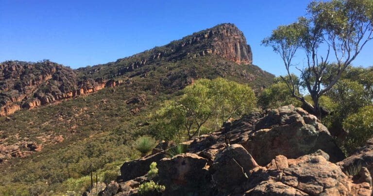
From the homestead, the trail crosses Aroona Creek, skirting past the Koolaman Campground before entering the embrace of Yuluna Creek. The name "Yuluna" stems from the Aboriginal word Yurla, meaning kingfisher. As the creek carves its way through the ABC Range, its blocky quartzite structures and clearly visible layers of ancient sediments tell a story stretching back millions of years. Entering the creek bed itself reveals intricate ripple marks, folding, and even a minor fault line etched into the stone. During warmer months, small frogs endemic to the Flinders Ranges, identified by the dark bands along their backs, can sometimes be spotted among the shallows.
Further along, an old stone cairn hints at the pathways once used by Hayward and his overseers. A short 200-metre side track leads to the weathered remains of Bendowta Hut, a shepherd’s shelter perched above the creek. Walking through the pines, traces of an old bridle track emerge—an avenue through the trees marked by a scarred blaze on a long-dead tree. It’s easy to imagine stockmen riding between Aroona and Monela Hut, navigating the rugged terrain by memory and subtle signs.
Crossing Yuluna Creek once more, the trail winds through groves of pine and silver wattle, gradually merging into Bulls Gap Track. Here, the contrast between the landscape’s slopes becomes apparent: the sun-drenched, north-facing hills are dominated by tough porcupine grass and the silvered trunks of coolibahs, while the cooler southern slopes shelter a softer understorey of pines and wattles.
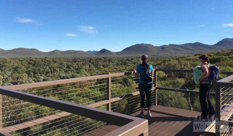
A short detour leads to Heysen Lookout, where Hans Heysen himself would pause in the evenings, glass in hand, to absorb the quiet majesty of the Aroona Valley. The lookout offers a sweeping view of the ranges, a landscape that still holds the same sense of timelessness that drew Heysen back time and again.
The final stretch of the walk takes you down a gentle slope to a boom gate, before crossing Aroona Creek one last time to return to the trailhead car park.
For those with a deeper interest in the region's pastoral and geological history, the Yuluna Circuit forms part of the wider Hayward’s Huts Hike Network. These trails offer glimpses into the early European occupation of the area, following in the hoofprints of Frederick Hayward and his overseer Douglas Bruce, who journeyed regularly between the remote shepherds' huts in the mid-1800s. Along these routes, the landscape itself tells a story—from the faulted cliffs of the ABC Range to the fossil-rich beds of the Trezona Range, and the softly undulating hills of Brachina Formation siltstones. In spring, the rolling hills come alive with the colour of flowering hopbushes, adding another layer of vibrancy to an already evocative landscape.
Content use
Please don’t copy GPX files or content from this site to AllTrails or other platforms. Each trail has been personally mapped, documented, and refined to support Australia’s bushwalking and hiking community. While some details come from land managers, every listing reflects significant personal effort. This is a free, community-driven initiative—your respect helps keep it that way.
Walk map and GPX file
Max elevation: 443 m
Min elevation: 354 m
Total climbing: 205 m
Total descent: -205 m
Getting there
Getting to the trailhead: Ikara-Flinders Ranges National Park.
The Yuluna Circuit Walk is located in Ikara-Flinders Ranges National Park, about a six-hour drive north of Adelaide. Leaving the city, follow Grote Street to West Terrace, then join National Highway A1 heading north. Continue for roughly four hours toward Port Augusta, before taking the B83 through to Hawker. From Hawker, follow Flinders Ranges Way for about 100 kilometres until you reach Aroona Valley Road. The Aroona Trailhead, where the hike begins, is located off this road.
There are three trailheads providing access to this part of the park. The Aroona Trailhead (Y1) is the most convenient for the Yuluna Circuit and sits about seven kilometres north of Brachina Gorge Road. Alternatively, the Trezona Trailhead (T1) near Trezona Campground or the Youngoona Trailhead (T3) close to the Youngoona Hut ruins can also be used. Parking is available at each trailhead.
Closest towns to this walk: Beltana, Blinman, Copley, Cradock, Hawker, Leigh Creek, Parachilna, Quorn, Wilpena Pound
About the region
Ancient and rugged mountain landscapes, peaceful tree-lined gorges, and a seasonal wealth of wildlife combine to make Ikara-Flinders Ranges National Park one of South Australia's iconic destinations. Covering approximately 95,000 hectares, the park includes the Heysen Range, Brachina and Bunyeroo Gorges, and the vast amphitheatre of mountains known as Wilpena Pound. Visitors can experience native wildlife, rich cultural heritage, impressive geological features, and a range of activities including bushwalking, four-wheel driving, birdwatching, photography, and mountain biking. Mild temperatures from April to October make this period the most comfortable for bushwalking and cycling, while summer temperatures can range from 30ºC to 45ºC.
Ikara-Flinders Ranges National Park has a rich and complex cultural heritage, combining Aboriginal and pastoral history. The park is co-managed by a board consisting of Adnyamathanha and Department for Environment and Water representatives. The Adnyamathanha people, meaning "hills or rock people," are the traditional custodians of the park, with a connection to the land that stretches back thousands of years. Visitors can view ancient rock paintings and engravings at Arkaroo Rock, Sacred Canyon, and Perawurtina Cultural Heritage Site.
Rugged mountain ranges, dramatic gorges, peaceful creeks lined with river red gums, and abundant wildlife are just the beginning of what awaits at one of South Australia's most popular tourist destinations.
Similar walks nearby
Looking for more walks in or near Ikara-Flinders Ranges National Park? Try these trails with a similar difficulty grade.
Track grade
Grade 4 (Hard) - Challenging Walks for Experienced Walkers: Grade 4 on the AWTGS signifies challenging walking tracks. Bushwalking experience is recommended for these tracks, which may be long, rough, and very steep. Directional signage may be limited, requiring a good sense of navigation. These walks are suited for experienced walkers who are comfortable with steeper inclines, rougher terrain, and potentially longer distances.
Explore safe
Plan ahead and hike safely! Carry enough water, pack layers for changing conditions, and bring safety gear like a torch, PLB, and reliable communication device. Check official sources for trail updates, closures, and access requirements, and review local weather and bushfire advice. Most importantly, share your plans with someone before you go. Being prepared makes for a safer and more enjoyable hike! Stay Safe, Explore More, and Always #ExploreSafe.
Packing checklists
What you carry in your pack depends on factors like weather, terrain, and your adventure type. Not sure what to bring? My free planning, food, and packing checklists are a great starting point, covering day hikes, overnight trips, and multi-day adventures. Use them to customise your kit and always prioritise safety.
Let someone know
Before heading out, take a moment to fill out your trip intentions form. It’s a quick way to share your hike details with family or friends. If something goes wrong, they can notify emergency services, ensuring a faster response and peace of mind. Stay safe and enjoy your adventure
Suggest an edit
Spotted a change on this trail? Maybe there are new features, the route has shifted, or the trail is permanently closed. Whatever the update, I’d love your input. Your feedback helps fellow hikers stay informed and ensures that our trail info stays fresh and reliable.
Acknowledgement of Country
Trail Hiking Australia acknowledges the Traditional Owners of the lands on which we hike and pay respects to their Elders, past and present, and we acknowledge the First Nations people of other communities who may be here today.
/Yuluna-Hike_23.jpg)
/Yuluna-Hike_19.jpg)
/Yuluna-Hike_15.jpg)
/Yuluna-Hike_6.jpg)
/Yuluna-Hike_24.jpg)
/Yuluna-Hike_33.jpg)
/Yuluna-Hike_3.jpg)
/Yuluna-Hike_17.jpg)
/Yuluna-Hike_11.jpg)
/Yuluna-Hike_21.jpg)
/Yuluna-Hike_1.jpg)
/Yuluna-Hike_12.jpg)
/Yuluna-Hike_10.jpg)
/Yuluna-Hike_34.jpg)
/Yuluna-Hike_30.jpg)


1 Review on “Yuluna Circuit Hike (8.5km)”
Completed this hike a few years ago. Its a really enjoyable walk with heaps of history. There are a couple of great walks in the area that are worth checking out.