Hike at a Glance
Max elevation: 101m
Min elevation: 28m
Total Ascent: 249m
Important info
This hike is classified as Grade 3 (Moderate) primarily due to its distance exceeding 10km. The terrain itself is relatively easy and suitable for most abilities. However, the longer distance requires some stamina. Feel free to turn back at any point for a shorter adventure.
Hike overview
Starting at the quaint Yarramalong township this walk follows a couple of rural roads to the Cedar Brush Trackhead. This is the longest road stretch on the Great North Walk. Some people see this is a road slog and either grab a lift or power walk it others see it as an opportunity to stroll through the country side. However you choose to undertake this section of the walk I encourage you to enjoy the valley views and soak up the vibe on the semi secluded rural valley community.
Gallery
Got some great shots from this hike? Upload your photos here to inspire others and show off the beauty of the trail!
Uploading your photos doesn’t mean you lose ownership. You can be credited for your contributions, and you can request removal at any time.
Content use
Please don’t copy GPX files or content from this site to AllTrails or other platforms. Each trail has been personally mapped, documented, and refined to support Australia’s bushwalking and hiking community. While some details come from land managers, every listing reflects significant personal effort. This is a free, community-driven initiative—your respect helps keep it that way.
Walk map and GPX file
Max elevation: 101 m
Min elevation: 28 m
Total climbing: 249 m
Total descent: -182 m
Getting there
Getting to the trailhead: Yarramalong.
Closest towns to this walk: Dooralong, Jilliby, Ourimbah, Wadalba, Wyong, Yarramalong
About the region
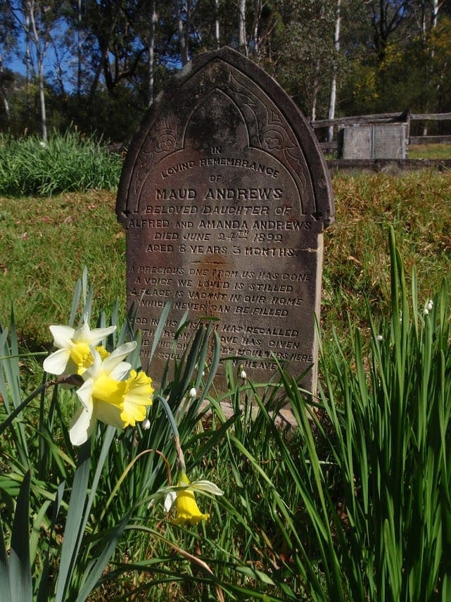
Yarramalong is a township and suburb of the Central Coast region of New South Wales, Australia, located 20km upstream from Wyong along the Wyong River. It is part of the local government area.The Yarramalong township has: Rural Fire Station, two cemeteries, public school, general store/petrol station, bottle shop/guest house and a hall which was originally an art hall but is now also used for community purposes. Busways now only operates a school bus service between Yarramalong and Wyong. It was acquired from Yarramalong Bus Lines in 2008.Yarramalong Valley is the home of many horse studs, turf farms, citrus crops as well as a macadamia nut farm and a lavender farm.
The Great North Walk also passes through Yarramalong to Cedar Brush Creek to the North and Kulnura.History of YarramalongThe Yarramalong Valley is in the land of the Darkinjung people. The name derives from the aboriginal words, "Yarraman," meaning horse, and "long" meaning place. Yarraman is thought to be derived from the word "yira" or "yera" which means large teeth, possibly from one of the Sydney languages.The Yarramalong Valley was first permanently settled by in 1856 by the Stinson and Waters families of Maitland. Prior to the 1850s the valley was logged by timber cutters driving teams of oxen from Wollombi and Maitland. See less
Similar walks nearby
Looking for more walks in or near Yarramalong? Try these trails with a similar difficulty grade.
Track grade
Grade 3 (Moderate) - Walks for Most Fitness Levels: Grade 3 on the AWTGS represents moderate walking tracks. These are ideal for walkers with some fitness who are comfortable with some hills and uneven terrain. While suitable for most ages, some bushwalking experience is recommended to ensure a safe and enjoyable experience. Tracks may have short, steep hill sections, a rough surface, and many steps. The total distance of a Grade 3 walk can be up to 20 kilometers.
Explore safe
Plan ahead and hike safely! Carry enough water, pack layers for changing conditions, and bring safety gear like a torch, PLB, and reliable communication device. Check official sources for trail updates, closures, and access requirements, and review local weather and bushfire advice. Most importantly, share your plans with someone before you go. Being prepared makes for a safer and more enjoyable hike! Stay Safe, Explore More, and Always #ExploreSafe.
Packing checklists
What you carry in your pack depends on factors like weather, terrain, and your adventure type. Not sure what to bring? My free planning, food, and packing checklists are a great starting point, covering day hikes, overnight trips, and multi-day adventures. Use them to customise your kit and always prioritise safety.
Let someone know
Before heading out, take a moment to fill out your trip intentions form. It’s a quick way to share your hike details with family or friends. If something goes wrong, they can notify emergency services, ensuring a faster response and peace of mind. Stay safe and enjoy your adventure
Suggest an edit
Spotted a change on this trail? Maybe there are new features, the route has shifted, or the trail is permanently closed. Whatever the update, I’d love your input. Your feedback helps fellow hikers stay informed and ensures that our trail info stays fresh and reliable.
Acknowledgement of Country
Trail Hiking Australia acknowledges the Traditional Owners of the lands on which we hike and pay respects to their Elders, past and present, and we acknowledge the First Nations people of other communities who may be here today.


